
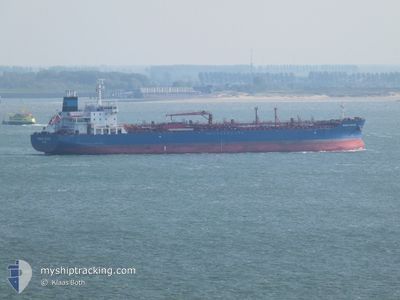
SUNNY APATITE
Tanker
Current Trip
| Time Travelled | 11 h, 49 mins |
|---|---|
| Remaining Time | --- |
| Distance Travelled | 137.58 nm |
| Remaining Distance | --- |
| AVG Speed | 11.4 Knots |
| MAX Speed | 14.8 Knots |
| AVG Wind | 5.1 knots |
| MAX Wind | 7.2 knots |
| MIN Temp | 10°C / 50°F |
| MAX Temp | 13.6°C / 56.48°F |
| Draught | 10.8 m |
| Position Received | 7 h, 50 m ago |
Current Position
| Longitude | 126.02192° |
|---|---|
| Latitude | 36.89660° |
| Status | Under way using engine |
| Speed | 13.7 Knots |
| Course | 206.9° |
| Area | Yellow Sea |
| Station | T-AIS |
| Position Received | 7 h, 50 m ago |
Info
Information
The current position of SUNNY APATITE is in Yellow Sea with coordinates 36.89660° / 126.02192° as reported on 2024-04-24 23:53 by AIS to our vessel tracker app. The vessel's current speed is 13.7 Knots and is heading at the port of CHIBA. The estimated time of arrival as calculated by MyShipTracking vessel tracking app is 2024-04-28 14:00 LT
The vessel SUNNY APATITE (IMO: 9721891, MMSI: 538005806) is a Tanker It's sailing under the flag of [MH] Marshall Is.
In this page you can find informations about the vessels current position, last detected port calls, and current voyage information. If the vessels is not in coverage by AIS you will find the latest position.
The current position of SUNNY APATITE is detected by our AIS receivers and we are not responsible for the reliability of the data. The last position was recorded while the vessel was in Coverage by the Ais receivers of our vessel tracking app.
The current draught of SUNNY APATITE as reported by AIS is 10.8 meters
Weather
| Temperature | 13.5°C / 56.3°F |
|---|---|
| Wind Speed | 1 knots |
| Direction | 279° W |
| Pressure | 1011 hPa |
| Humidity | 72.8 % |
| Cloud Coverage | --- |
Featured Company
Last Port Calls
| Port | Arrival | Departure | Time In Port |
|---|---|---|---|
| 2024-04-23 06:58 | 2024-04-24 19:54 | 1 d | |
| 2024-04-12 13:39 | 2024-04-14 20:22 | 2 d | |
| 2024-02-28 22:20 | 2024-03-01 11:44 | 1 d |
Most Visited Ports (Last year)
| Port | Arrivals | |
|---|---|---|
| 3 | ||
| 2 | ||
| 1 | ||
| 1 | ||
| 1 | ||
| 1 |
Last Trips
| Origin | Departure | Destination | Arrival | Distance | |
|---|---|---|---|---|---|
| 2024-04-15 04:22 | 2024-04-23 15:58 | 2673.92 nm | |||
| 2024-03-01 19:44 | 2024-04-12 21:39 | 7170.17 nm | |||
| 2024-01-30 11:45 | 2024-02-29 06:20 | 8230.02 nm |
Events
| Time | Event | Details | Position / Dest | Info |
|---|---|---|---|---|
| 2024-04-24 23:54 | Status Changed | Default Under way using engine |
36.89313 / 126.01996
CHIBA
|
Speed: 13.7 kn Course: 206.9° |
| 2024-04-24 23:53 | OUT of Coverage |
36.89660 / 126.02192
Yellow Sea
CHIBA
|
Speed: 13.7 kn Course: 206.9° |
|
| 2024-04-24 23:49 | Status Changed | Under way using engine Default |
36.90843 / 126.02926
CHIBA
|
Speed: 13 kn Course: 198° |
| 2024-04-24 23:45 | Status Changed | Default Under way using engine |
36.92333 / 126.03500
CHIBA
|
Speed: 13.6 kn Course: 200.9° |
| 2024-04-24 19:57 | Draught Changed | 10.8 8 |
37.48202 / 126.58967
CHIBA
|
Speed: 8.8 kn Course: 200.4° |
| 2024-04-24 19:57 | Destination Changed | CHIBA INCHEON |
37.48202 / 126.58967
CHIBA
|
Speed: 8.8 kn Course: 200.4° |
| 2024-04-24 19:57 | ETA Changed | 2024/04/28 14:00 2024/04/23 04:00 |
37.48202 / 126.58967
CHIBA
|
Speed: 8.8 kn Course: 200.4° |
| 2024-04-24 19:54 | PORT DEPARTURE |
|
37.48735 / 126.59208
INCHEON
|
Speed: 5.4 kn Course: 200° |
| 2024-04-24 19:48 | Status Changed | Under way using engine Default |
37.49919 / 126.59739
[KR] INCHEON
|
Speed: Course: 180° |
| 2024-04-24 19:48 | START Moving |
37.49919 / 126.59739
[KR] INCHEON
|
Speed: 4.7 kn Course: 199° |