
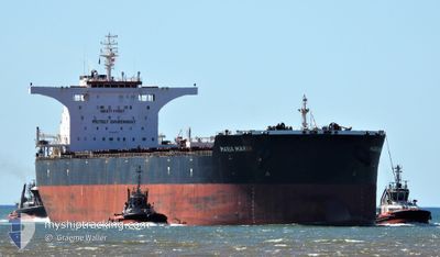
MARIA MARIA
Cargo
Current Trip
AU DAM
| Time Travelled | 1 day |
|---|---|
| Remaining Time | --- |
| Distance Travelled | 202.80 nm |
| Remaining Distance | --- |
| AVG Speed | 10.1 Knopen |
| MAX Speed | 11.5 Knopen |
| AVG Wind | 8.2 knots |
| MAX Wind | 13 knots |
| MIN Temp | 26.4°C / 79.52°F |
| MAX Temp | 28.8°C / 83.84°F |
| Diepgang | 8.5 M |
| Positie ontvangen | 1 d geleden |
Current Position
| Lengtegraad | --- |
|---|---|
| Breedtegraat | --- |
| Status | Under way using engine |
| Snelheid | 2.8 Knopen |
| Koers | 309° |
| Gebied | Indian Ocean |
| Station | T-AIS |
| Positie ontvangen | 1 d geleden |
Info
Information
The current position of MARIA MARIA is in Indian Ocean with coordinates -20.38457° / 116.61043° as reported on 2025-12-10 08:19 by AIS to our vessel tracker app. The vessel's current speed is 2.8 Knopen
The vessel MARIA MARIA (IMO: 9453767, MMSI: 210813000) is a Cargo It's sailing under the flag of [CY] Cyprus.
In this page you can find informations about the vessels current position, last detected port calls, and current voyage information. If the vessels is not in coverage by AIS you will find the latest position.
The current position of MARIA MARIA is detected by our AIS receivers and we are not responsible for the reliability of the data. The last position was recorded while the vessel was in Coverage by the Ais receivers of our vessel tracking app.
The current draught of MARIA MARIA as reported by AIS is 8.5 meters
Weather
| Temperature | 28.5°C / 83.3°F |
|---|---|
| Wind Speed | 7 knots |
| Direction | 339° NNW |
| Pressure | 1007.3 hPa |
| Humidity | 73.7 % |
| Cloud Coverage | 94 % |
Featured Company
Most Visited Ports (Last year)
| Port | Arrivals | |
|---|---|---|
| 2 | ||
| 2 | ||
| 2 | ||
| 1 | ||
| 1 | ||
| 1 |
Last Trips
Events
| Tijd | Evenement | Details | Positie / Bestemming | Info |
|---|---|---|---|---|
| 2025-12-10 16:48 | Start beweging | 16.13 nm, North West of DAMPIER |
-20.38868 / 116.60886
AU DAM
|
Snelheid: 3.4 kn Koers: 95° |
| 2025-12-10 08:27 | Stop beweging | 16.45 nm, North West of DAMPIER |
-20.38312 / 116.60774
AU DAM
|
Snelheid: 0.3 kn Koers: 317° |
| 2025-12-10 08:24 | Status Changed | Default Under way using engine |
-20.38295 / 116.60800
AU DAM
|
Snelheid: 2.8 kn Koers: 309° |
| 2025-12-10 08:19 | Buitenbereik |
-20.38457 / 116.61043
Indian Ocean
|
Snelheid: 2.8 kn Koers: 311° |
|
| 2025-12-10 08:14 | Status Changed | Under way using engine Default |
-20.38735 / 116.61368
AU DAM
|
Snelheid: 3.2 kn Koers: 312° |
| 2025-12-10 07:56 | Binnenbereik |
-20.38600 / 116.61212
Indian Ocean
|
Snelheid: 3 kn Koers: 311° |
|
| 2025-12-10 05:48 | Vertrekhaven |
|
-20.62440 / 116.69335
AU DAM
|
Snelheid: 6.4 kn Koers: 322° |
| 2025-12-10 05:44 | Start beweging |
-20.63115 / 116.69782
[AU] DAMPIER
|
Snelheid: 6.4 kn Koers: 322° |
|
| 2025-12-08 08:18 | Stop beweging |
-20.63717 / 116.71815
[AU] DAMPIER
|
Snelheid: Koers: 270° |
|
| 2025-12-08 07:32 | Aankomsthaven |
|
-20.62262 / 116.72852
[AU] DAMPIER
|
Snelheid: 9.8 kn Koers: 131° |