
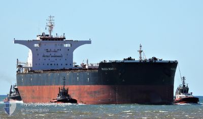
MARIA MARIA
Cargo
Current Trip
DAMPIER
| Time Travelled | 58 days |
|---|---|
| Remaining Time | --- |
| Distance Travelled | 3555.67 nm |
| Remaining Distance | --- |
| AVG Speed | 10.4 Knots |
| MAX Speed | 13.7 Knots |
| AVG Wind | 9.9 knots |
| MAX Wind | 23 knots |
| MIN Temp | 0.7°C / 33.26°F |
| MAX Temp | 29.8°C / 85.64°F |
| Draught | 8.8 m |
| Position Received | 2 m ago |
Current Position
| Longitude | 116.56328° |
|---|---|
| Latitude | -20.38568° |
| Status | At anchor |
| Speed | |
| Course | 24° |
| Area | Indian Ocean |
| Station | T-AIS |
| Position Received | 2 m ago |
Info
Information
The current position of MARIA MARIA is in Indian Ocean with coordinates -20.38568° / 116.56328° as reported on 2024-04-25 11:57 by AIS to our vessel tracker app. The vessel's current speed is 0 Knots
The vessel MARIA MARIA (IMO: 9453767, MMSI: 210813000) is a Cargo It's sailing under the flag of [CY] Cyprus.
In this page you can find informations about the vessels current position, last detected port calls, and current voyage information. If the vessels is not in coverage by AIS you will find the latest position.
The current position of MARIA MARIA is detected by our AIS receivers and we are not responsible for the reliability of the data. The last position was recorded while the vessel was in Coverage by the Ais receivers of our vessel tracking app.
The current draught of MARIA MARIA as reported by AIS is 8.8 meters
Weather
| Temperature | 27.2°C / 80.96°F |
|---|---|
| Wind Speed | 10 knots |
| Direction | 27° NNE |
| Pressure | 1011.8 hPa |
| Humidity | 72.2 % |
| Cloud Coverage | 94 % |
Featured Company
Last Port Calls
| Port | Arrival | Departure | Time In Port |
|---|---|---|---|
| 2024-02-22 21:03 | 2024-02-26 12:10 | 3 d |
Most Visited Ports (Last year)
| Port | Arrivals | |
|---|---|---|
| 2 | ||
| 2 | ||
| 1 | ||
| 1 | ||
| 1 |
Last Trips
| Origin | Departure | Destination | Arrival | Distance | |
|---|---|---|---|---|---|
| 2023-12-29 08:13 | 2024-02-23 05:03 | 11096.81 nm |
Events
| Time | Event | Details | Position / Dest | Info |
|---|---|---|---|---|
| 2024-04-25 11:36 | Status Changed | At anchor Default |
-20.38565 / 116.56330
DAMPIER
|
Speed: 0.1 kn Course: 22° |
| 2024-04-25 11:33 | Status Changed | Default At anchor |
-20.38568 / 116.56333
DAMPIER
|
Speed: 0.1 kn Course: 24° |
| 2024-04-25 11:12 | Status Changed | At anchor Default |
-20.38553 / 116.56300
DAMPIER
|
Speed: Course: 32° |
| 2024-04-25 11:09 | Status Changed | Default At anchor |
-20.38547 / 116.56305
DAMPIER
|
Speed: Course: 33° |
| 2024-04-25 10:36 | Status Changed | At anchor Default |
-20.38517 / 116.56253
DAMPIER
|
Speed: Course: 48° |
| 2024-04-25 10:33 | Status Changed | Default At anchor |
-20.38513 / 116.56257
DAMPIER
|
Speed: Course: 48° |
| 2024-04-25 09:36 | Status Changed | At anchor Default |
-20.38453 / 116.56225
DAMPIER
|
Speed: 0.1 kn Course: 63° |
| 2024-04-25 09:33 | Status Changed | Default At anchor |
-20.38452 / 116.56215
DAMPIER
|
Speed: 0.1 kn Course: 70° |
| 2024-04-25 08:45 | Status Changed | At anchor Default |
-20.38420 / 116.56200
DAMPIER
|
Speed: Course: 70° |
| 2024-04-25 08:39 | Status Changed | Default At anchor |
-20.38413 / 116.56197
DAMPIER
|
Speed: 0.1 kn Course: 61° |