
MALACCA HIGHWAY
Vehicles Carrier
Current Trip
| Time Travelled | 18 h, 47 mins |
|---|---|
| Remaining Time | 11 h, 38 mins |
| Distance Travelled | 287.62 nm |
| Remaining Distance | 176.22 nm |
| AVG Speed | 15.6 Knopen |
| MAX Speed | 17.5 Knopen |
| AVG Wind | 13.3 knots |
| MAX Wind | 29.7 knots |
| MIN Temp | 1.6°C / 34.88°F |
| MAX Temp | 9.4°C / 48.92°F |
| Diepgang | 6.8 M |
| Positie ontvangen | 2 m geleden |
Current Position
| Lengtegraad | --- |
|---|---|
| Breedtegraat | --- |
| Status | Under way using engine |
| Snelheid | 15.1 Knopen |
| Koers | 222° |
| Gebied | North Sea |
| Station | T-AIS |
| Positie ontvangen | 2 m geleden |
Info
Information
The current position of MALACCA HIGHWAY is in North Sea with coordinates 51.71038° / 2.31748° as reported on 2025-12-05 19:01 by AIS to our vessel tracker app. The vessel's current speed is 15.1 Knopen and is heading at the port of SOUTHAMPTON. The estimated time of arrival as calculated by MyShipTracking vessel tracking app is 2025-12-06 06:42 LT
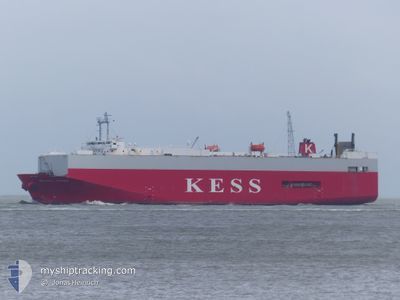
The vessel MALACCA HIGHWAY (IMO: 9235414, MMSI: 355351000) is a Vehicles Carrier that was built in 2001 ( 24 Jaar oud ). It's sailing under the flag of [PA] Panama.
In this page you can find informations about the vessels current position, last detected port calls, and current voyage information. If the vessels is not in coverage by AIS you will find the latest position.
The current position of MALACCA HIGHWAY is detected by our AIS receivers and we are not responsible for the reliability of the data. The last position was recorded while the vessel was in Coverage by the Ais receivers of our vessel tracking app.
The current draught of MALACCA HIGHWAY as reported by AIS is 6.8 meters
Weather
| Temperature | 8.3°C / 46.94°F |
|---|---|
| Wind Speed | 30 knots |
| Direction | 175° S |
| Pressure | 1003 hPa |
| Humidity | 77.2 % |
| Cloud Coverage | 100 % |
Featured Company
Last Port Calls
| Port | Arrival | Departure | Time In Port |
|---|---|---|---|
| 2025-12-04 13:01 | 2025-12-05 01:17 | 12 h | |
| 2025-11-30 12:20 | 2025-12-01 15:03 | 1 d | |
| 2025-11-28 15:46 | 2025-11-29 13:00 | 21 h | |
| 2025-11-27 01:53 | 2025-11-27 14:23 | 12 h | |
| 2025-11-25 21:52 | 2025-11-26 11:37 | 13 h | |
| 2025-11-22 09:16 | 2025-11-22 17:07 | 7 h | |
| 2025-11-18 13:34 | 2025-11-20 00:51 | 1 d | |
| 2025-11-13 15:48 | 2025-11-16 14:38 | 2 d | |
| 2025-11-09 21:22 | 2025-11-10 14:50 | 17 h | |
| 2025-11-08 11:50 | 2025-11-08 20:51 | 9 h |
Last Trips
| Origin | Departure | Destination | Arrival | Distance | |
|---|---|---|---|---|---|
| 2025-12-01 15:03 | 2025-12-04 13:01 | 726.41 nm | |||
| 2025-11-29 13:00 | 2025-11-30 12:20 | 338.89 nm | |||
| 2025-11-27 14:23 | 2025-11-28 15:46 | 340.02 nm | |||
| 2025-11-26 11:37 | 2025-11-27 01:53 | 186.85 nm | |||
| 2025-11-22 17:07 | 2025-11-25 21:52 | 1072.65 nm | |||
| 2025-11-20 00:51 | 2025-11-22 09:16 | 667.74 nm | |||
| 2025-11-16 14:38 | 2025-11-18 13:34 | 586.14 nm | |||
| 2025-11-10 14:50 | 2025-11-13 15:48 | 488.93 nm | |||
| 2025-11-08 20:51 | 2025-11-09 21:22 | 336.55 nm | |||
| 2025-11-07 14:17 | 2025-11-08 11:50 | 339.40 nm |
Events
| Tijd | Evenement | Details | Positie / Bestemming | Info |
|---|---|---|---|---|
| 2025-12-05 18:15 | Wijzig zee gebeid | United Kingdom part of the North Sea Belgian part of the North Sea |
51.85781 / 2.52745
North Sea
GBSOU
|
Snelheid: 15.4 kn Koers: 221.2° |
| 2025-12-05 18:14 | Gevonden in zee | Belgian part of the North Sea |
51.86104 / 2.53194
North Sea
GBSOU
|
Snelheid: 15.3 kn Koers: 221° |
| 2025-12-05 17:39 | Status Changed | Under way using engine Default |
51.97112 / 2.68798
GBSOU
|
Snelheid: 15.2 kn Koers: 222° |
| 2025-12-05 17:25 | Status Changed | Default Under way using engine |
52.01593 / 2.74874
GBSOU
|
Snelheid: 15.1 kn Koers: 218.7° |
| 2025-12-05 17:18 | Status Changed | Under way using engine Default |
52.03883 / 2.77936
GBSOU
|
Snelheid: 15 kn Koers: 219° |
| 2025-12-05 17:01 | Binnenbereik |
52.03883 / 2.77936
North Sea
GBSOU
|
Snelheid: 15.1 kn Koers: 218.7° |
|
| 2025-12-05 15:57 | Status Changed | Default Under way using engine |
52.30135 / 3.09509
GBSOU
|
Snelheid: 14.3 kn Koers: 213.9° |
| 2025-12-05 15:56 | Buitenbereik |
52.30630 / 3.10068
North Sea
GBSOU
|
Snelheid: 14.3 kn Koers: 213.9° |
|
| 2025-12-05 15:52 | Binnenbereik |
52.31921 / 3.11546
North Sea
GBSOU
|
Snelheid: 14.3 kn Koers: 215.2° |
|
| 2025-12-05 15:51 | Status Changed | Under way using engine Default |
52.32246 / 3.11917
GBSOU
|
Snelheid: 14.1 kn Koers: 215° |