
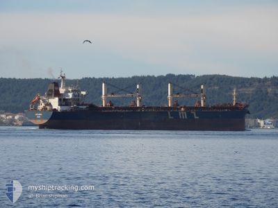
LMZ ARIEL
Bulk Carrier
Current Trip
IN NML
| Time Travelled | 4 days |
|---|---|
| Remaining Time | --- |
| Distance Travelled | 213.57 nm |
| Remaining Distance | --- |
| AVG Speed | 10.3 Knopen |
| MAX Speed | 12 Knopen |
| AVG Wind | 9.2 knots |
| MAX Wind | 15 knots |
| MIN Temp | 21.3°C / 70.34°F |
| MAX Temp | 29.8°C / 85.64°F |
| Diepgang | 9.8 M |
| Positie ontvangen | 11 d geleden |
Current Position
| Lengtegraad | --- |
|---|---|
| Breedtegraat | --- |
| Status | Under way using engine |
| Snelheid | 13 Knopen |
| Koers | 295.1° |
| Gebied | Laccadive Sea |
| Station | T-AIS |
| Positie ontvangen | 11 d geleden |
Info
Information
The current position of LMZ ARIEL is in Laccadive Sea with coordinates 7.92127° / 76.91096° as reported on 2025-12-06 14:00 by AIS to our vessel tracker app. The vessel's current speed is 13 Knopen
The vessel LMZ ARIEL (IMO: 9632818, MMSI: 538004551) is a Bulk Carrier that was built in 2012 ( 13 Jaar oud ). It's sailing under the flag of [MH] Marshall Is.
In this page you can find informations about the vessels current position, last detected port calls, and current voyage information. If the vessels is not in coverage by AIS you will find the latest position.
The current position of LMZ ARIEL is detected by our AIS receivers and we are not responsible for the reliability of the data. The last position was recorded while the vessel was in Coverage by the Ais receivers of our vessel tracking app.
The current draught of LMZ ARIEL as reported by AIS is 9.8 meters
Weather
| Temperature | 22.4°C / 72.32°F |
|---|---|
| Wind Speed | 8 knots |
| Direction | 86° E |
| Pressure | 1012.3 hPa |
| Humidity | 49.7 % |
| Cloud Coverage | 17 % |
Featured Company
Last Port Calls
| Port | Arrival | Departure | Time In Port |
|---|---|---|---|
| 2025-12-08 07:35 | 2025-12-13 17:07 | 5 d | |
| 2025-12-02 00:27 | 2025-12-06 05:16 | 4 d | |
| 2025-10-04 07:07 | 2025-10-06 00:23 | 1 d |
Last Trips
| Origin | Departure | Destination | Arrival | Distance | |
|---|---|---|---|---|---|
| 2025-12-06 05:16 | 2025-12-08 07:35 | 512.79 nm | |||
| 2025-10-06 00:23 | 2025-12-02 00:27 | 6637.63 nm | |||
| 2025-09-25 13:58 | 2025-10-04 07:07 | 1429.66 nm |
Events
| Tijd | Evenement | Details | Positie / Bestemming | Info |
|---|---|---|---|---|
| 2025-12-14 14:34 | Stop beweging | 5.01 nm, West of MORMUGAO |
15.44017 / 73.72778
IN NML
|
Snelheid: 0.2 kn Koers: 356° |
| 2025-12-14 12:01 | Start beweging | 14.09 nm, West of MORMUGAO |
15.47268 / 73.57460
IN NML
|
Snelheid: 4.1 kn Koers: 76° |
| 2025-12-14 09:15 | Stop beweging | 14.6 nm, West of MORMUGAO |
15.42333 / 73.55833
IN NML
|
Snelheid: Koers: -1° |
| 2025-12-13 11:37 | Vertrekhaven |
|
12.92362 / 74.79178
IN NML
|
Snelheid: 7.8 kn Koers: 259° |
| 2025-12-13 11:25 | Start beweging |
12.92799 / 74.81439
[IN] PANAMBUR
|
Snelheid: 3.7 kn Koers: 260° |
|
| 2025-12-08 02:37 | Stop beweging |
12.93351 / 74.81677
[IN] PANAMBUR
|
Snelheid: 0.1 kn Koers: 172° |
|
| 2025-12-08 02:05 | Aankomsthaven |
|
12.92535 / 74.80123
[IN] PANAMBUR
|
Snelheid: 5.5 kn Koers: 79° |
| 2025-12-08 01:05 | Start beweging | 7.77 nm, West of PANAMBUR |
12.93334 / 74.67384
IN NML
|
Snelheid: 4.2 kn Koers: 138° |