
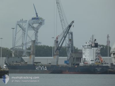
KOGA ROYAL
General Cargo
Current Trip
LR UCN
| Time Travelled | 1 day |
|---|---|
| Remaining Time | --- |
| Distance Travelled | 413.11 nm |
| Remaining Distance | --- |
| AVG Speed | 12.9 Knopen |
| MAX Speed | 14.2 Knopen |
| AVG Wind | 10.7 knots |
| MAX Wind | 17 knots |
| MIN Temp | 25.5°C / 77.9°F |
| MAX Temp | 27.6°C / 81.68°F |
| Diepgang | 6 M |
| Positie ontvangen | 16 d geleden |
Current Position
| Lengtegraad | -76.48223° |
|---|---|
| Breedtegraat | 25.70620° |
| Status | Under way using engine |
| Snelheid | 13.4 Knopen |
| Koers | 90.1° |
| Gebied | North Atlantic Ocean |
| Station | T-AIS |
| Positie ontvangen | 16 d geleden |
Info
Information
The current position of KOGA ROYAL is in North Atlantic Ocean with coordinates 25.70620° / -76.48223° as reported on 2024-05-21 04:28 by AIS to our vessel tracker app. The vessel's current speed is 13.4 Knopen
The vessel KOGA ROYAL (IMO: 9267754, MMSI: 636092312) is a General Cargo that was built in 2005 ( 19 Jaar oud ). It's sailing under the flag of [LR] Liberia.
In this page you can find informations about the vessels current position, last detected port calls, and current voyage information. If the vessels is not in coverage by AIS you will find the latest position.
The current position of KOGA ROYAL is detected by our AIS receivers and we are not responsible for the reliability of the data. The last position was recorded while the vessel was in Coverage by the Ais receivers of our vessel tracking app.
The current draught of KOGA ROYAL as reported by AIS is 6 meters
Weather
| Temperature | 25.5°C / 77.9°F |
|---|---|
| Wind Speed | 17 knots |
| Direction | 152° SSE |
| Pressure | 1013.6 hPa |
| Humidity | 77.3 % |
| Cloud Coverage | 59 % |
Featured Company
Last Port Calls
Last Trips
| Origin | Departure | Destination | Arrival | Distance | |
|---|---|---|---|---|---|
| 2024-05-16 23:55 | 2024-06-03 11:39 | 5249.94 nm | |||
| 2024-04-27 06:30 | 2024-05-09 22:28 | 2306.23 nm | |||
| 2024-04-22 06:41 | 2024-04-22 07:14 | 2.88 nm | |||
| 2024-04-04 11:40 | 2024-04-21 08:47 | 5538.20 nm | |||
| 2024-03-17 00:51 | 2024-04-03 22:44 | 5725.91 nm |
Events
| Tijd | Evenement | Details | Positie / Bestemming | Info |
|---|---|---|---|---|
| 2024-06-04 20:01 | Start beweging | 0.62 nm, West of BUCHANAN |
5.86120 / -10.06462
LR UCN
|
Snelheid: 7.4 kn Koers: 288° |
| 2024-06-04 20:01 | Vertrekhaven |
|
5.86120 / -10.06462
LR UCN
|
Snelheid: 2.9 kn Koers: 288° |
| 2024-06-03 11:57 | Stop beweging |
5.85874 / -10.05158
[LR] BUCHANAN
|
Snelheid: 0.3 kn Koers: 122° |
|
| 2024-06-03 11:39 | Aankomsthaven |
|
5.85857 / -10.05636
[LR] BUCHANAN
|
Snelheid: 5 kn Koers: 95° |
| 2024-06-03 11:12 | Start beweging | 1.61 nm, West of BUCHANAN |
5.85917 / -10.08166
LR UCN
|
Snelheid: 3.3 kn Koers: 81° |
| 2024-06-03 09:03 | Stop beweging | 1.75 nm, West of BUCHANAN |
5.85841 / -10.08408
LR UCN
|
Snelheid: 0.2 kn Koers: 181° |