
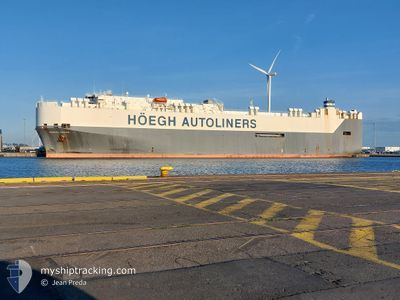
HOEGH TROVE
Vehicles Carrier
Current Trip
| Time Travelled | 8 days |
|---|---|
| Remaining Time | --- |
| Distance Travelled | 3018.94 nm |
| Remaining Distance | --- |
| AVG Speed | 14.6 Knopen |
| MAX Speed | 18.9 Knopen |
| AVG Wind | 13.3 knots |
| MAX Wind | 24.5 knots |
| MIN Temp | 6.1°C / 42.98°F |
| MAX Temp | 28.3°C / 82.94°F |
| Diepgang | 9.3 M |
| Positie ontvangen | 1 d geleden |
Current Position
| Lengtegraad | --- |
|---|---|
| Breedtegraat | --- |
| Status | Under way using engine |
| Snelheid | 16.4 Knopen |
| Koers | 310.1° |
| Gebied | Malacca Strait |
| Station | T-AIS |
| Positie ontvangen | 1 d geleden |
Info
Information
The current position of HOEGH TROVE is in Malacca Strait with coordinates 2.14188° / 102.02062° as reported on 2026-01-02 15:06 by AIS to our vessel tracker app. The vessel's current speed is 16.4 Knopen and is heading at the port of PORTBURY. The estimated time of arrival as calculated by MyShipTracking vessel tracking app is 2026-03-02 05:00 LT
The vessel HOEGH TROVE (IMO: 9186302, MMSI: 258774000) is a Vehicles Carrier that was built in 2000 ( 26 Jaar oud ). It's sailing under the flag of [NO] Norway.
In this page you can find informations about the vessels current position, last detected port calls, and current voyage information. If the vessels is not in coverage by AIS you will find the latest position.
The current position of HOEGH TROVE is detected by our AIS receivers and we are not responsible for the reliability of the data. The last position was recorded while the vessel was in Coverage by the Ais receivers of our vessel tracking app.
The current draught of HOEGH TROVE as reported by AIS is 9.3 meters
Weather
| Temperature | 27.8°C / 82.04°F |
|---|---|
| Wind Speed | 8 knots |
| Direction | 94° E |
| Pressure | 1010.1 hPa |
| Humidity | 72.7 % |
| Cloud Coverage | 87 % |
Featured Company
Most Visited Ports (Last year)
| Port | Arrivals | |
|---|---|---|
| 5 | ||
| 4 | ||
| 3 | ||
| 3 | ||
| 3 | ||
| 2 |
Events
| Tijd | Evenement | Details | Positie / Bestemming | Info |
|---|---|---|---|---|
| 2026-01-02 15:13 | Status Changed | Default Under way using engine |
2.16176 / 101.99759
GBBRS
|
Snelheid: 16.4 kn Koers: 310.1° |
| 2026-01-02 15:06 | Status Changed | Under way using engine Default |
2.14188 / 102.02062
GBBRS
|
Snelheid: 16.4 kn Koers: 310° |
| 2026-01-02 15:06 | Buitenbereik |
2.14188 / 102.02062
Malacca Strait
|
Snelheid: 16.4 kn Koers: 310.1° |
|
| 2026-01-02 15:05 | Status Changed | Default Under way using engine |
2.13703 / 102.02627
GBBRS
|
Snelheid: 16.5 kn Koers: 309.7° |
| 2026-01-02 13:32 | Status Changed | Under way using engine Default |
1.89756 / 102.35411
GBBRS
|
Snelheid: 15 kn Koers: 293° |
| 2026-01-02 12:57 | Status Changed | Default Under way using engine |
1.83959 / 102.48903
GBBRS
|
Snelheid: 15 kn Koers: 293.5° |
| 2026-01-02 12:56 | Wijzig zee gebeid | Malaysian part of the Malacca Strait Malaysian part of the Singapore Strait |
1.83775 / 102.49326
Malacca Strait
|
Snelheid: 15 kn Koers: 293.5° |
| 2026-01-02 12:56 | Status Changed | Under way using engine Default |
1.83708 / 102.49480
GBBRS
|
Snelheid: 14.9 kn Koers: 292° |
| 2026-01-02 12:41 | Binnenbereik |
1.83775 / 102.49326
Malacca Strait
|
Snelheid: 15 kn Koers: 293.5° |
|
| 2026-01-02 08:29 | Buitenbereik |
1.22813 / 103.47537
Singapore Strait
|
Snelheid: 16.7 kn Koers: 283.3° |