
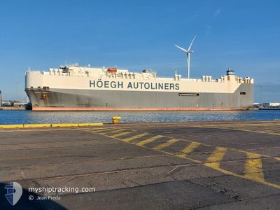
HOEGH TROVE
Vehicles Carrier
Current Trip
| Time Travelled | 29 days |
|---|---|
| Remaining Time | --- |
| Distance Travelled | 11071.23 nm |
| Remaining Distance | --- |
| AVG Speed | 15.3 Knop |
| MAX Speed | 21 Knop |
| AVG Wind | 10.1 knots |
| MAX Wind | 29.4 knots |
| MIN Temp | 11.2°C / 52.16°F |
| MAX Temp | 30.5°C / 86.9°F |
| Djupgående | 9.3 m |
| Position mottagen | 3 d sen |
Current Position
| Longitud | -0.00288° |
|---|---|
| Latitude | -12.65152° |
| Status | Under way using engine |
| Fart | 16.5 Knop |
| Kurs | 322.3° |
| Område | South Atlantic Ocean |
| Station | T-AIS |
| Position mottagen | 3 d sen |
Info
Information
The current position of HOEGH TROVE is in South Atlantic Ocean with coordinates -12.65152° / -0.00288° as reported on 2024-04-21 21:40 by AIS to our vessel tracker app. The vessel's current speed is 16.5 Knop and is heading at the port of BARCELONA. The estimated time of arrival as calculated by MyShipTracking vessel tracking app is 2024-05-03 03:00 LT
The vessel HOEGH TROVE (IMO: 9186302, MMSI: 258774000) is a Vehicles Carrier that was built in 2000 ( 24 År gammal ). It's sailing under the flag of [NO] Norway.
In this page you can find informations about the vessels current position, last detected port calls, and current voyage information. If the vessels is not in coverage by AIS you will find the latest position.
The current position of HOEGH TROVE is detected by our AIS receivers and we are not responsible for the reliability of the data. The last position was recorded while the vessel was in Coverage by the Ais receivers of our vessel tracking app.
The current draught of HOEGH TROVE as reported by AIS is 9.3 meters
Weather
| Temperature | 27.8°C / 82.04°F |
|---|---|
| Wind Speed | 6 knots |
| Direction | 324° NW |
| Pressure | 1009.7 hPa |
| Humidity | 72.6 % |
| Cloud Coverage | 85 % |
Featured Company
Last Port Calls
| Port | Arrival | Departure | Time In Port |
|---|---|---|---|
| 2024-03-26 05:05 | 2024-03-27 05:30 | 1 d | |
| 2024-02-20 14:00 | 2024-02-22 03:51 | 1 d | |
| 2024-02-14 12:21 | 2024-02-15 09:52 | 21 h |
Last Trips
| Origin | Departure | Destination | Arrival | Distance | |
|---|---|---|---|---|---|
| 2024-02-21 21:51 | 2024-03-26 13:05 | 11001.87 nm | |||
| 2024-02-15 04:52 | 2024-02-20 08:00 | 1373.66 nm | |||
| 2024-01-27 15:44 | 2024-02-14 07:21 | 7104.11 nm |
Events
| Tid | Event | Detaljer | Position / Dest | Information |
|---|---|---|---|---|
| 2024-04-21 21:44 | Status ändrad | Default Under way using engine |
-12.63762 / -.01399
ESBCN
|
Fart: 16.5 kn Kurs: 322.3° |
| 2024-04-21 21:40 | Status ändrad | Under way using engine Default |
-12.65152 / -.00288
ESBCN
|
Fart: 16.6 kn Kurs: 321° |
| 2024-04-21 21:40 | UTANFÖR täckningsområde |
-12.65152 / -.00288
South Atlantic Ocean
ESBCN
|
Fart: 16.5 kn Kurs: 322.3° |
|
| 2024-04-21 20:44 | Status ändrad | Default Under way using engine |
-12.85348 / .15638
ESBCN
|
Fart: 16.7 kn Kurs: 322.8° |
| 2024-04-21 20:40 | Status ändrad | Under way using engine Default |
-12.86977 / .16887
ESBCN
|
Fart: 16.4 kn Kurs: 324° |
| 2024-04-21 19:55 | Status ändrad | Default Under way using engine |
-13.03597 / .29522
ESBCN
|
Fart: 16.6 kn Kurs: 322.1° |
| 2024-04-21 19:44 | Status ändrad | Under way using engine Default |
-13.07624 / .32673
ESBCN
|
Fart: 16.3 kn Kurs: 323° |
| 2024-04-21 19:35 | I täckningsområde |
-13.06820 / .32045
South Atlantic Ocean
ESBCN
|
Fart: 16.6 kn Kurs: 321.3° |
|
| 2024-04-21 15:29 | Status ändrad | Default Under way using engine |
-14.02881 / 1.05866
ESBCN
|
Fart: 16.9 kn Kurs: 321.7° |
| 2024-04-21 15:26 | UTANFÖR täckningsområde |
-14.03930 / 1.06695
South Atlantic Ocean
ESBCN
|
Fart: 16.9 kn Kurs: 321.7° |