
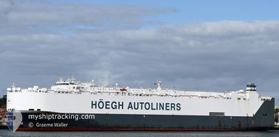
HOEGH DETROIT
Other Type
Current Trip
| Time Travelled | 4 days |
|---|---|
| Remaining Time | --- |
| Distance Travelled | 1667.11 nm |
| Remaining Distance | --- |
| AVG Speed | 14.6 Knopen |
| MAX Speed | 19.1 Knopen |
| AVG Wind | 11.2 knots |
| MAX Wind | 20 knots |
| MIN Temp | 21.3°C / 70.34°F |
| MAX Temp | 29.4°C / 84.92°F |
| Diepgang | 7.3 M |
| Positie ontvangen | 4 d geleden |
Current Position
| Lengtegraad | --- |
|---|---|
| Breedtegraat | --- |
| Status | Under way using engine |
| Snelheid | 14.9 Knopen |
| Koers | 19° |
| Gebied | Coral Sea |
| Station | T-AIS |
| Positie ontvangen | 4 d geleden |
Info
Information
The current position of HOEGH DETROIT is in Coral Sea with coordinates -25.52393° / 153.70532° as reported on 2025-12-08 02:08 by AIS to our vessel tracker app. The vessel's current speed is 14.9 Knopen and is heading at the port of HITACHINAKA. The estimated time of arrival as calculated by MyShipTracking vessel tracking app is 2025-12-18 12:00 LT
The vessel HOEGH DETROIT (IMO: 9312470, MMSI: 257869000) is a Other Type It's sailing under the flag of [NO] Norway.
In this page you can find informations about the vessels current position, last detected port calls, and current voyage information. If the vessels is not in coverage by AIS you will find the latest position.
The current position of HOEGH DETROIT is detected by our AIS receivers and we are not responsible for the reliability of the data. The last position was recorded while the vessel was in Coverage by the Ais receivers of our vessel tracking app.
The current draught of HOEGH DETROIT as reported by AIS is 7.3 meters
Weather
| Temperature | 27.1°C / 80.78°F |
|---|---|
| Wind Speed | 1 knots |
| Direction | 288° WNW |
| Pressure | 1007.4 hPa |
| Humidity | 75.4 % |
| Cloud Coverage | 100 % |
Featured Company
Last Port Calls
| Port | Arrival | Departure | Time In Port |
|---|---|---|---|
| 2025-12-07 13:08 | 2025-12-08 03:24 | 14 h | |
| 2025-12-05 10:40 | 2025-12-06 00:15 | 13 h | |
| 2025-12-02 04:04 | 2025-12-03 18:18 | 1 d | |
| 2025-11-27 07:57 | 2025-11-27 20:14 | 12 h | |
| 2025-11-05 02:42 | 2025-11-06 01:42 | 23 h | |
| 2025-10-26 16:45 | 2025-10-27 20:41 | 1 d | |
| 2025-10-13 09:33 | 2025-10-13 23:53 | 14 h | |
| 2025-10-08 19:55 | 2025-10-12 12:05 | 3 d | |
| 2025-10-04 21:48 | 2025-10-05 14:38 | 16 h | |
| 2025-10-01 03:02 | 2025-10-03 20:36 | 2 d |
Most Visited Ports (Last year)
| Port | Arrivals | |
|---|---|---|
| 3 | ||
| 3 | ||
| 3 | ||
| 2 | ||
| 2 | ||
| 2 |
Last Trips
| Origin | Departure | Destination | Arrival | Distance | |
|---|---|---|---|---|---|
| 2025-12-06 00:15 | 2025-12-07 13:08 | 573.73 nm | |||
| 2025-12-03 18:18 | 2025-12-05 10:40 | 581.07 nm | |||
| 2025-11-27 20:14 | 2025-12-02 04:04 | 1681.79 nm | |||
| 2025-11-06 01:42 | 2025-11-27 07:57 | 7243.19 nm | |||
| 2025-10-27 20:41 | 2025-11-05 02:42 | 783.55 nm | |||
| 2025-10-13 23:53 | 2025-10-26 16:45 | 4208.09 nm | |||
| 2025-10-12 12:05 | 2025-10-13 09:33 | 276.11 nm | |||
| 2025-10-05 14:38 | 2025-10-08 19:55 | 587.50 nm | |||
| 2025-10-03 20:36 | 2025-10-04 21:48 | 416.65 nm | |||
| 2025-09-28 16:14 | 2025-10-01 03:02 | 508.31 nm |
Events
| Tijd | Evenement | Details | Positie / Bestemming | Info |
|---|---|---|---|---|
| 2025-12-08 02:16 | Status Changed | Default Under way using engine |
-25.49510 / 153.71652
AUBNE>JPHIC
|
Snelheid: 14.9 kn Koers: 19° |
| 2025-12-08 02:08 | Buitenbereik |
-25.52393 / 153.70532
Coral Sea
AUBNE>JPHIC
|
Snelheid: 14.9 kn Koers: 19° |
|
| 2025-12-07 22:18 | Start beweging | 12.16 nm, East of NOOSAVILLE |
-26.46820 / 153.27235
AUBNE>JPHIC
|
Snelheid: 4.5 kn Koers: 30° |
| 2025-12-07 22:06 | Stop beweging | 12.11 nm, East of NOOSAVILLE |
-26.46955 / 153.27083
AUBNE>JPHIC
|
Snelheid: 0.3 kn Koers: 34° |
| 2025-12-07 17:24 | Vertrekhaven |
|
-27.34312 / 153.18618
AUBNE>JPHIC
|
Snelheid: 13 kn Koers: 33° |
| 2025-12-07 17:12 | Start beweging |
-27.37670 / 153.16460
[AU] BRISBANE
|
Snelheid: 3.3 kn Koers: 27° |
|
| 2025-12-07 17:01 | Status Changed | Under way using engine Moored |
-27.37932 / 153.16488
[AU] BRISBANE
|
Snelheid: Koers: 38° |
| 2025-12-07 15:39 | Draught Changed | 7.3 7.6 |
-27.37933 / 153.16490
[AU] BRISBANE
|
Snelheid: Koers: 38° |
| 2025-12-07 14:33 | Destination Changed | AUBNE>JPHIC AUPKL>AUBNE |
-27.37937 / 153.16488
[AU] BRISBANE
|
Snelheid: Koers: 38° |
| 2025-12-07 14:33 | ETA Changed | 2025/12/18 03:00 2025/12/06 23:15 |
-27.37937 / 153.16488
[AU] BRISBANE
|
Snelheid: Koers: 38° |