
HISUI HORIZON
Cargo
Current Trip
| Time Travelled | 24 days |
|---|---|
| Remaining Time | --- |
| Distance Travelled | 4461.70 nm |
| Remaining Distance | --- |
| AVG Speed | 12.4 Knopen |
| MAX Speed | 15.5 Knopen |
| AVG Wind | 16 knots |
| MAX Wind | 40 knots |
| MIN Temp | 3.4°C / 38.12°F |
| MAX Temp | 16.4°C / 61.52°F |
| Diepgang | 13 M |
| Positie ontvangen | 20 h, 56 m geleden |
Current Position
| Lengtegraad | --- |
|---|---|
| Breedtegraat | --- |
| Status | Under way using engine |
| Snelheid | 13.3 Knopen |
| Koers | 281.1° |
| Gebied | The Coastal Waters of Southeast Alaska and British Columbia |
| Station | T-AIS |
| Positie ontvangen | 20 h, 56 m geleden |
Info
Information
The current position of HISUI HORIZON is in The Coastal Waters of Southeast Alaska and British Columbia with coordinates 54.40317° / -132.07347° as reported on 2025-12-10 03:35 by AIS to our vessel tracker app. The vessel's current speed is 13.3 Knopen and is heading at the port of TSAWWASSEN. The estimated time of arrival as calculated by MyShipTracking vessel tracking app is 2025-12-12 08:00 LT
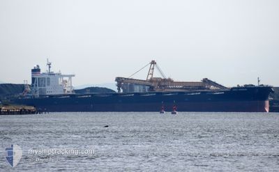
The vessel HISUI HORIZON (IMO: 9707546, MMSI: 431139000) is a Cargo It's sailing under the flag of [JP] Japan.
In this page you can find informations about the vessels current position, last detected port calls, and current voyage information. If the vessels is not in coverage by AIS you will find the latest position.
The current position of HISUI HORIZON is detected by our AIS receivers and we are not responsible for the reliability of the data. The last position was recorded while the vessel was in Coverage by the Ais receivers of our vessel tracking app.
The current draught of HISUI HORIZON as reported by AIS is 13 meters
Weather
| Temperature | 7.6°C / 45.68°F |
|---|---|
| Wind Speed | 25 knots |
| Direction | 287° WNW |
| Pressure | 1003.1 hPa |
| Humidity | 70.7 % |
| Cloud Coverage | 49 % |
Featured Company
Events
| Tijd | Evenement | Details | Positie / Bestemming | Info |
|---|---|---|---|---|
| 2025-12-10 03:42 | Status Changed | Default Under way using engine |
54.40819 / -132.11719
CA RTB
|
Snelheid: 13.3 kn Koers: 281.1° |
| 2025-12-10 03:35 | Buitenbereik |
54.40317 / -132.07347
The Coastal Waters of Southeast Alaska and British Columbia
CA RTB
|
Snelheid: 13.3 kn Koers: 281.1° |
|
| 2025-12-10 03:21 | Gevonden in zee | United States (Alaska) part of the The Coastal Waters of Southeast Alaska and British Columbia |
54.39383 / -131.98884
The Coastal Waters of Southeast Alaska and British Columbia
CA RTB
|
Snelheid: 13.7 kn Koers: 278° |
| 2025-12-10 01:11 | ETA Changed | 2025/12/12 16:00 2025/12/09 23:51 |
54.33816 / -131.18875
CA RTB
|
Snelheid: 12.9 kn Koers: 274.6° |
| 2025-12-09 23:58 | ETA Changed | 2025/12/09 23:51 2025/12/08 23:24 |
54.29050 / -130.79012
CA RTB
|
Snelheid: 10.1 kn Koers: 295.4° |
| 2025-12-09 22:18 | Start beweging | 5.01 nm, South of PRINCE RUPERT |
54.22728 / -130.34664
CA RTB
|
Snelheid: 3.2 kn Koers: 215° |
| 2025-12-09 21:51 | Draught Changed | 13 13.3 |
54.22703 / -130.33820
CA RTB
|
Snelheid: Koers: 187° |
| 2025-12-09 21:51 | Status Changed | Under way using engine Moored |
54.22704 / -130.33820
CA RTB
|
Snelheid: Koers: 187° |
| 2025-12-09 10:21 | Status Changed | Moored Default |
54.22704 / -130.33822
CA RTB
|
Snelheid: Koers: 187° |
| 2025-12-09 10:18 | Status Changed | Default Moored |
54.22706 / -130.33821
CA RTB
|
Snelheid: Koers: 187° |