
HISUI HORIZON
Cargo
Current Trip
| Time Travelled | 21 days |
|---|---|
| Remaining Time | --- |
| Distance Travelled | 4142.72 nm |
| Remaining Distance | 2.91 nm |
| AVG Speed | 12.8 Knots |
| MAX Speed | 15.5 Knots |
| AVG Wind | 16.1 knots |
| MAX Wind | 40 knots |
| MIN Temp | 3.4°C / 38.12°F |
| MAX Temp | 16.4°C / 61.52°F |
| Dybgang | 9.2 m |
| Position Modtaget | 3 m siden |
Current Position
| Longitude | --- |
|---|---|
| Latitude | --- |
| Status | Moored |
| Fart | |
| Kurs | 187° |
| Område | The Coastal Waters of Southeast Alaska and British Columbia |
| Station | T-AIS |
| Position Modtaget | 3 m siden |
Info
Information
The current position of HISUI HORIZON is in The Coastal Waters of Southeast Alaska and British Columbia with coordinates 54.22694° / -130.33836° as reported on 2025-12-07 23:45 by AIS to our vessel tracker app. The vessel's current speed is 0 Knots and is heading at the port of PRINCE RUPERT.
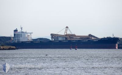
The vessel HISUI HORIZON (IMO: 9707546, MMSI: 431139000) is a Cargo It's sailing under the flag of [JP] Japan.
In this page you can find informations about the vessels current position, last detected port calls, and current voyage information. If the vessels is not in coverage by AIS you will find the latest position.
The current position of HISUI HORIZON is detected by our AIS receivers and we are not responsible for the reliability of the data. The last position was recorded while the vessel was in Coverage by the Ais receivers of our vessel tracking app.
The current draught of HISUI HORIZON as reported by AIS is 9.2 meters
Weather
| Temperature | 5.6°C / 42.08°F |
|---|---|
| Wind Speed | 14 knots |
| Direction | 183° S |
| Pressure | 997 hPa |
| Humidity | 87.5 % |
| Cloud Coverage | 100 % |
Featured Company
Events
| Tid | Hændelsen | Detaljer | Position / Dest | Info |
|---|---|---|---|---|
| 2025-12-07 22:51 | Status er ændret | Moored Default |
54.22699 / -130.33828
CA PRR
|
Fart: 0.1 kn Kurs: 187° |
| 2025-12-07 22:48 | Status er ændret | Default Moored |
54.22702 / -130.33826
CA PRR
|
Fart: 0.1 kn Kurs: 187° |
| 2025-12-07 22:36 | Status er ændret | Moored Default |
54.22699 / -130.33827
CA PRR
|
Fart: Kurs: 187° |
| 2025-12-07 22:33 | Status er ændret | Default Moored |
54.22704 / -130.33823
CA PRR
|
Fart: Kurs: 187° |
| 2025-12-07 20:24 | Status er ændret | Moored Default |
54.22700 / -130.33826
CA PRR
|
Fart: 0.1 kn Kurs: 187° |
| 2025-12-07 20:21 | Status er ændret | Default Moored |
54.22700 / -130.33824
CA PRR
|
Fart: 0.1 kn Kurs: 187° |
| 2025-12-07 18:01 | Status er ændret | Moored Under way using engine |
54.22695 / -130.33827
CA PRR
|
Fart: 0.1 kn Kurs: 186° |
| 2025-12-07 17:48 | STOP Sejllads | 5.02 nm, South of PRINCE RUPERT |
54.22704 / -130.33851
CA PRR
|
Fart: 0.3 kn Kurs: 191° |
| 2025-12-07 15:32 | Status er ændret | Under way using engine At anchor |
54.28073 / -130.65328
CA PRR
|
Fart: 3.4 kn Kurs: 230° |
| 2025-12-07 15:32 | START Sejllads | 11.09 nm, West of PRINCE RUPERT |
54.28084 / -130.65281
CA PRR
|
Fart: 3.3 kn Kurs: 230° |