
GERHARD SCHULTE
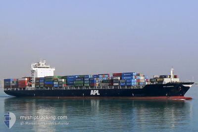
Container Ship
Current Trip
| Time Travelled | 3 days |
|---|---|
| Remaining Time | 9 h, 50 mins |
| Distance Travelled | 732.80 nm |
| Remaining Distance | 161.16 nm |
| AVG Speed | 11 Knopen |
| MAX Speed | 18.1 Knopen |
| AVG Wind | 16.9 knots |
| MAX Wind | 29.5 knots |
| MIN Temp | 7.2°C / 44.96°F |
| MAX Temp | 16.6°C / 61.88°F |
| Diepgang | 11.1 M |
| Positie ontvangen | 4 h, 52 m geleden |
Current Position
| Lengtegraad | --- |
|---|---|
| Breedtegraat | --- |
| Status | Under way using engine |
| Snelheid | 11.1 Knopen |
| Koers | 56° |
| Gebied | Mediterranean Sea - Western Basin |
| Station | T-AIS |
| Positie ontvangen | 4 h, 52 m geleden |
Info
Information
The current position of GERHARD SCHULTE is in Mediterranean Sea - Western Basin with coordinates 42.16269° / 7.18204° as reported on 2025-12-06 04:11 by AIS to our vessel tracker app. The vessel's current speed is 11.1 Knopen and is heading at the port of LIVORNO. The estimated time of arrival as calculated by MyShipTracking vessel tracking app is 2025-12-06 19:53 LT
The vessel GERHARD SCHULTE (IMO: 9328481, MMSI: 477214400) is a Container Ship that was built in 2006 ( 19 Jaar oud ). It's sailing under the flag of [HK] Hong Kong.
In this page you can find informations about the vessels current position, last detected port calls, and current voyage information. If the vessels is not in coverage by AIS you will find the latest position.
The current position of GERHARD SCHULTE is detected by our AIS receivers and we are not responsible for the reliability of the data. The last position was recorded while the vessel was in Coverage by the Ais receivers of our vessel tracking app.
The current draught of GERHARD SCHULTE as reported by AIS is 11.1 meters
Weather
| Temperature | 14.7°C / 58.46°F |
|---|---|
| Wind Speed | 14 knots |
| Direction | 246° WSW |
| Pressure | 1014.9 hPa |
| Humidity | 56.1 % |
| Cloud Coverage | 52 % |
Featured Company
Last Port Calls
| Port | Arrival | Departure | Time In Port |
|---|---|---|---|
| 2025-12-02 21:21 | 2025-12-03 09:12 | 11 h | |
| 2025-11-25 14:49 | 2025-11-26 23:40 | 1 d | |
| 2025-11-23 06:45 | 2025-11-25 08:59 | 2 d | |
| 2025-11-20 07:03 | 2025-11-20 18:56 | 11 h | |
| 2025-11-12 16:29 | 2025-11-13 23:49 | 1 d | |
| 2025-11-09 12:27 | 2025-11-12 02:48 | 2 d | |
| 2025-11-06 18:51 | 2025-11-07 06:29 | 11 h | |
| 2025-11-01 05:48 | 2025-11-02 08:25 | 1 d | |
| 2025-10-30 08:35 | 2025-11-01 02:00 | 1 d | |
| 2025-10-22 11:16 | 2025-10-22 11:20 | 3 m |
Last Trips
| Origin | Departure | Destination | Arrival | Distance | |
|---|---|---|---|---|---|
| 2025-11-26 23:40 | 2025-12-02 21:21 | 992.15 nm | |||
| 2025-11-25 08:59 | 2025-11-25 14:49 | 52.59 nm | |||
| 2025-11-20 18:56 | 2025-11-23 06:45 | 896.26 nm | |||
| 2025-11-13 23:49 | 2025-11-20 07:03 | 962.32 nm | |||
| 2025-11-12 02:48 | 2025-11-12 16:29 | 56.87 nm | |||
| 2025-11-07 06:29 | 2025-11-09 12:27 | 894.03 nm | |||
| 2025-11-02 08:25 | 2025-11-06 18:51 | 980.98 nm | |||
| 2025-11-01 02:00 | 2025-11-01 05:48 | 52.51 nm | |||
| 2025-10-22 11:20 | 2025-10-30 08:35 | 1092.60 nm | |||
| 2025-10-22 06:01 | 2025-10-22 11:16 | 3.74 nm |
Events
| Tijd | Evenement | Details | Positie / Bestemming | Info |
|---|---|---|---|---|
| 2025-12-06 05:06 | Status Changed | Default Under way using engine |
42.25667 / 7.37833
LIVORNO
|
Snelheid: 11.1 kn Koers: 56° |
| 2025-12-06 04:11 | Status Changed | Under way using engine Default |
42.16269 / 7.18204
LIVORNO
|
Snelheid: 11 kn Koers: 57° |
| 2025-12-06 04:11 | Buitenbereik |
42.16269 / 7.18204
Mediterranean Sea - Western Basin
LIVORNO
|
Snelheid: 11.1 kn Koers: 56° |
|
| 2025-12-06 03:51 | Status Changed | Default Under way using engine |
42.12833 / 7.11167
LIVORNO
|
Snelheid: 11.2 kn Koers: 57° |
| 2025-12-06 03:44 | Wijzig zee gebeid | French part of the Mediterranean Sea - Western Basin Spanish part of the Balearic Sea |
42.11735 / 7.08660
Mediterranean Sea - Western Basin
LIVORNO
|
Snelheid: 11.2 kn Koers: 57.7° |
| 2025-12-06 03:44 | Status Changed | Under way using engine Default |
42.11735 / 7.08660
LIVORNO
|
Snelheid: 11 kn Koers: 58° |
| 2025-12-06 03:24 | Binnenbereik |
42.11735 / 7.08660
Mediterranean Sea - Western Basin
LIVORNO
|
Snelheid: 11.2 kn Koers: 57.7° |
|
| 2025-12-05 05:09 | Status Changed | Default Under way using engine |
40.15443 / 2.82558
LIVORNO
|
Snelheid: 10 kn Koers: 54° |
| 2025-12-05 05:04 | Buitenbereik |
40.14582 / 2.80993
Balearic Sea
LIVORNO
|
Snelheid: 10 kn Koers: 54° |
|
| 2025-12-05 04:45 | Status Changed | Under way using engine Default |
40.11327 / 2.75019
LIVORNO
|
Snelheid: 10.5 kn Koers: 54° |