
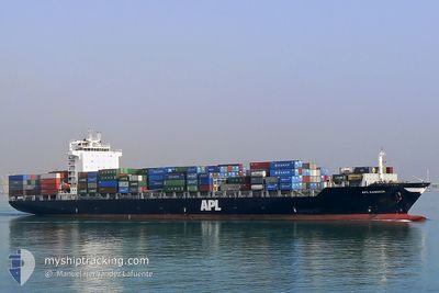
GERHARD SCHULTE
Container Ship
Current Trip
ALGECI
| Time Travelled | 7 days |
|---|---|
| Remaining Time | --- |
| Distance Travelled | 2953.96 nm |
| Remaining Distance | --- |
| AVG Speed | 15.7 Knots |
| MAX Speed | 18 Knots |
| AVG Wind | 11.9 knots |
| MAX Wind | 25.9 knots |
| MIN Temp | 18°C / 64.4°F |
| MAX Temp | 28.2°C / 82.76°F |
| Dybgang | 11.8 m |
| Position Modtaget | 4 d siden |
Current Position
| Longitude | -66.78195° |
|---|---|
| Latitude | 19.50694° |
| Status | Under way using engine |
| Fart | 17.8 Knots |
| Kurs | 62.5° |
| Område | North Atlantic Ocean |
| Station | T-AIS |
| Position Modtaget | 4 d siden |
Info
Information
The current position of GERHARD SCHULTE is in North Atlantic Ocean with coordinates 19.50694° / -66.78195° as reported on 2024-04-13 20:03 by AIS to our vessel tracker app. The vessel's current speed is 17.8 Knots
The vessel GERHARD SCHULTE (IMO: 9328481, MMSI: 477214400) is a Container Ship that was built in 2006 ( 18 år gamle ). It's sailing under the flag of [HK] Hong Kong.
In this page you can find informations about the vessels current position, last detected port calls, and current voyage information. If the vessels is not in coverage by AIS you will find the latest position.
The current position of GERHARD SCHULTE is detected by our AIS receivers and we are not responsible for the reliability of the data. The last position was recorded while the vessel was in Coverage by the Ais receivers of our vessel tracking app.
The current draught of GERHARD SCHULTE as reported by AIS is 11.8 meters
Weather
| Temperature | 18.6°C / 65.48°F |
|---|---|
| Wind Speed | 11 knots |
| Direction | 300° WNW |
| Pressure | 1017.4 hPa |
| Humidity | 72.7 % |
| Cloud Coverage | 100 % |
Featured Company
Last Port Calls
| Port | Arrival | Departure | Time In Port |
|---|---|---|---|
| 2024-04-08 14:26 | 2024-04-10 19:05 | 2 d | |
| 2024-03-28 23:41 | 2024-03-30 08:04 | 1 d | |
| 2024-03-26 00:53 | 2024-03-27 01:07 | 1 d | |
| 2024-03-20 12:25 | 2024-03-21 00:06 | 11 h | |
| 2024-03-19 04:30 | 2024-03-19 18:10 | 13 h | |
| 2024-03-15 00:45 | |||
| 2024-03-13 13:47 | 2024-03-14 09:33 | 19 h | |
| 2024-03-13 09:21 | |||
| 2024-03-09 13:49 | 2024-03-10 08:05 | 18 h | |
| 2024-03-07 11:55 |
Most Visited Ports (Last year)
| Port | Arrivals | |
|---|---|---|
| 33 | ||
| 27 | ||
| 24 | ||
| 23 | ||
| 21 | ||
| 20 |
Last Trips
| Origin | Departure | Destination | Arrival | Distance | |
|---|---|---|---|---|---|
| 2024-03-30 04:04 | 2024-04-08 09:26 | 894.39 nm | |||
| 2024-03-26 20:07 | 2024-03-28 19:41 | 813.51 nm | |||
| 2024-03-20 19:06 | 2024-03-25 19:53 | 25.68 nm | |||
| 2024-03-19 13:10 | 2024-03-20 07:25 | 18.22 nm | |||
| 2024-03-14 05:33 | 2024-03-14 20:45 | 246.22 nm | |||
| 2024-03-13 05:21 | 2024-03-13 09:47 | 20.29 nm | |||
| 2024-03-07 06:55 | 2024-03-09 08:49 | 316.09 nm | |||
| 2024-03-01 12:32 | 2024-03-05 05:16 | 1014.73 nm | |||
| 2024-02-27 17:52 | 2024-02-29 12:40 | 258.63 nm | |||
| 2024-02-23 13:29 | 2024-02-25 19:56 | 618.30 nm |
Events
| Tid | Hændelsen | Detaljer | Position / Dest | Info |
|---|---|---|---|---|
| 2024-04-13 20:19 | Status er ændret | Default Under way using engine |
19.54167 / -66.70834
ALGECI
|
Fart: 17.8 kn Kurs: 62.5° |
| 2024-04-13 20:03 | Udenfor Dækning |
19.50694 / -66.78195
North Atlantic Ocean
ALGECI
|
Fart: 17.8 kn Kurs: 62.5° |
|
| 2024-04-13 19:46 | Ændre havområde | Puerto Rican part of the North Atlantic Ocean Panamanian part of the Caribbean Sea |
19.46663 / -66.86402
North Atlantic Ocean
ALGECI
|
Fart: 17.6 kn Kurs: 63° |
| 2024-04-13 19:46 | Status er ændret | Under way using engine Default |
19.46663 / -66.86402
ALGECI
|
Fart: 17 kn Kurs: 63° |
| 2024-04-13 19:31 | Indenfor Dækning |
19.46663 / -66.86402
North Atlantic Ocean
ALGECI
|
Fart: 17.6 kn Kurs: 63° |
|
| 2024-04-11 12:10 | Status er ændret | Default Under way using engine |
9.71167 / -79.69334
ALGECI
|
Fart: 16.4 kn Kurs: 33.8° |
| 2024-04-11 11:48 | Udenfor Dækning |
9.62626 / -79.76235
Caribbean Sea
ALGECI
|
Fart: 16.4 kn Kurs: 33.8° |
|
| 2024-04-11 10:35 | Ændre havområde | Panamanian part of the Caribbean Sea Panamanian part of the North Pacific Ocean |
9.36823 / -79.91835
Caribbean Sea
ALGECI
|
Fart: 9.4 kn Kurs: 2.4° |
| 2024-04-11 09:48 | START Sejllads | 4 nm, South of CRISTOBAL |
9.28050 / -79.92163
ALGECI
|
Fart: 3.2 kn Kurs: 7° |
| 2024-04-11 08:29 | STOP Sejllads | 4.62 nm, South of CRISTOBAL |
9.27023 / -79.92310
ALGECI
|
Fart: 0.3 kn Kurs: 7° |