
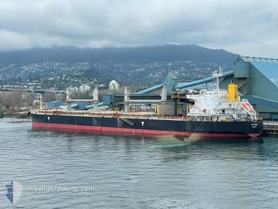
EFE MERSIN
Cargo
Current Trip
| Trip Time | 54 days |
|---|---|
| Trip Distance | 6954.19 nm |
| AVG Speed | 11.2 Knopen |
| MAX Speed | 14.7 Knopen |
| Diepgang | 13.1 M |
| AVG Wind | 12.5 knots |
| MAX Wind | 31.2 knots |
| MIN Temp | 16.4°C / 61.52°F |
| MAX Temp | 27.9°C / 82.22°F |
| Positie ontvangen | 24 d geleden |
Current Position
| Lengtegraad | --- |
|---|---|
| Breedtegraat | --- |
| Status | Under way using engine |
| Snelheid | 12.2 Knopen |
| Koers | 44.7° |
| Gebied | Indian Ocean |
| Station | T-AIS |
| Positie ontvangen | 24 d geleden |
Info
Information
The current position of EFE MERSIN is in Indian Ocean with coordinates -30.54321° / 35.27404° as reported on 2025-11-12 16:40 by AIS to our vessel tracker app. The vessel's current speed is 12.2 Knopen and is currently inside the port of PORT QASIM.
The vessel EFE MERSIN (IMO: 9792022, MMSI: 249189000) is a Cargo It's sailing under the flag of [MT] Malta.
In this page you can find informations about the vessels current position, last detected port calls, and current voyage information. If the vessels is not in coverage by AIS you will find the latest position.
The current position of EFE MERSIN is detected by our AIS receivers and we are not responsible for the reliability of the data. The last position was recorded while the vessel was in Coverage by the Ais receivers of our vessel tracking app.
The current draught of EFE MERSIN as reported by AIS is 13.1 meters
Weather
| Temperature | 23.2°C / 73.76°F |
|---|---|
| Wind Speed | 8 knots |
| Direction | 57° ENE |
| Pressure | 1018.8 hPa |
| Humidity | 13 % |
| Cloud Coverage | 7 % |
Featured Company
Last Port Calls
| Port | Arrival | Departure | Time In Port |
|---|---|---|---|
| 2025-12-05 08:41 | |||
| 2025-10-06 00:49 | 2025-10-11 17:22 | 5 d |
Last Trips
| Origin | Departure | Destination | Arrival | Distance | |
|---|---|---|---|---|---|
| 2025-10-11 17:22 | 2025-12-05 08:41 | 6954.19 nm | |||
| 2025-09-12 22:38 | 2025-10-06 00:49 | 6763.29 nm |
Events
| Tijd | Evenement | Details | Positie / Bestemming | Info |
|---|---|---|---|---|
| 2025-12-05 03:41 | Stop beweging |
24.76485 / 67.32000
[PK] PORT QASIM
|
Snelheid: 0.3 kn Koers: 309° |
|
| 2025-12-05 03:41 | Aankomsthaven |
|
24.76485 / 67.32000
[PK] PORT QASIM
|
Snelheid: 0.6 kn Koers: 316° |
| 2025-12-05 00:53 | Start beweging | 16.51 nm, South of SALEHAABAD ISLAND |
24.52955 / 66.98840
PK BQM
|
Snelheid: 4.2 kn Koers: 78° |
| 2025-12-04 06:37 | Stop beweging | 16.74 nm, South of SALEHAABAD ISLAND |
24.52524 / 66.98092
PK BQM
|
Snelheid: 0.2 kn Koers: 73° |
| 2025-12-04 03:28 | Start beweging | 3.41 nm, West of PORT QASIM |
24.78909 / 67.26144
PK BQM
|
Snelheid: 4.4 kn Koers: 264° |
| 2025-12-03 04:41 | Stop beweging | 3.08 nm, West of PORT QASIM |
24.79079 / 67.26861
PK BQM
|
Snelheid: 0.2 kn Koers: 98° |
| 2025-12-03 00:45 | Start beweging | 16.35 nm, South of SALEHAABAD ISLAND |
24.53171 / 66.96265
PK BQM
|
Snelheid: 4 kn Koers: 193° |
| 2025-12-02 12:12 | Stop beweging | 15.92 nm, South of SALEHAABAD ISLAND |
24.53874 / 66.96987
PK BQM
|
Snelheid: 0.2 kn Koers: 237° |
| 2025-12-02 10:57 | Start beweging | 13.22 nm, South of SALEHAABAD ISLAND |
24.58454 / 66.95281
PK BQM
|
Snelheid: 3.2 kn Koers: 230° |
| 2025-11-27 06:43 | Stop beweging | 13.22 nm, South of SALEHAABAD ISLAND |
24.58432 / 66.95679
PK BQM
|
Snelheid: 0.1 kn Koers: 50° |