
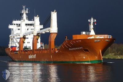
DIJKSGRACHT
General Cargo
Current Trip
| Time Travelled | 6 days |
|---|---|
| Remaining Time | 5 days |
| Distance Travelled | 2623.59 nm |
| Remaining Distance | 1959.60 nm |
| AVG Speed | 15.6 Knopen |
| MAX Speed | 17.9 Knopen |
| AVG Wind | 12.2 knots |
| MAX Wind | 26 knots |
| MIN Temp | 9.8°C / 49.64°F |
| MAX Temp | 19.8°C / 67.64°F |
| Diepgang | 7.8 M |
| Positie ontvangen | 4 d geleden |
Current Position
| Lengtegraad | -7.54557° |
|---|---|
| Breedtegraat | 35.90282° |
| Status | Under way using engine |
| Snelheid | 16.2 Knopen |
| Koers | 267° |
| Gebied | North Atlantic Ocean |
| Station | T-AIS |
| Positie ontvangen | 4 d geleden |
Info
Information
The current position of DIJKSGRACHT is in North Atlantic Ocean with coordinates 35.90282° / -7.54557° as reported on 2024-05-06 06:46 by AIS to our vessel tracker app. The vessel's current speed is 16.2 Knopen and is heading at the port of CHARLESTON. The estimated time of arrival as calculated by MyShipTracking vessel tracking app is 2024-05-16 00:30 LT
The vessel DIJKSGRACHT (IMO: 9420772, MMSI: 245912000) is a General Cargo that was built in 2008 ( 16 Jaar oud ). It's sailing under the flag of [NL] Netherlands.
In this page you can find informations about the vessels current position, last detected port calls, and current voyage information. If the vessels is not in coverage by AIS you will find the latest position.
The current position of DIJKSGRACHT is detected by our AIS receivers and we are not responsible for the reliability of the data. The last position was recorded while the vessel was in Coverage by the Ais receivers of our vessel tracking app.
The current draught of DIJKSGRACHT as reported by AIS is 7.8 meters
Weather
| Temperature | 19.1°C / 66.38°F |
|---|---|
| Wind Speed | 13 knots |
| Direction | 210° SSW |
| Pressure | 1023.2 hPa |
| Humidity | 80.9 % |
| Cloud Coverage | 43 % |
Featured Company
Last Port Calls
| Port | Arrival | Departure | Time In Port |
|---|---|---|---|
| 2024-04-30 20:26 | 2024-05-03 17:57 | 2 d | |
| 2024-04-27 15:12 | 2024-04-30 14:40 | 2 d | |
| 2024-04-19 05:58 | 2024-04-22 07:16 | 3 d | |
| 2024-04-14 21:48 | 2024-04-15 16:42 | 18 h | |
| 2024-03-27 15:25 | 2024-03-28 03:46 | 12 h | |
| 2024-03-24 05:11 | |||
| 2024-03-12 21:58 | 2024-03-15 19:04 | 2 d | |
| 2024-03-09 12:54 | 2024-03-10 01:32 | 12 h |
Most Visited Ports (Last year)
| Port | Arrivals | |
|---|---|---|
| 3 | ||
| 2 | ||
| 2 | ||
| 2 | ||
| 2 | ||
| 2 |
Last Trips
| Origin | Departure | Destination | Arrival | Distance | |
|---|---|---|---|---|---|
| 2024-04-30 16:40 | 2024-04-30 22:26 | 81.74 nm | |||
| 2024-04-22 09:16 | 2024-04-27 17:12 | 1061.07 nm | |||
| 2024-04-15 19:42 | 2024-04-19 07:58 | 1202.16 nm | |||
| 2024-03-27 23:46 | 2024-04-15 00:48 | 5843.25 nm | |||
| 2024-03-24 00:11 | 2024-03-27 11:25 | 1260.98 nm | |||
| 2024-03-09 20:32 | 2024-03-12 16:58 | 1013.34 nm | |||
| 2024-02-27 23:30 | 2024-03-09 07:54 | 3591.06 nm |
Events
| Tijd | Evenement | Details | Positie / Bestemming | Info |
|---|---|---|---|---|
| 2024-05-08 09:54 | Start beweging |
35.14667 / -24.39667
CHARLESTON
|
Snelheid: 5 kn Koers: 182° |
|
| 2024-05-08 09:30 | Stop beweging |
35.14834 / -24.40500
CHARLESTON
|
Snelheid: Koers: -1° |
|
| 2024-05-06 06:48 | Status Changed | Default Under way using engine |
35.90167 / -7.55833
CHARLESTON
|
Snelheid: 16.2 kn Koers: 267° |
| 2024-05-06 06:46 | Status Changed | Under way using engine Default |
35.90283 / -7.54557
CHARLESTON
|
Snelheid: 16 kn Koers: 267° |
| 2024-05-06 06:46 | Buitenbereik |
35.90283 / -7.54557
North Atlantic Ocean
CHARLESTON
|
Snelheid: 16.2 kn Koers: 267° |
|
| 2024-05-06 06:46 | Wijzig zee gebeid | Portuguese part of the North Atlantic Ocean Spanish part of the North Atlantic Ocean |
35.90283 / -7.54557
North Atlantic Ocean
CHARLESTON
|
Snelheid: 16.2 kn Koers: 267° |
| 2024-05-06 06:42 | Binnenbereik |
35.90283 / -7.54557
North Atlantic Ocean
CHARLESTON
|
Snelheid: 16.2 kn Koers: 267° |
|
| 2024-05-06 05:45 | Status Changed | Default Under way using engine |
35.91333 / -7.21167
CHARLESTON
|
Snelheid: 16.1 kn Koers: 266.9° |
| 2024-05-06 05:34 | Status Changed | Under way using engine Default |
35.91712 / -7.15387
CHARLESTON
|
Snelheid: 16 kn Koers: 267° |
| 2024-05-06 05:34 | Buitenbereik |
35.91712 / -7.15387
North Atlantic Ocean
CHARLESTON
|
Snelheid: 16.1 kn Koers: 266.9° |