
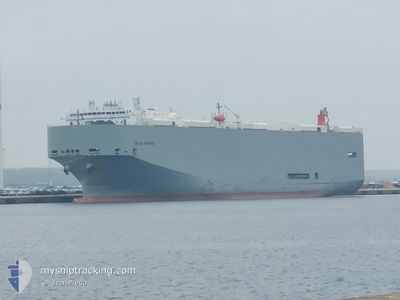
DALIAN HIGHWAY
Vehicles Carrier
Current Trip
VNSGN
| Time Travelled | 4 days |
|---|---|
| Remaining Time | --- |
| Distance Travelled | 1340.20 nm |
| Remaining Distance | --- |
| AVG Speed | 14.5 Knopen |
| MAX Speed | 18.5 Knopen |
| AVG Wind | 12.3 knots |
| MAX Wind | 32 knots |
| MIN Temp | 21.9°C / 71.42°F |
| MAX Temp | 31.4°C / 88.52°F |
| Diepgang | 8.9 M |
| Positie ontvangen | 4 d geleden |
Current Position
| Lengtegraad | --- |
|---|---|
| Breedtegraat | --- |
| Status | Under way using engine |
| Snelheid | 16.6 Knopen |
| Koers | 202.8° |
| Gebied | Gulf of Thailand |
| Station | T-AIS |
| Positie ontvangen | 4 d geleden |
Info
Information
The current position of DALIAN HIGHWAY is in Gulf of Thailand with coordinates 12.94793° / 100.73043° as reported on 2025-12-30 15:20 by AIS to our vessel tracker app. The vessel's current speed is 16.6 Knopen
The vessel DALIAN HIGHWAY (IMO: 9565560, MMSI: 357694000) is a Vehicles Carrier that was built in 2011 ( 15 Jaar oud ). It's sailing under the flag of [PA] Panama.
In this page you can find informations about the vessels current position, last detected port calls, and current voyage information. If the vessels is not in coverage by AIS you will find the latest position.
The current position of DALIAN HIGHWAY is detected by our AIS receivers and we are not responsible for the reliability of the data. The last position was recorded while the vessel was in Coverage by the Ais receivers of our vessel tracking app.
The current draught of DALIAN HIGHWAY as reported by AIS is 8.9 meters
Weather
| Temperature | 21.9°C / 71.42°F |
|---|---|
| Wind Speed | 9 knots |
| Direction | 59° ENE |
| Pressure | 1019.5 hPa |
| Humidity | 62.6 % |
| Cloud Coverage | 12 % |
Featured Company
Last Port Calls
| Port | Arrival | Departure | Time In Port |
|---|---|---|---|
| 2025-12-30 09:12 | 2025-12-30 21:24 | 12 h | |
| 2025-12-27 19:47 | 2025-12-28 08:22 | 12 h | |
| 2025-12-26 22:03 | 2025-12-27 03:54 | 5 h | |
| 2025-12-25 22:34 | 2025-12-26 08:12 | 9 h | |
| 2025-12-22 05:33 | 2025-12-23 02:45 | 21 h | |
| 2025-12-17 07:08 | 2025-12-17 21:47 | 14 h | |
| 2025-12-14 12:41 | 2025-12-15 01:22 | 12 h | |
| 2025-12-08 06:53 | 2025-12-09 00:37 | 17 h | |
| 2025-12-02 08:08 | 2025-12-02 20:20 | 12 h | |
| 2025-11-29 09:49 | 2025-11-29 21:25 | 11 h |
Most Visited Ports (Last year)
| Port | Arrivals | |
|---|---|---|
| 20 | ||
| 19 | ||
| 10 | ||
| 9 | ||
| 9 | ||
| 2 |
Last Trips
| Origin | Departure | Destination | Arrival | Distance | |
|---|---|---|---|---|---|
| 2025-12-28 08:22 | 2025-12-30 09:12 | 808.98 nm | |||
| 2025-12-27 03:54 | 2025-12-27 19:47 | 199.99 nm | |||
| 2025-12-26 08:12 | 2025-12-26 22:03 | 43.46 nm | |||
| 2025-12-23 02:45 | 2025-12-25 22:34 | 944.48 nm | |||
| 2025-12-17 21:47 | 2025-12-22 05:33 | 751.52 nm | |||
| 2025-12-15 01:22 | 2025-12-17 07:08 | 808.63 nm | |||
| 2025-12-09 00:37 | 2025-12-14 12:41 | 1469.05 nm | |||
| 2025-12-02 20:20 | 2025-12-08 06:53 | 1552.56 nm | |||
| 2025-11-29 21:25 | 2025-12-02 08:08 | 1004.90 nm | |||
| 2025-11-28 09:07 | 2025-11-29 09:49 | 263.32 nm |
Events
| Tijd | Evenement | Details | Positie / Bestemming | Info |
|---|---|---|---|---|
| 2026-01-02 04:13 | Start beweging | 15.26 nm, West of PHU MY |
10.63861 / 106.76777
VNSGN
|
Snelheid: 4.9 kn Koers: 132° |
| 2026-01-01 06:37 | Stop beweging | 15.59 nm, West of PHU MY |
10.64048 / 106.76241
VNSGN
|
Snelheid: 0.2 kn Koers: 161° |
| 2025-12-30 15:25 | Status Changed | Default Under way using engine |
12.92728 / 100.72401
VNSGN
|
Snelheid: 16.6 kn Koers: 202.8° |
| 2025-12-30 15:20 | Buitenbereik |
12.94793 / 100.73043
Gulf of Thailand
VNSGN
|
Snelheid: 16.6 kn Koers: 202.8° |
|
| 2025-12-30 15:14 | Status Changed | Under way using engine Default |
12.97414 / 100.74203
VNSGN
|
Snelheid: 15.9 kn Koers: 209° |
| 2025-12-30 15:13 | Status Changed | Default Under way using engine |
12.97845 / 100.74422
VNSGN
|
Snelheid: 15.7 kn Koers: 216.2° |
| 2025-12-30 15:00 | Status Changed | Under way using engine Default |
13.02111 / 100.77456
VNSGN
|
Snelheid: 13.4 kn Koers: 216° |
| 2025-12-30 14:49 | Status Changed | Default Under way using engine |
13.05613 / 100.80080
VNSGN
|
Snelheid: 11 kn Koers: 237.8° |
| 2025-12-30 14:31 | Draught Changed | 8.9 8.2 |
13.08141 / 100.84766
VNSGN
|
Snelheid: 10.6 kn Koers: 269.2° |
| 2025-12-30 14:31 | Destination Changed | VNSGN TH LCH |
13.08141 / 100.84766
VNSGN
|
Snelheid: 10.6 kn Koers: 269.2° |