
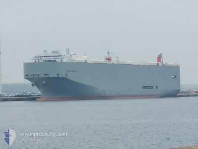
DALIAN HIGHWAY
Vehicles Carrier
Current Trip
CNSHA
| Time Travelled | 12 h, 46 mins |
|---|---|
| Remaining Time | --- |
| Distance Travelled | 182.74 nm |
| Remaining Distance | --- |
| AVG Speed | 14.9 Knots |
| MAX Speed | 17.9 Knots |
| AVG Wind | 9 knots |
| MAX Wind | 10.9 knots |
| MIN Temp | 15.6°C / 60.08°F |
| MAX Temp | 16.8°C / 62.24°F |
| Draught | 7.9 m |
| Position Received | 2 d ago |
Current Position
| Longitude | 121.29638° |
|---|---|
| Latitude | 25.31758° |
| Status | Under way using engine |
| Speed | 11.2 Knots |
| Course | 16° |
| Area | Eastern China Sea |
| Station | T-AIS |
| Position Received | 2 d ago |
Info
Information
The current position of DALIAN HIGHWAY is in Eastern China Sea with coordinates 25.31758° / 121.29638° as reported on 2024-04-22 09:42 by AIS to our vessel tracker app. The vessel's current speed is 11.2 Knots
The vessel DALIAN HIGHWAY (IMO: 9565560, MMSI: 357694000) is a Vehicles Carrier that was built in 2011 ( 13 years old ). It's sailing under the flag of [PA] Panama.
In this page you can find informations about the vessels current position, last detected port calls, and current voyage information. If the vessels is not in coverage by AIS you will find the latest position.
The current position of DALIAN HIGHWAY is detected by our AIS receivers and we are not responsible for the reliability of the data. The last position was recorded while the vessel was in Coverage by the Ais receivers of our vessel tracking app.
The current draught of DALIAN HIGHWAY as reported by AIS is 7.9 meters
Weather
| Temperature | 16.6°C / 61.88°F |
|---|---|
| Wind Speed | 8 knots |
| Direction | 146° SE |
| Pressure | 1010.8 hPa |
| Humidity | 69.2 % |
| Cloud Coverage | 95 % |
Featured Company
Last Port Calls
| Port | Arrival | Departure | Time In Port |
|---|---|---|---|
| 2024-04-24 13:36 | 2024-04-24 17:12 | 3 h | |
| 2024-04-20 14:16 | 2024-04-22 08:36 | 1 d | |
| 2024-04-14 07:53 | 2024-04-14 19:17 | 11 h | |
| 2024-03-13 01:54 | 2024-03-15 00:06 | 1 d | |
| 2024-03-10 01:31 | 2024-03-11 22:58 | 1 d | |
| 2024-03-07 01:55 | 2024-03-08 14:53 | 1 d | |
| 2024-02-26 01:25 | 2024-02-27 21:05 | 1 d | |
| 2024-02-23 16:45 | 2024-02-24 13:08 | 20 h | |
| 2024-02-22 04:06 | 2024-02-22 16:27 | 12 h |
Last Trips
| Origin | Departure | Destination | Arrival | Distance | |
|---|---|---|---|---|---|
| 2024-04-22 16:36 | 2024-04-24 21:36 | 514.38 nm | |||
| 2024-04-15 03:17 | 2024-04-20 22:16 | 1860.84 nm | |||
| 2024-03-15 01:06 | 2024-04-14 15:53 | 12145.66 nm | |||
| 2024-03-11 23:58 | 2024-03-13 02:54 | 313.41 nm | |||
| 2024-03-08 14:53 | 2024-03-10 02:31 | 569.89 nm | |||
| 2024-02-27 23:05 | 2024-03-07 01:55 | 3012.34 nm | |||
| 2024-02-24 15:08 | 2024-02-26 03:25 | 524.21 nm | |||
| 2024-02-22 19:27 | 2024-02-23 18:45 | 401.44 nm | |||
| 2024-01-25 04:04 | 2024-02-22 07:06 | 12672.30 nm |
Events
| Time | Event | Details | Position / Dest | Info |
|---|---|---|---|---|
| 2024-04-24 17:16 | START Moving | 4.83 nm, South East of SHANGHAI |
31.32683 / 121.68730
CNSHA
|
Speed: 3.2 kn Course: 100° |
| 2024-04-24 17:12 | PORT DEPARTURE |
|
31.32612 / 121.68442
CNSHA
|
Speed: 1.5 kn Course: 100° |
| 2024-04-24 13:48 | STOP Moving |
31.32330 / 121.67963
[CN] SHANGHAI
|
Speed: 0.2 kn Course: 125° |
|
| 2024-04-24 13:36 | PORT ARRIVAL |
|
31.32533 / 121.68051
[CN] SHANGHAI
|
Speed: 3.5 kn Course: -1° |
| 2024-04-22 09:48 | Status Changed | Default Under way using engine |
25.33678 / 121.30231
CNSHA
|
Speed: 11.2 kn Course: 16° |
| 2024-04-22 09:42 | Change Sea Area | Taiwanese part of the Eastern China Sea Taiwanese part of the South China Sea |
25.31758 / 121.29638
Eastern China Sea
CNSHA
|
Speed: 11.2 kn Course: 16° |
| 2024-04-22 09:42 | Status Changed | Under way using engine Default |
25.31758 / 121.29638
CNSHA
|
Speed: 11.2 kn Course: 15° |
| 2024-04-22 09:42 | OUT of Coverage |
25.31758 / 121.29638
Eastern China Sea
CNSHA
|
Speed: 11.2 kn Course: 16° |
|
| 2024-04-22 09:36 | Status Changed | Default Under way using engine |
25.30152 / 121.29117
CNSHA
|
Speed: 11.3 kn Course: 19° |
| 2024-04-22 09:15 | Status Changed | Under way using engine Default |
25.23685 / 121.28233
CNSHA
|
Speed: 11.9 kn Course: 326° |