
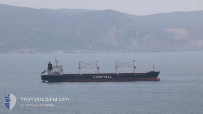
CS CAPRICE
Bulk Carrier
Current Trip
| Time Travelled | 14 days |
|---|---|
| Remaining Time | 1 day |
| Distance Travelled | 3754.00 nm |
| Remaining Distance | 345.01 nm |
| AVG Speed | 10.8 Knopen |
| MAX Speed | 14.5 Knopen |
| AVG Wind | 12.6 knots |
| MAX Wind | 31.9 knots |
| MIN Temp | 16.2°C / 61.16°F |
| MAX Temp | 28.4°C / 83.12°F |
| Diepgang | 9.7 M |
| Positie ontvangen | 1 h, 11 m geleden |
Current Position
| Lengtegraad | 2.12230° |
|---|---|
| Breedtegraat | 37.66747° |
| Status | Under way using engine |
| Snelheid | 11.7 Knopen |
| Koers | 72.1° |
| Gebied | Mediterranean Sea - Western Basin |
| Station | T-AIS |
| Positie ontvangen | 1 h, 11 m geleden |
Info
Information
The current position of CS CAPRICE is in Mediterranean Sea - Western Basin with coordinates 37.66747° / 2.12230° as reported on 2024-05-12 19:14 by AIS to our vessel tracker app. The vessel's current speed is 11.7 Knopen and is heading at the port of CAGLIARI. The estimated time of arrival as calculated by MyShipTracking vessel tracking app is 2024-05-14 04:20 LT
The vessel CS CAPRICE (IMO: 9406104, MMSI: 311016600) is a Bulk Carrier that was built in 2010 ( 14 Jaar oud ). It's sailing under the flag of [BS] Bahamas.
In this page you can find informations about the vessels current position, last detected port calls, and current voyage information. If the vessels is not in coverage by AIS you will find the latest position.
The current position of CS CAPRICE is detected by our AIS receivers and we are not responsible for the reliability of the data. The last position was recorded while the vessel was in Coverage by the Ais receivers of our vessel tracking app.
The current draught of CS CAPRICE as reported by AIS is 9.7 meters
Weather
| Temperature | 19°C / 66.2°F |
|---|---|
| Wind Speed | 11 knots |
| Direction | 89° E |
| Pressure | 1014.7 hPa |
| Humidity | 80.4 % |
| Cloud Coverage | 69 % |
Featured Company
Last Port Calls
| Port | Arrival | Departure | Time In Port |
|---|---|---|---|
| 2024-04-23 11:38 | 2024-04-28 11:37 | 4 d | |
| 2024-04-08 15:02 | 2024-04-11 10:08 | 2 d | |
| 2024-04-04 21:22 | 2024-04-06 07:18 | 1 d | |
| 2024-04-01 06:47 | 2024-04-01 15:36 | 8 h | |
| 2024-03-20 08:48 |
Most Visited Ports (Last year)
| Port | Arrivals | |
|---|---|---|
| 2 | ||
| 2 | ||
| 2 | ||
| 2 | ||
| 1 | ||
| 1 |
Last Trips
| Origin | Departure | Destination | Arrival | Distance | |
|---|---|---|---|---|---|
| 2024-04-11 10:08 | 2024-04-23 11:38 | 2115.82 nm | |||
| 2024-04-06 07:18 | 2024-04-08 15:02 | 586.96 nm | |||
| 2024-04-01 15:36 | 2024-04-04 21:22 | 746.79 nm | |||
| 2024-03-20 08:48 | 2024-04-01 06:47 | 3111.59 nm |
Events
| Tijd | Evenement | Details | Positie / Bestemming | Info |
|---|---|---|---|---|
| 2024-05-12 19:20 | Status Changed | Default Under way using engine |
37.67342 / 2.14591
IT CAG
|
Snelheid: 11.7 kn Koers: 72.1° |
| 2024-05-12 19:14 | Buitenbereik |
37.66747 / 2.12230
Mediterranean Sea - Western Basin
IT CAG
|
Snelheid: 11.7 kn Koers: 72.1° |
|
| 2024-05-12 18:50 | Wijzig zee gebeid | Algerian part of the Mediterranean Sea - Western Basin Spanish part of the Mediterranean Sea - Western Basin |
37.63944 / 2.02742
Mediterranean Sea - Western Basin
IT CAG
|
Snelheid: 11.7 kn Koers: 68.6° |
| 2024-05-12 18:49 | Status Changed | Under way using engine Default |
37.63882 / 2.02546
IT CAG
|
Snelheid: 11.7 kn Koers: 68° |
| 2024-05-12 18:48 | Status Changed | Default Under way using engine |
37.63784 / 2.02236
IT CAG
|
Snelheid: 11.7 kn Koers: 68° |
| 2024-05-12 18:48 | Status Changed | Under way using engine Default |
37.63762 / 2.02166
IT CAG
|
Snelheid: 11.7 kn Koers: 67° |
| 2024-05-12 18:48 | Binnenbereik |
37.63944 / 2.02742
Mediterranean Sea - Western Basin
IT CAG
|
Snelheid: 11.7 kn Koers: 68.6° |
|
| 2024-05-12 03:15 | Status Changed | Default Under way using engine |
36.62239 / -1.43684
IT CAG
|
Snelheid: 11.4 kn Koers: 66.3° |
| 2024-05-12 03:13 | Status Changed | Under way using engine Default |
36.62025 / -1.44282
IT CAG
|
Snelheid: 11.3 kn Koers: 67° |
| 2024-05-12 03:13 | Buitenbereik |
36.62025 / -1.44282
Mediterranean Sea - Western Basin
IT CAG
|
Snelheid: 11.4 kn Koers: 66.3° |