
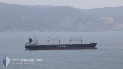
CS CAPRICE
Bulk Carrier
Current Trip
| Time Travelled | 8 days |
|---|---|
| Remaining Time | --- |
| Distance Travelled | 1864.24 nm |
| Remaining Distance | --- |
| AVG Speed | 8.9 Knots |
| MAX Speed | 12.4 Knots |
| AVG Wind | 17.7 knots |
| MAX Wind | 27 knots |
| MIN Temp | 25.9°C / 78.62°F |
| MAX Temp | 31.8°C / 89.24°F |
| Draught | 5.2 m |
| Position Received | 7 d ago |
Current Position
| Longitude | -74.22226° |
|---|---|
| Latitude | 11.53534° |
| Status | Under way using engine |
| Speed | 9.2 Knots |
| Course | 62° |
| Area | Caribbean Sea |
| Station | T-AIS |
| Position Received | 7 d ago |
Info
Information
The current position of CS CAPRICE is in Caribbean Sea with coordinates 11.53534° / -74.22226° as reported on 2024-04-11 21:03 by AIS to our vessel tracker app. The vessel's current speed is 9.2 Knots
The vessel CS CAPRICE (IMO: 9406104, MMSI: 311016600) is a Bulk Carrier that was built in 2010 ( 14 years old ). It's sailing under the flag of [BS] Bahamas.
In this page you can find informations about the vessels current position, last detected port calls, and current voyage information. If the vessels is not in coverage by AIS you will find the latest position.
The current position of CS CAPRICE is detected by our AIS receivers and we are not responsible for the reliability of the data. The last position was recorded while the vessel was in Coverage by the Ais receivers of our vessel tracking app.
The current draught of CS CAPRICE as reported by AIS is 5.2 meters
Weather
| Temperature | 28.1°C / 82.58°F |
|---|---|
| Wind Speed | 9 knots |
| Direction | 75° ENE |
| Pressure | 1010.2 hPa |
| Humidity | 80.2 % |
| Cloud Coverage | 99 % |
Featured Company
Last Port Calls
| Port | Arrival | Departure | Time In Port |
|---|---|---|---|
| 2024-04-08 20:02 | 2024-04-11 15:08 | 2 d | |
| 2024-04-05 01:22 | 2024-04-06 11:18 | 1 d | |
| 2024-04-01 10:47 | 2024-04-01 19:36 | 8 h | |
| 2024-03-20 11:48 | |||
| 2024-02-18 02:11 | 2024-02-20 02:36 | 2 d | |
| 2024-02-05 17:40 |
Most Visited Ports (Last year)
| Port | Arrivals | |
|---|---|---|
| 2 | ||
| 2 | ||
| 2 | ||
| 1 | ||
| 1 | ||
| 1 |
Last Trips
| Origin | Departure | Destination | Arrival | Distance | |
|---|---|---|---|---|---|
| 2024-04-06 07:18 | 2024-04-08 15:02 | 586.96 nm | |||
| 2024-04-01 15:36 | 2024-04-04 21:22 | 746.79 nm | |||
| 2024-03-20 08:48 | 2024-04-01 06:47 | 3111.59 nm | |||
| 2024-02-05 17:40 | 2024-02-17 23:11 | 2910.72 nm |
Events
| Time | Event | Details | Position / Dest | Info |
|---|---|---|---|---|
| 2024-04-11 21:11 | Status Changed | Default Under way using engine |
11.54469 / -74.20412
CO BAQ
|
Speed: 9.2 kn Course: 62° |
| 2024-04-11 21:03 | OUT of Coverage |
11.53534 / -74.22226
Caribbean Sea
CO BAQ
|
Speed: 9.2 kn Course: 62° |
|
| 2024-04-11 20:55 | Status Changed | Under way using engine Default |
11.52567 / -74.24130
CO BAQ
|
Speed: 9 kn Course: 62° |
| 2024-04-11 20:42 | Status Changed | Default Under way using engine |
11.50833 / -74.27167
CO BAQ
|
Speed: 9.7 kn Course: 61.8° |
| 2024-04-11 20:36 | Status Changed | Under way using engine Default |
11.50197 / -74.28679
CO BAQ
|
Speed: 10 kn Course: 61° |
| 2024-04-11 20:33 | Status Changed | Default Under way using engine |
11.49667 / -74.29333
CO BAQ
|
Speed: 10 kn Course: 60.1° |
| 2024-04-11 20:29 | Status Changed | Under way using engine Default |
11.49239 / -74.30401
CO BAQ
|
Speed: 9.5 kn Course: 60° |
| 2024-04-11 20:19 | IN Coverage |
11.49239 / -74.30401
Caribbean Sea
CO BAQ
|
Speed: 10 kn Course: 60.1° |
|
| 2024-04-11 18:30 | Status Changed | Default Under way using engine |
11.33167 / -74.58500
CO BAQ
|
Speed: 9.3 kn Course: 58.1° |
| 2024-04-11 18:25 | OUT of Coverage |
11.32565 / -74.59704
Caribbean Sea
CO BAQ
|
Speed: 9.3 kn Course: 58.1° |