
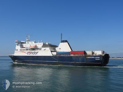
COMMODORE CLIPPER
Ro-Ro/Passenger Ship
Current Trip
| Time Travelled | 16 mins |
|---|---|
| Remaining Time | 6 h, 35 mins |
| Distance Travelled | 3.21 nm |
| Remaining Distance | 100.38 nm |
| AVG Speed | 16.9 Knopen |
| MAX Speed | 17.5 Knopen |
| AVG Wind | 33.1 knots |
| MAX Wind | 34 knots |
| MIN Temp | 10.8°C / 51.44°F |
| MAX Temp | 11°C / 51.8°F |
| Diepgang | 5.3 M |
| Positie ontvangen | 1 m geleden |
Current Position
| Lengtegraad | --- |
|---|---|
| Breedtegraat | --- |
| Status | Moored |
| Snelheid | 17.7 Knopen |
| Koers | 141° |
| Gebied | English Channel |
| Station | T-AIS |
| Positie ontvangen | 1 m geleden |
Info
Information
The current position of COMMODORE CLIPPER is in English Channel with coordinates 50.73825° / -1.07023° as reported on 2025-12-05 19:25 by AIS to our vessel tracker app. The vessel's current speed is 17.7 Knopen and is heading at the port of GUERNSEY. The estimated time of arrival as calculated by MyShipTracking vessel tracking app is 2025-12-06 02:01 LT
The vessel COMMODORE CLIPPER (IMO: 9201750, MMSI: 308094000) is a Ro-Ro/Passenger Ship that was built in 1999 ( 26 Jaar oud ). It's sailing under the flag of [BS] Bahamas.
In this page you can find informations about the vessels current position, last detected port calls, and current voyage information. If the vessels is not in coverage by AIS you will find the latest position.
The current position of COMMODORE CLIPPER is detected by our AIS receivers and we are not responsible for the reliability of the data. The last position was recorded while the vessel was in Coverage by the Ais receivers of our vessel tracking app.
The current draught of COMMODORE CLIPPER as reported by AIS is 5.3 meters
Weather
| Temperature | 10.8°C / 51.44°F |
|---|---|
| Wind Speed | 34 knots |
| Direction | 192° SSW |
| Pressure | 995.3 hPa |
| Humidity | 88.5 % |
| Cloud Coverage | 100 % |
Featured Company
Last Port Calls
| Port | Arrival | Departure | Time In Port |
|---|---|---|---|
| 2025-12-05 15:49 | 2025-12-05 19:10 | 3 h | |
| 2025-12-05 03:54 | 2025-12-05 07:51 | 3 h | |
| 2025-12-04 15:29 | 2025-12-04 20:09 | 4 h | |
| 2025-12-04 03:52 | 2025-12-04 08:12 | 4 h | |
| 2025-12-03 15:39 | 2025-12-03 19:57 | 4 h | |
| 2025-12-03 03:54 | 2025-12-03 08:17 | 4 h | |
| 2025-12-02 15:33 | 2025-12-02 20:21 | 4 h | |
| 2025-12-02 03:51 | 2025-12-02 08:06 | 4 h | |
| 2025-12-01 15:44 | 2025-12-01 20:08 | 4 h | |
| 2025-12-01 03:53 | 2025-12-01 08:15 | 4 h |
Last Trips
| Origin | Departure | Destination | Arrival | Distance | |
|---|---|---|---|---|---|
| 2025-12-05 07:51 | 2025-12-05 15:49 | 116.21 nm | |||
| 2025-12-04 20:09 | 2025-12-05 03:54 | 107.94 nm | |||
| 2025-12-04 08:12 | 2025-12-04 15:29 | 109.90 nm | |||
| 2025-12-03 19:57 | 2025-12-04 03:52 | 108.11 nm | |||
| 2025-12-03 08:17 | 2025-12-03 15:39 | 108.86 nm | |||
| 2025-12-02 20:21 | 2025-12-03 03:54 | 108.32 nm | |||
| 2025-12-02 08:06 | 2025-12-02 15:33 | 113.07 nm | |||
| 2025-12-01 20:08 | 2025-12-02 03:51 | 110.29 nm | |||
| 2025-12-01 08:15 | 2025-12-01 15:44 | 110.54 nm | |||
| 2025-11-30 19:47 | 2025-12-01 03:53 | 107.74 nm |
Events
| Tijd | Evenement | Details | Positie / Bestemming | Info |
|---|---|---|---|---|
| 2025-12-05 19:10 | Vertrekhaven |
|
50.78650 / -1.10783
GUERNSEY
|
Snelheid: 10.9 kn Koers: 155° |
| 2025-12-05 18:58 | Start beweging |
50.81122 / -1.09973
[GB] PORTSMOUTH
|
Snelheid: 5.4 kn Koers: 262° |
|
| 2025-12-05 18:47 | Destination Changed | GUERNSEY PORTSMOUTH |
50.81133 / -1.09650
[GB] PORTSMOUTH
|
Snelheid: Koers: 259° |
| 2025-12-05 18:47 | ETA Changed | 2025/12/06 04:00 2025/12/05 15:00 |
50.81133 / -1.09650
[GB] PORTSMOUTH
|
Snelheid: Koers: 259° |
| 2025-12-05 16:04 | Stop beweging |
50.81133 / -1.09650
[GB] PORTSMOUTH
|
Snelheid: 0.1 kn Koers: 259° |
|
| 2025-12-05 15:49 | Aankomsthaven |
|
50.80841 / -1.11247
[GB] PORTSMOUTH
|
Snelheid: 7.3 kn Koers: 45° |
| 2025-12-05 12:30 | Status Changed | Moored Default |
50.37633 / -1.33767
PORTSMOUTH
|
Snelheid: 15.1 kn Koers: 58° |
| 2025-12-05 12:27 | Status Changed | Default Moored |
50.36956 / -1.35401
PORTSMOUTH
|
Snelheid: 15.2 kn Koers: 58° |
| 2025-12-05 12:27 | Status Changed | Moored Default |
50.36923 / -1.35484
PORTSMOUTH
|
Snelheid: 14.8 kn Koers: 57° |
| 2025-12-05 12:22 | Wijzig zee gebeid | United Kingdom part of the English Channel Guernsey part of the English Channel |
50.35800 / -1.38233
English Channel
PORTSMOUTH
|
Snelheid: 14.7 kn Koers: 52° |