
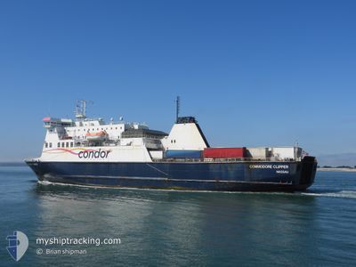
COMMODORE CLIPPER
Ro-Ro/Passenger Ship
Current Trip
| Time Travelled | 2 h, 44 mins |
|---|---|
| Remaining Time | --- |
| Distance Travelled | 42.57 nm |
| Remaining Distance | 68.61 nm |
| AVG Speed | 17.4 Knots |
| MAX Speed | 20.7 Knots |
| AVG Wind | 18.6 knots |
| MAX Wind | 23.3 knots |
| MIN Temp | 10.6°C / 51.08°F |
| MAX Temp | 11°C / 51.8°F |
| Dybgang | 5.3 m |
| Position Modtaget | 1 h, 26 m siden |
Current Position
| Longitude | --- |
|---|---|
| Latitude | --- |
| Status | Moored |
| Fart | 17.5 Knots |
| Kurs | 24° |
| Område | English Channel |
| Station | T-AIS |
| Position Modtaget | 1 h, 26 m siden |
Info
Information
The current position of COMMODORE CLIPPER is in English Channel with coordinates 49.63053° / -2.11499° as reported on 2025-12-05 09:09 by AIS to our vessel tracker app. The vessel's current speed is 17.5 Knots and is heading at the port of PORTSMOUTH. The estimated time of arrival as calculated by MyShipTracking vessel tracking app is 2025-12-05 15:00 LT
The vessel COMMODORE CLIPPER (IMO: 9201750, MMSI: 308094000) is a Ro-Ro/Passenger Ship that was built in 1999 ( 26 år gamle ). It's sailing under the flag of [BS] Bahamas.
In this page you can find informations about the vessels current position, last detected port calls, and current voyage information. If the vessels is not in coverage by AIS you will find the latest position.
The current position of COMMODORE CLIPPER is detected by our AIS receivers and we are not responsible for the reliability of the data. The last position was recorded while the vessel was in Coverage by the Ais receivers of our vessel tracking app.
The current draught of COMMODORE CLIPPER as reported by AIS is 5.3 meters
Weather
| Temperature | 10.7°C / 51.26°F |
|---|---|
| Wind Speed | 22 knots |
| Direction | 186° S |
| Pressure | 1007 hPa |
| Humidity | 66.9 % |
| Cloud Coverage | 100 % |
Featured Company
Last Port Calls
| Port | Arrival | Departure | Time In Port |
|---|---|---|---|
| 2025-12-05 03:54 | 2025-12-05 07:51 | 3 h | |
| 2025-12-04 15:29 | 2025-12-04 20:09 | 4 h | |
| 2025-12-04 03:52 | 2025-12-04 08:12 | 4 h | |
| 2025-12-03 15:39 | 2025-12-03 19:57 | 4 h | |
| 2025-12-03 03:54 | 2025-12-03 08:17 | 4 h | |
| 2025-12-02 15:33 | 2025-12-02 20:21 | 4 h | |
| 2025-12-02 03:51 | 2025-12-02 08:06 | 4 h | |
| 2025-12-01 15:44 | 2025-12-01 20:08 | 4 h | |
| 2025-12-01 03:53 | 2025-12-01 08:15 | 4 h | |
| 2025-11-29 08:18 | 2025-11-30 19:47 | 1 d |
Last Trips
| Origin | Departure | Destination | Arrival | Distance | |
|---|---|---|---|---|---|
| 2025-12-04 20:09 | 2025-12-05 03:54 | 107.94 nm | |||
| 2025-12-04 08:12 | 2025-12-04 15:29 | 109.90 nm | |||
| 2025-12-03 19:57 | 2025-12-04 03:52 | 108.11 nm | |||
| 2025-12-03 08:17 | 2025-12-03 15:39 | 108.86 nm | |||
| 2025-12-02 20:21 | 2025-12-03 03:54 | 108.32 nm | |||
| 2025-12-02 08:06 | 2025-12-02 15:33 | 113.07 nm | |||
| 2025-12-01 20:08 | 2025-12-02 03:51 | 110.29 nm | |||
| 2025-12-01 08:15 | 2025-12-01 15:44 | 110.54 nm | |||
| 2025-11-30 19:47 | 2025-12-01 03:53 | 107.74 nm | |||
| 2025-11-28 21:34 | 2025-11-29 08:18 | 154.61 nm |
Events
| Tid | Hændelsen | Detaljer | Position / Dest | Info |
|---|---|---|---|---|
| 2025-12-05 09:19 | Status er ændret | Default Moored |
49.67400 / -2.08683
PORTSMOUTH
|
Fart: 17.5 kn Kurs: 24° |
| 2025-12-05 09:09 | Udenfor Dækning |
49.63053 / -2.11499
English Channel
PORTSMOUTH
|
Fart: 17.5 kn Kurs: 24° |
|
| 2025-12-05 07:51 | Afsejlet fra sidste havn |
|
49.45602 / -2.52267
PORTSMOUTH
|
Fart: 7.2 kn Kurs: 84° |
| 2025-12-05 07:50 | START Sejllads |
49.45583 / -2.52571
[GG] GUERNSEY
|
Fart: 3.7 kn Kurs: 88° |
|
| 2025-12-05 07:31 | Destination er ændret | PORTSMOUTH GUERNSEY |
49.45650 / -2.52850
[GG] GUERNSEY
|
Fart: 0.1 kn Kurs: 160° |
| 2025-12-05 07:31 | ETA er ændret | 2025/12/05 15:00 2025/12/05 04:00 |
49.45650 / -2.52850
[GG] GUERNSEY
|
Fart: 0.1 kn Kurs: 160° |
| 2025-12-05 07:24 | Status er ændret | Moored Default |
49.45650 / -2.52850
[GG] GUERNSEY
|
Fart: 0.1 kn Kurs: 160° |
| 2025-12-05 07:21 | Status er ændret | Default Moored |
49.45651 / -2.52843
[GG] GUERNSEY
|
Fart: 0.1 kn Kurs: 160° |
| 2025-12-05 06:12 | Status er ændret | Moored Default |
49.45651 / -2.52844
[GG] GUERNSEY
|
Fart: 0.1 kn Kurs: 160° |
| 2025-12-05 06:09 | Status er ændret | Default Moored |
49.45651 / -2.52843
[GG] GUERNSEY
|
Fart: Kurs: 160° |