
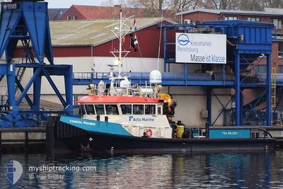
COASTAL ROAMER
Tug
Current Trip
NMDC
| Time Travelled | 14 h, 49 mins |
|---|---|
| Remaining Time | --- |
| Distance Travelled | 9.72 nm |
| Remaining Distance | --- |
| AVG Speed | 7.8 Knopen |
| MAX Speed | 9.6 Knopen |
| AVG Wind | 5.3 knots |
| MAX Wind | 6 knots |
| MIN Temp | 24.4°C / 75.92°F |
| MAX Temp | 25.1°C / 77.18°F |
| Diepgang | 1.5 M |
| Positie ontvangen | 4 h, 7 m geleden |
Current Position
| Lengtegraad | --- |
|---|---|
| Breedtegraat | --- |
| Status | Under way using engine |
| Snelheid | 0.2 Knopen |
| Koers | 35° |
| Gebied | Persian Gulf |
| Station | T-AIS |
| Positie ontvangen | 4 h, 7 m geleden |
Info
Information
The current position of COASTAL ROAMER is in Persian Gulf with coordinates 24.48835° / 54.25690° as reported on 2025-12-05 23:41 by AIS to our vessel tracker app. The vessel's current speed is 0.2 Knopen
The vessel COASTAL ROAMER (IMO: 9688893, MMSI: 244824000) is a Tug that was built in 2014 ( 11 Jaar oud ). It's sailing under the flag of [NL] Netherlands.
In this page you can find informations about the vessels current position, last detected port calls, and current voyage information. If the vessels is not in coverage by AIS you will find the latest position.
The current position of COASTAL ROAMER is detected by our AIS receivers and we are not responsible for the reliability of the data. The last position was recorded while the vessel was in Coverage by the Ais receivers of our vessel tracking app.
The current draught of COASTAL ROAMER as reported by AIS is 1.5 meters
Weather
| Temperature | 24.4°C / 75.92°F |
|---|---|
| Wind Speed | 3 knots |
| Direction | 38° NE |
| Pressure | 1018.4 hPa |
| Humidity | 62.1 % |
| Cloud Coverage | 45 % |
Featured Company
Events
| Tijd | Evenement | Details | Positie / Bestemming | Info |
|---|---|---|---|---|
| 2025-12-05 23:49 | Status Changed | Default Under way using engine |
24.48833 / 54.25667
NMDC
|
Snelheid: 0.2 kn Koers: 35° |
| 2025-12-05 23:41 | Buitenbereik |
24.48835 / 54.25690
Persian Gulf
|
Snelheid: 0.2 kn Koers: 305.5° |
|
| 2025-12-05 19:45 | Status Changed | Under way using engine Default |
24.48842 / 54.25720
NMDC
|
Snelheid: Koers: -1° |
| 2025-12-05 19:40 | Status Changed | Default Under way using engine |
24.48833 / 54.25667
NMDC
|
Snelheid: Koers: 331° |
| 2025-12-05 19:31 | Status Changed | Under way using engine Default |
24.48844 / 54.25720
NMDC
|
Snelheid: Koers: -1° |
| 2025-12-05 19:28 | Status Changed | Default Under way using engine |
24.48833 / 54.25667
NMDC
|
Snelheid: Koers: 334° |
| 2025-12-05 19:00 | Status Changed | Under way using engine Default |
24.48855 / 54.25724
NMDC
|
Snelheid: Koers: -1° |
| 2025-12-05 18:29 | Status Changed | Default Under way using engine |
24.48862 / 54.25719
NMDC
|
Snelheid: Koers: 309° |
| 2025-12-05 18:24 | Status Changed | Under way using engine Default |
24.48863 / 54.25722
NMDC
|
Snelheid: 0.1 kn Koers: 278° |
| 2025-12-05 18:15 | Binnenbereik |
24.48863 / 54.25722
Persian Gulf
|
Snelheid: Koers: 309.3° |