
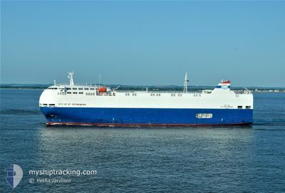
CITY OF STPETERSBURG
Vehicles Carrier
Current Trip
| Time Travelled | 3 days |
|---|---|
| Remaining Time | 12 h, 14 mins |
| Distance Travelled | 868.72 nm |
| Remaining Distance | 189.48 nm |
| AVG Speed | 10.7 Knopen |
| MAX Speed | 16.2 Knopen |
| AVG Wind | 18.9 knots |
| MAX Wind | 36.3 knots |
| MIN Temp | 8.7°C / 47.66°F |
| MAX Temp | 14.6°C / 58.28°F |
| Diepgang | 6.9 M |
| Positie ontvangen | 18 h, 20 m geleden |
Current Position
| Lengtegraad | --- |
|---|---|
| Breedtegraat | --- |
| Status | Under way using engine |
| Snelheid | 6.7 Knopen |
| Koers | 168.1° |
| Gebied | Celtic Sea |
| Station | T-AIS |
| Positie ontvangen | 18 h, 20 m geleden |
Info
Information
The current position of CITY OF STPETERSBURG is in Celtic Sea with coordinates 46.86030° / -5.24634° as reported on 2025-12-10 19:07 by AIS to our vessel tracker app. The vessel's current speed is 6.7 Knopen and is heading at the port of SANTANDER. The estimated time of arrival as calculated by MyShipTracking vessel tracking app is 2025-12-12 02:41 LT
The vessel CITY OF STPETERSBURG (IMO: 9473456, MMSI: 353083000) is a Vehicles Carrier that was built in 2010 ( 15 Jaar oud ). It's sailing under the flag of [PA] Panama.
In this page you can find informations about the vessels current position, last detected port calls, and current voyage information. If the vessels is not in coverage by AIS you will find the latest position.
The current position of CITY OF STPETERSBURG is detected by our AIS receivers and we are not responsible for the reliability of the data. The last position was recorded while the vessel was in Coverage by the Ais receivers of our vessel tracking app.
The current draught of CITY OF STPETERSBURG as reported by AIS is 6.9 meters
Weather
| Temperature | 14.2°C / 57.56°F |
|---|---|
| Wind Speed | 7 knots |
| Direction | 201° SSW |
| Pressure | 1016.6 hPa |
| Humidity | 80.1 % |
| Cloud Coverage | 79 % |
Featured Company
Last Port Calls
| Port | Arrival | Departure | Time In Port |
|---|---|---|---|
| 2025-12-06 17:26 | 2025-12-07 21:42 | 1 d | |
| 2025-12-03 10:20 | 2025-12-03 15:17 | 4 h | |
| 2025-12-01 16:29 | 2025-12-02 06:43 | 14 h | |
| 2025-11-26 00:12 | 2025-11-28 22:31 | 2 d | |
| 2025-11-25 03:06 | 2025-11-25 03:42 | 35 m | |
| 2025-11-24 13:46 | 2025-11-25 01:48 | 12 h | |
| 2025-11-24 12:08 | 2025-11-24 12:54 | 46 m | |
| 2025-11-22 16:00 | 2025-11-23 14:47 | 22 h | |
| 2025-11-19 06:21 | 2025-11-19 15:15 | 8 h | |
| 2025-11-15 17:20 | 2025-11-16 10:26 | 17 h |
Last Trips
| Origin | Departure | Destination | Arrival | Distance | |
|---|---|---|---|---|---|
| 2025-12-03 15:17 | 2025-12-06 17:26 | 1081.77 nm | |||
| 2025-12-02 06:43 | 2025-12-03 10:20 | 369.06 nm | |||
| 2025-11-28 22:31 | 2025-12-01 16:29 | 882.58 nm | |||
| 2025-11-25 03:42 | 2025-11-26 00:12 | 282.80 nm | |||
| 2025-11-25 01:48 | 2025-11-25 03:06 | 4.74 nm | |||
| 2025-11-24 12:54 | 2025-11-24 13:46 | 7.28 nm | |||
| 2025-11-23 14:47 | 2025-11-24 12:08 | 284.32 nm | |||
| 2025-11-19 15:15 | 2025-11-22 16:00 | 1009.30 nm | |||
| 2025-11-16 10:26 | 2025-11-19 06:21 | 949.08 nm | |||
| 2025-11-13 20:38 | 2025-11-15 17:20 | 452.57 nm |
Events
| Tijd | Evenement | Details | Positie / Bestemming | Info |
|---|---|---|---|---|
| 2025-12-10 19:24 | Status Changed | Default Under way using engine |
46.82667 / -5.23333
ES SDR
|
Snelheid: 6.7 kn Koers: 168.1° |
| 2025-12-10 19:07 | Buitenbereik |
46.86030 / -5.24634
Celtic Sea
ES SDR
|
Snelheid: 6.7 kn Koers: 168.1° |
|
| 2025-12-10 19:06 | Status Changed | Under way using engine Default |
46.86150 / -5.24674
ES SDR
|
Snelheid: 6 kn Koers: 161° |
| 2025-12-10 19:06 | Binnenbereik |
46.86030 / -5.24634
Celtic Sea
ES SDR
|
Snelheid: 6.7 kn Koers: 168.1° |
|
| 2025-12-10 04:07 | Status Changed | Default Under way using engine |
49.16659 / -5.18566
ES SDR
|
Snelheid: 9.6 kn Koers: 240.8° |
| 2025-12-10 04:01 | Gevonden in zee | French part of the Celtic Sea |
49.17495 / -5.16405
Celtic Sea
ES SDR
|
Snelheid: 9.6 kn Koers: 240.8° |
| 2025-12-10 04:01 | Status Changed | Under way using engine Default |
49.17495 / -5.16405
ES SDR
|
Snelheid: 8.9 kn Koers: 238° |
| 2025-12-10 04:01 | Buitenbereik |
49.17495 / -5.16405
Celtic Sea
ES SDR
|
Snelheid: 9.6 kn Koers: 240.8° |
|
| 2025-12-10 03:47 | Binnenbereik |
49.17495 / -5.16405
Celtic Sea
ES SDR
|
Snelheid: 9.6 kn Koers: 240.8° |
|
| 2025-12-10 02:31 | Buitenbereik |
49.29135 / -4.86064
English Channel
ES SDR
|
Snelheid: 9.5 kn Koers: 241.3° |