
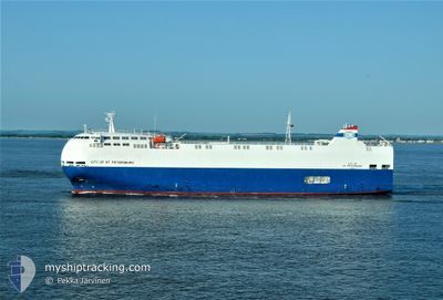
CITY OF STPETERSBURG
Vehicles Carrier
Current Trip
| Time Travelled | 11 h, 16 mins |
|---|---|
| Remaining Time | 2 days |
| Distance Travelled | 162.38 nm |
| Remaining Distance | 756.45 nm |
| AVG Speed | 14.7 Knots |
| MAX Speed | 16.2 Knots |
| AVG Wind | 22.5 knots |
| MAX Wind | 31.3 knots |
| MIN Temp | 8.7°C / 47.66°F |
| MAX Temp | 10.5°C / 50.9°F |
| Dybgang | 6.9 m |
| Position Modtaget | Nu |
Current Position
| Longitude | --- |
|---|---|
| Latitude | --- |
| Status | Under way using engine |
| Fart | 15.7 Knots |
| Kurs | 136.4° |
| Område | North Sea |
| Station | T-AIS |
| Position Modtaget | Nu |
Info
Information
The current position of CITY OF STPETERSBURG is in North Sea with coordinates 52.96986° / 1.56187° as reported on 2025-12-08 08:57 by AIS to our vessel tracker app. The vessel's current speed is 15.7 Knots and is heading at the port of SANTANDER. The estimated time of arrival as calculated by MyShipTracking vessel tracking app is 2025-12-10 10:28 LT
The vessel CITY OF STPETERSBURG (IMO: 9473456, MMSI: 353083000) is a Vehicles Carrier that was built in 2010 ( 15 år gamle ). It's sailing under the flag of [PA] Panama.
In this page you can find informations about the vessels current position, last detected port calls, and current voyage information. If the vessels is not in coverage by AIS you will find the latest position.
The current position of CITY OF STPETERSBURG is detected by our AIS receivers and we are not responsible for the reliability of the data. The last position was recorded while the vessel was in Coverage by the Ais receivers of our vessel tracking app.
The current draught of CITY OF STPETERSBURG as reported by AIS is 6.9 meters
Weather
| Temperature | 10.2°C / 50.36°F |
|---|---|
| Wind Speed | 18 knots |
| Direction | 214° SW |
| Pressure | 1005.3 hPa |
| Humidity | 87.5 % |
| Cloud Coverage | 100 % |
Featured Company
Last Port Calls
| Port | Arrival | Departure | Time In Port |
|---|---|---|---|
| 2025-12-06 17:26 | 2025-12-07 21:42 | 1 d | |
| 2025-12-03 10:20 | 2025-12-03 15:17 | 4 h | |
| 2025-12-01 16:29 | 2025-12-02 06:43 | 14 h | |
| 2025-11-26 00:12 | 2025-11-28 22:31 | 2 d | |
| 2025-11-25 03:06 | 2025-11-25 03:42 | 35 m | |
| 2025-11-24 13:46 | 2025-11-25 01:48 | 12 h | |
| 2025-11-24 12:08 | 2025-11-24 12:54 | 46 m | |
| 2025-11-22 16:00 | 2025-11-23 14:47 | 22 h | |
| 2025-11-19 06:21 | 2025-11-19 15:15 | 8 h | |
| 2025-11-15 17:20 | 2025-11-16 10:26 | 17 h |
Last Trips
| Origin | Departure | Destination | Arrival | Distance | |
|---|---|---|---|---|---|
| 2025-12-03 15:17 | 2025-12-06 17:26 | 1081.77 nm | |||
| 2025-12-02 06:43 | 2025-12-03 10:20 | 369.06 nm | |||
| 2025-11-28 22:31 | 2025-12-01 16:29 | 882.58 nm | |||
| 2025-11-25 03:42 | 2025-11-26 00:12 | 282.80 nm | |||
| 2025-11-25 01:48 | 2025-11-25 03:06 | 4.74 nm | |||
| 2025-11-24 12:54 | 2025-11-24 13:46 | 7.28 nm | |||
| 2025-11-23 14:47 | 2025-11-24 12:08 | 284.32 nm | |||
| 2025-11-19 15:15 | 2025-11-22 16:00 | 1009.30 nm | |||
| 2025-11-16 10:26 | 2025-11-19 06:21 | 949.08 nm | |||
| 2025-11-13 20:38 | 2025-11-15 17:20 | 452.57 nm |
Events
| Tid | Hændelsen | Detaljer | Position / Dest | Info |
|---|---|---|---|---|
| 2025-12-08 07:54 | Status er ændret | Under way using engine Default |
53.19656 / 1.31229
ES SDR
|
Fart: 15.5 kn Kurs: 148° |
| 2025-12-08 07:45 | Indenfor Dækning |
53.19357 / 1.31543
North Sea
ES SDR
|
Fart: 15.5 kn Kurs: 147.9° |
|
| 2025-12-08 04:33 | Status er ændret | Default Under way using engine |
53.90606 / .48604
ES SDR
|
Fart: 15.1 kn Kurs: 137.1° |
| 2025-12-08 04:27 | Udenfor Dækning |
53.92465 / .45677
North Sea
ES SDR
|
Fart: 15.1 kn Kurs: 137.1° |
|
| 2025-12-08 02:50 | Status er ændret | Under way using engine Default |
54.21602 / -.00770
ES SDR
|
Fart: 14.3 kn Kurs: 138° |
| 2025-12-08 02:01 | Status er ændret | Default Under way using engine |
54.35618 / -.23919
ES SDR
|
Fart: 14 kn Kurs: 137° |
| 2025-12-08 01:08 | Status er ændret | Under way using engine Default |
54.50827 / -.47794
ES SDR
|
Fart: 13.6 kn Kurs: 138° |
| 2025-12-08 01:03 | Status er ændret | Default Under way using engine |
54.52291 / -.49988
ES SDR
|
Fart: 13.5 kn Kurs: 138.3° |
| 2025-12-08 00:53 | Status er ændret | Under way using engine Default |
54.55107 / -.54278
ES SDR
|
Fart: 13.3 kn Kurs: 136° |
| 2025-12-08 00:50 | Status er ændret | Default Under way using engine |
54.55837 / -.55446
ES SDR
|
Fart: 13.3 kn Kurs: 137.9° |