
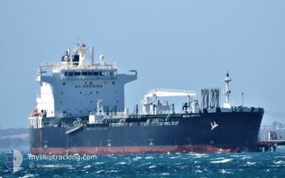
BRITISH OFFICER
Tanker
Current Trip
AU GTE
| Time Travelled | 1 day |
|---|---|
| Remaining Time | --- |
| Distance Travelled | 228.27 nm |
| Remaining Distance | --- |
| AVG Speed | 10 Knopen |
| MAX Speed | 13.1 Knopen |
| AVG Wind | 10.9 knots |
| MAX Wind | 22 knots |
| MIN Temp | 19.6°C / 67.28°F |
| MAX Temp | 25.3°C / 77.54°F |
| Diepgang | 10.2 M |
| Positie ontvangen | 3 m geleden |
Current Position
| Lengtegraad | 114.53291° |
|---|---|
| Breedtegraat | -28.78704° |
| Status | At anchor |
| Snelheid | 0.3 Knopen |
| Koers | 293° |
| Gebied | Indian Ocean |
| Station | T-AIS |
| Positie ontvangen | 3 m geleden |
Info
Information
The current position of BRITISH OFFICER is in Indian Ocean with coordinates -28.78704° / 114.53291° as reported on 2024-05-20 10:12 by AIS to our vessel tracker app. The vessel's current speed is 0.3 Knopen
The vessel BRITISH OFFICER (IMO: 9724697, MMSI: 235113769) is a Tanker It's sailing under the flag of [GB] United Kingdom.
In this page you can find informations about the vessels current position, last detected port calls, and current voyage information. If the vessels is not in coverage by AIS you will find the latest position.
The current position of BRITISH OFFICER is detected by our AIS receivers and we are not responsible for the reliability of the data. The last position was recorded while the vessel was in Coverage by the Ais receivers of our vessel tracking app.
The current draught of BRITISH OFFICER as reported by AIS is 10.2 meters
Weather
| Temperature | 24.5°C / 76.1°F |
|---|---|
| Wind Speed | 5 knots |
| Direction | 96° E |
| Pressure | 1021.8 hPa |
| Humidity | 41.1 % |
| Cloud Coverage | 100 % |
Featured Company
Last Port Calls
| Port | Arrival | Departure | Time In Port |
|---|---|---|---|
| 2024-05-09 13:16 | 2024-05-18 20:01 | 9 d | |
| 2024-04-04 13:35 | 2024-04-07 13:25 | 3 d | |
| 2024-03-17 00:28 | 2024-03-18 17:01 | 1 d | |
| 2024-03-15 16:13 | 2024-03-16 22:45 | 1 d | |
| 2024-03-11 21:55 | 2024-03-13 11:44 | 1 d | |
| 2024-03-01 16:26 | 2024-03-03 07:26 | 1 d |
Most Visited Ports (Last year)
| Port | Arrivals | |
|---|---|---|
| 6 | ||
| 2 | ||
| 2 | ||
| 2 | ||
| 2 | ||
| 1 |
Last Trips
| Origin | Departure | Destination | Arrival | Distance | |
|---|---|---|---|---|---|
| 2024-04-07 13:25 | 2024-05-09 13:16 | 8023.13 nm | |||
| 2024-03-18 17:01 | 2024-04-04 13:35 | 4401.23 nm | |||
| 2024-03-16 22:45 | 2024-03-17 00:28 | 11.87 nm | |||
| 2024-03-13 11:44 | 2024-03-15 16:13 | 213.78 nm | |||
| 2024-03-03 07:26 | 2024-03-11 21:55 | 1836.93 nm | |||
| 2024-02-15 22:38 | 2024-03-01 16:26 | 3581.68 nm |
Events
| Tijd | Evenement | Details | Positie / Bestemming | Info |
|---|---|---|---|---|
| 2024-05-20 08:21 | Status Changed | At anchor Default |
-28.78754 / 114.53261
AU GTE
|
Snelheid: 0.7 kn Koers: 319° |
| 2024-05-20 08:18 | Status Changed | Default At anchor |
-28.78758 / 114.53264
AU GTE
|
Snelheid: 0.4 kn Koers: 319° |
| 2024-05-20 01:54 | Status Changed | At anchor Default |
-28.78798 / 114.53128
AU GTE
|
Snelheid: 0.1 kn Koers: 14° |
| 2024-05-20 01:48 | Status Changed | Default At anchor |
-28.78802 / 114.53128
AU GTE
|
Snelheid: 0.1 kn Koers: 17° |
| 2024-05-20 00:04 | Status Changed | At anchor Default |
-28.78786 / 114.53095
AU GTE
|
Snelheid: 0.1 kn Koers: 24° |
| 2024-05-20 00:00 | Status Changed | Default At anchor |
-28.78788 / 114.53095
AU GTE
|
Snelheid: 0.1 kn Koers: 30° |
| 2024-05-19 21:51 | Status Changed | At anchor Default |
-28.78769 / 114.53076
AU GTE
|
Snelheid: 0.3 kn Koers: 31° |
| 2024-05-19 21:47 | Status Changed | Default At anchor |
-28.78771 / 114.53080
AU GTE
|
Snelheid: 0.2 kn Koers: 35° |
| 2024-05-19 20:58 | Status Changed | At anchor Default |
-28.78759 / 114.53104
AU GTE
|
Snelheid: Koers: 32° |
| 2024-05-19 20:54 | Status Changed | Default At anchor |
-28.78757 / 114.53097
AU GTE
|
Snelheid: 0.1 kn Koers: 27° |