
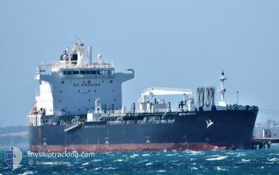
BRITISH OFFICER
Tanker
Current Trip
| Trip Time | 32 days |
|---|---|
| Trip Distance | 8023.13 nm |
| AVG Speed | 12 Knots |
| MAX Speed | 15.8 Knots |
| Dybgang | 12.3 m |
| AVG Wind | 10.7 knots |
| MAX Wind | 24.9 knots |
| MIN Temp | 20.7°C / 69.26°F |
| MAX Temp | 30.8°C / 87.44°F |
| Position Modtaget | 2 d siden |
Current Position
| Longitude | 115.75235° |
|---|---|
| Latitude | -32.22836° |
| Status | Constrained by her draught |
| Fart | 1.1 Knots |
| Kurs | 147° |
| Område | Indian Ocean |
| Station | T-AIS |
| Position Modtaget | 2 d siden |
Info
Information
The current position of BRITISH OFFICER is in Indian Ocean with coordinates -32.22836° / 115.75235° as reported on 2024-05-09 05:57 by AIS to our vessel tracker app. The vessel's current speed is 1.1 Knots and is currently inside the port of KWINANA.
The vessel BRITISH OFFICER (IMO: 9724697, MMSI: 235113769) is a Tanker It's sailing under the flag of [GB] United Kingdom.
In this page you can find informations about the vessels current position, last detected port calls, and current voyage information. If the vessels is not in coverage by AIS you will find the latest position.
The current position of BRITISH OFFICER is detected by our AIS receivers and we are not responsible for the reliability of the data. The last position was recorded while the vessel was in Coverage by the Ais receivers of our vessel tracking app.
The current draught of BRITISH OFFICER as reported by AIS is 12.3 meters
Weather
| Temperature | 19.7°C / 67.46°F |
|---|---|
| Wind Speed | 7 knots |
| Direction | 193° SSW |
| Pressure | 1021.9 hPa |
| Humidity | 72.3 % |
| Cloud Coverage | 30 % |
Featured Company
Last Port Calls
| Port | Arrival | Departure | Time In Port |
|---|---|---|---|
| 2024-05-09 05:16 | |||
| 2024-04-04 02:35 | 2024-04-07 03:25 | 3 d | |
| 2024-03-16 16:28 | 2024-03-18 09:01 | 1 d | |
| 2024-03-15 08:13 | 2024-03-16 14:45 | 1 d | |
| 2024-03-11 13:55 | 2024-03-13 03:44 | 1 d | |
| 2024-03-01 08:26 | 2024-03-02 23:26 | 1 d |
Most Visited Ports (Last year)
| Port | Arrivals | |
|---|---|---|
| 6 | ||
| 2 | ||
| 2 | ||
| 2 | ||
| 2 | ||
| 1 |
Last Trips
| Origin | Departure | Destination | Arrival | Distance | |
|---|---|---|---|---|---|
| 2024-04-07 13:25 | 2024-05-09 13:16 | 8023.13 nm | |||
| 2024-03-18 17:01 | 2024-04-04 13:35 | 4401.23 nm | |||
| 2024-03-16 22:45 | 2024-03-17 00:28 | 11.87 nm | |||
| 2024-03-13 11:44 | 2024-03-15 16:13 | 213.78 nm | |||
| 2024-03-03 07:26 | 2024-03-11 21:55 | 1836.93 nm | |||
| 2024-02-15 22:38 | 2024-03-01 16:26 | 3581.68 nm |
Events
| Tid | Hændelsen | Detaljer | Position / Dest | Info |
|---|---|---|---|---|
| 2024-05-09 06:03 | Status er ændret | Default Constrained by her draught |
-32.22900 / 115.75378
[AU] KWINANA
|
Fart: 1.1 kn Kurs: 147° |
| 2024-05-09 06:03 | STOP Sejllads |
-32.22900 / 115.75378
[AU] KWINANA
|
Fart: Kurs: 168° |
|
| 2024-05-09 05:57 | Udenfor Dækning |
-32.22836 / 115.75235
Indian Ocean
[AU] KWINANA
|
Fart: 1.1 kn Kurs: 120.1° |
|
| 2024-05-09 05:16 | Skibe i havn |
|
-32.14501 / 115.70783
[AU] KWINANA
|
Fart: 11.5 kn Kurs: 161.7° |
| 2024-05-09 04:26 | Status er ændret | Constrained by her draught Under way using engine |
-31.98124 / 115.69217
AU KWI
|
Fart: 12.3 kn Kurs: 175° |
| 2024-05-09 03:29 | Status er ændret | Under way using engine Default |
-31.88493 / 115.54796
AU KWI
|
Fart: 10.6 kn Kurs: 130° |
| 2024-05-09 03:18 | Status er ændret | Default Under way using engine |
-31.86461 / 115.51977
AU KWI
|
Fart: 4.4 kn Kurs: 115° |
| 2024-05-09 03:09 | Dybgangen er ændret | 12.3 8.6 |
-31.85727 / 115.50640
AU KWI
|
Fart: 2.8 kn Kurs: 78° |
| 2024-05-09 03:09 | Destination er ændret | AU KWI CN QZJ |
-31.85727 / 115.50640
AU KWI
|
Fart: 2.8 kn Kurs: 78° |
| 2024-05-09 03:09 | ETA er ændret | 2024/05/09 04:00 2024/04/22 06:00 |
-31.85727 / 115.50640
AU KWI
|
Fart: 2.8 kn Kurs: 78° |