
BORE WAY
Cargo
Current Trip
| Time Travelled | 19 h, 21 mins |
|---|---|
| Remaining Time | --- |
| Distance Travelled | 231.72 nm |
| Remaining Distance | --- |
| AVG Speed | 11.6 Knopen |
| MAX Speed | 14.3 Knopen |
| AVG Wind | 17.8 knots |
| MAX Wind | 25 knots |
| MIN Temp | 2.6°C / 36.68°F |
| MAX Temp | 7.6°C / 45.68°F |
| Diepgang | 6.7 M |
| Positie ontvangen | 4 h, 23 m geleden |
Current Position
| Lengtegraad | --- |
|---|---|
| Breedtegraat | --- |
| Status | Under way using engine |
| Snelheid | 12.1 Knopen |
| Koers | 231° |
| Gebied | Baltic Sea |
| Station | T-AIS |
| Positie ontvangen | 4 h, 23 m geleden |
Info
Information
The current position of BORE WAY is in Baltic Sea with coordinates 59.22425° / 21.79148° as reported on 2025-12-11 04:15 by AIS to our vessel tracker app. The vessel's current speed is 12.1 Knopen and is heading at the port of AMSTERDAM. The estimated time of arrival as calculated by MyShipTracking vessel tracking app is 2025-12-14 18:00 LT
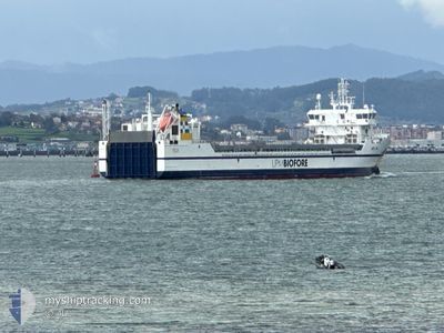
The vessel BORE WAY (IMO: 9892884, MMSI: 230696000) is a Cargo It's sailing under the flag of [FI] Finland.
In this page you can find informations about the vessels current position, last detected port calls, and current voyage information. If the vessels is not in coverage by AIS you will find the latest position.
The current position of BORE WAY is detected by our AIS receivers and we are not responsible for the reliability of the data. The last position was recorded while the vessel was in Coverage by the Ais receivers of our vessel tracking app.
The current draught of BORE WAY as reported by AIS is 6.7 meters
Weather
| Temperature | 7.3°C / 45.14°F |
|---|---|
| Wind Speed | 19 knots |
| Direction | 260° W |
| Pressure | 1003.2 hPa |
| Humidity | 87.2 % |
| Cloud Coverage | 100 % |
Featured Company
Last Port Calls
| Port | Arrival | Departure | Time In Port |
|---|---|---|---|
| 2025-12-10 05:13 | 2025-12-10 15:17 | 10 h | |
| 2025-12-08 06:12 | 2025-12-08 23:45 | 17 h | |
| 2025-12-02 20:02 | 2025-12-04 13:01 | 1 d | |
| 2025-12-02 17:43 | 2025-12-02 19:09 | 1 h | |
| 2025-11-27 20:59 | 2025-11-28 20:57 | 23 h | |
| 2025-11-20 12:20 | 2025-11-21 19:23 | 1 d | |
| 2025-11-17 21:43 | 2025-11-17 22:24 | 41 m | |
| 2025-11-16 23:22 | 2025-11-17 20:10 | 20 h | |
| 2025-11-16 21:58 | 2025-11-16 22:29 | 30 m | |
| 2025-11-11 23:16 | 2025-11-12 21:27 | 22 h |
Last Trips
| Origin | Departure | Destination | Arrival | Distance | |
|---|---|---|---|---|---|
| 2025-12-08 23:45 | 2025-12-10 05:13 | 373.57 nm | |||
| 2025-12-04 13:01 | 2025-12-08 06:12 | 1147.42 nm | |||
| 2025-12-02 19:09 | 2025-12-02 20:02 | 7.07 nm | |||
| 2025-11-28 20:57 | 2025-12-02 17:43 | 1011.56 nm | |||
| 2025-11-21 19:23 | 2025-11-27 20:59 | 1951.97 nm | |||
| 2025-11-17 22:24 | 2025-11-20 12:20 | 808.43 nm | |||
| 2025-11-17 20:10 | 2025-11-17 21:43 | 5.17 nm | |||
| 2025-11-16 22:29 | 2025-11-16 23:22 | 7.02 nm | |||
| 2025-11-12 21:27 | 2025-11-16 21:58 | 1198.14 nm | |||
| 2025-11-10 20:12 | 2025-11-11 23:16 | 372.74 nm |
Events
| Tijd | Evenement | Details | Positie / Bestemming | Info |
|---|---|---|---|---|
| 2025-12-11 04:21 | Status Changed | Default Under way using engine |
59.21059 / 21.75806
AMSTERDAM
|
Snelheid: 12.1 kn Koers: 231° |
| 2025-12-11 04:15 | Buitenbereik |
59.22425 / 21.79148
Baltic Sea
AMSTERDAM
|
Snelheid: 12.1 kn Koers: 231° |
|
| 2025-12-11 03:36 | Gevonden in zee | Estonian part of the Baltic Sea |
59.30324 / 21.98800
Baltic Sea
AMSTERDAM
|
Snelheid: 11.9 kn Koers: 234.4° |
| 2025-12-11 03:35 | Status Changed | Under way using engine Default |
59.30581 / 21.99498
AMSTERDAM
|
Snelheid: 11.9 kn Koers: 234° |
| 2025-12-11 03:35 | Binnenbereik |
59.30324 / 21.98800
Baltic Sea
AMSTERDAM
|
Snelheid: 11.9 kn Koers: 234.4° |
|
| 2025-12-10 23:08 | Status Changed | Default Under way using engine |
59.66104 / 23.51972
AMSTERDAM
|
Snelheid: 12.4 kn Koers: 254.5° |
| 2025-12-10 23:00 | Status Changed | Under way using engine Default |
59.66788 / 23.56833
AMSTERDAM
|
Snelheid: 12.4 kn Koers: 255° |
| 2025-12-10 23:00 | Buitenbereik |
59.66788 / 23.56833
Gulf of Finland
AMSTERDAM
|
Snelheid: 12.4 kn Koers: 254.5° |
|
| 2025-12-10 22:45 | Status Changed | Default Under way using engine |
59.68194 / 23.66925
AMSTERDAM
|
Snelheid: 11.7 kn Koers: 254.2° |
| 2025-12-10 22:39 | Status Changed | Under way using engine Default |
59.68729 / 23.70667
AMSTERDAM
|
Snelheid: 11.9 kn Koers: 254° |