
BORE WAY
Cargo
Current Trip
| Time Travelled | 3 days |
|---|---|
| Remaining Time | 7 h, 0 mins |
| Distance Travelled | 1060.40 nm |
| Remaining Distance | 87.39 nm |
| AVG Speed | 12.4 Knots |
| MAX Speed | 15.7 Knots |
| AVG Wind | 13.8 knots |
| MAX Wind | 25.8 knots |
| MIN Temp | 3.2°C / 37.76°F |
| MAX Temp | 8.8°C / 47.84°F |
| Draught | 6.1 m |
| Position Received | Now |
Current Position
| Longitude | --- |
|---|---|
| Latitude | --- |
| Status | Under way using engine |
| Speed | 12.2 Knots |
| Course | 6.1° |
| Area | Gulf of Bothnia |
| Station | T-AIS |
| Position Received | Now |
Info
Information
The current position of BORE WAY is in Gulf of Bothnia with coordinates 60.42754° / 19.04478° as reported on 2025-12-07 20:55 by AIS to our vessel tracker app. The vessel's current speed is 12.2 Knots and is heading at the port of RAUMA. The estimated time of arrival as calculated by MyShipTracking vessel tracking app is 2025-12-08 05:56 LT
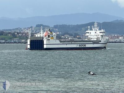
The vessel BORE WAY (IMO: 9892884, MMSI: 230696000) is a Cargo It's sailing under the flag of [FI] Finland.
In this page you can find informations about the vessels current position, last detected port calls, and current voyage information. If the vessels is not in coverage by AIS you will find the latest position.
The current position of BORE WAY is detected by our AIS receivers and we are not responsible for the reliability of the data. The last position was recorded while the vessel was in Coverage by the Ais receivers of our vessel tracking app.
The current draught of BORE WAY as reported by AIS is 6.1 meters
Weather
| Temperature | 5.4°C / 41.72°F |
|---|---|
| Wind Speed | 10 knots |
| Direction | 161° SSE |
| Pressure | 1009.9 hPa |
| Humidity | 96.1 % |
| Cloud Coverage | 100 % |
Featured Company
Last Port Calls
| Port | Arrival | Departure | Time In Port |
|---|---|---|---|
| 2025-12-02 20:02 | 2025-12-04 13:01 | 1 d | |
| 2025-12-02 17:43 | 2025-12-02 19:09 | 1 h | |
| 2025-11-27 20:59 | 2025-11-28 20:57 | 23 h | |
| 2025-11-20 12:20 | 2025-11-21 19:23 | 1 d | |
| 2025-11-17 21:43 | 2025-11-17 22:24 | 41 m | |
| 2025-11-16 23:22 | 2025-11-17 20:10 | 20 h | |
| 2025-11-16 21:58 | 2025-11-16 22:29 | 30 m | |
| 2025-11-11 23:16 | 2025-11-12 21:27 | 22 h | |
| 2025-11-09 16:46 | 2025-11-10 20:12 | 1 d | |
| 2025-11-05 18:59 | 2025-11-06 23:28 | 1 d |
Last Trips
| Origin | Departure | Destination | Arrival | Distance | |
|---|---|---|---|---|---|
| 2025-12-02 19:09 | 2025-12-02 20:02 | 7.07 nm | |||
| 2025-11-28 20:57 | 2025-12-02 17:43 | 1011.56 nm | |||
| 2025-11-21 19:23 | 2025-11-27 20:59 | 1951.97 nm | |||
| 2025-11-17 22:24 | 2025-11-20 12:20 | 808.43 nm | |||
| 2025-11-17 20:10 | 2025-11-17 21:43 | 5.17 nm | |||
| 2025-11-16 22:29 | 2025-11-16 23:22 | 7.02 nm | |||
| 2025-11-12 21:27 | 2025-11-16 21:58 | 1198.14 nm | |||
| 2025-11-10 20:12 | 2025-11-11 23:16 | 372.74 nm | |||
| 2025-11-06 23:28 | 2025-11-09 16:46 | 594.36 nm | |||
| 2025-11-03 22:22 | 2025-11-05 18:59 | 590.84 nm |
Events
| Time | Event | Details | Position / Dest | Info |
|---|---|---|---|---|
| 2025-12-07 19:50 | Change Sea Area | Swedish part of the Gulf of Bothnia Finnish part of the Gulf of Bothnia |
60.21116 / 19.08748
Gulf of Bothnia
FIRAU
|
Speed: 12.1 kn Course: 334.3° |
| 2025-12-07 17:32 | Status Changed | Under way using engine Default |
59.84275 / 19.67073
FIRAU
|
Speed: 12.9 kn Course: 321° |
| 2025-12-07 17:29 | Status Changed | Default Under way using engine |
59.83307 / 19.68647
FIRAU
|
Speed: 12.9 kn Course: 319.8° |
| 2025-12-07 17:13 | Change Sea Area | Finnish part of the Gulf of Bothnia Finnish part of the Baltic Sea |
59.79071 / 19.75717
Gulf of Bothnia
FIRAU
|
Speed: 12.9 kn Course: 318.6° |
| 2025-12-07 16:23 | Status Changed | Under way using engine Default |
59.65853 / 19.99295
FIRAU
|
Speed: 12.9 kn Course: 315° |
| 2025-12-07 16:21 | Status Changed | Default Under way using engine |
59.65231 / 20.00542
FIRAU
|
Speed: 12.8 kn Course: 314.9° |
| 2025-12-07 16:06 | Change Sea Area | Finnish part of the Baltic Sea Swedish part of the Baltic Sea |
59.61604 / 20.07831
Baltic Sea
FIRAU
|
Speed: 12.9 kn Course: 314.1° |
| 2025-12-07 16:06 | Status Changed | Under way using engine Default |
59.61442 / 20.08159
FIRAU
|
Speed: 12.9 kn Course: 314° |
| 2025-12-07 15:57 | IN Coverage |
59.61604 / 20.07831
Baltic Sea
FIRAU
|
Speed: 12.9 kn Course: 314.1° |
|
| 2025-12-07 08:38 | OUT of Coverage |
58.26203 / 18.71351
Baltic Sea
FIRAU
|
Speed: 12.6 kn Course: 32° |