
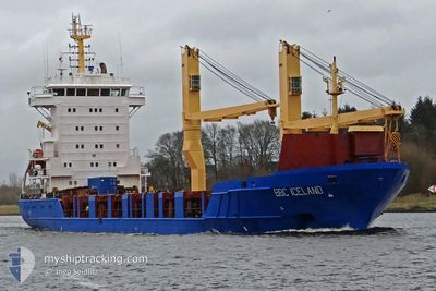
BBC ICELAND
General Cargo
Current Trip
PAPCN
| Time Travelled | 2 days |
|---|---|
| Remaining Time | --- |
| Distance Travelled | 498.71 nm |
| Remaining Distance | --- |
| AVG Speed | 11 Knopen |
| MAX Speed | 14.8 Knopen |
| AVG Wind | 11.6 knots |
| MAX Wind | 22.5 knots |
| MIN Temp | 18.9°C / 66.02°F |
| MAX Temp | 26.3°C / 79.34°F |
| Diepgang | 7 M |
| Positie ontvangen | 10 d geleden |
Current Position
| Lengtegraad | --- |
|---|---|
| Breedtegraat | --- |
| Status | Under way using engine |
| Snelheid | 13.4 Knopen |
| Koers | 11.2° |
| Gebied | South Atlantic Ocean |
| Station | T-AIS |
| Positie ontvangen | 10 d geleden |
Info
Information
The current position of BBC ICELAND is in South Atlantic Ocean with coordinates -39.02131° / -56.19669° as reported on 2025-11-30 23:01 by AIS to our vessel tracker app. The vessel's current speed is 13.4 Knopen
The vessel BBC ICELAND (IMO: 9605906, MMSI: 305657000) is a General Cargo that was built in 2013 ( 12 Jaar oud ). It's sailing under the flag of [AG] Antigua Barbuda.
In this page you can find informations about the vessels current position, last detected port calls, and current voyage information. If the vessels is not in coverage by AIS you will find the latest position.
The current position of BBC ICELAND is detected by our AIS receivers and we are not responsible for the reliability of the data. The last position was recorded while the vessel was in Coverage by the Ais receivers of our vessel tracking app.
The current draught of BBC ICELAND as reported by AIS is 7 meters
Weather
| Temperature | 19.5°C / 67.1°F |
|---|---|
| Wind Speed | 19 knots |
| Direction | 204° SSW |
| Pressure | 1001 hPa |
| Humidity | 80.8 % |
| Cloud Coverage | 100 % |
Featured Company
Last Port Calls
| Port | Arrival | Departure | Time In Port |
|---|---|---|---|
| 2025-12-02 16:38 | 2025-12-08 15:26 | 5 d | |
| 2025-11-21 05:56 | 2025-11-22 11:04 | 1 d | |
| 2025-11-08 15:32 | 2025-11-19 14:33 | 10 d | |
| 2025-10-27 11:21 | 2025-10-28 00:00 | 12 h | |
| 2025-10-09 16:03 | 2025-10-13 12:15 | 3 d | |
| 2025-10-05 04:16 | 2025-10-06 08:20 | 1 d | |
| 2025-10-02 12:35 |
Most Visited Ports (Last year)
| Port | Arrivals | |
|---|---|---|
| 3 | ||
| 1 | ||
| 1 | ||
| 1 | ||
| 1 | ||
| 1 |
Last Trips
| Origin | Departure | Destination | Arrival | Distance | |
|---|---|---|---|---|---|
| 2025-11-22 11:04 | 2025-12-02 16:38 | 3286.66 nm | |||
| 2025-11-19 14:33 | 2025-11-21 05:56 | 487.07 nm | |||
| 2025-10-28 00:00 | 2025-11-08 15:32 | 1268.34 nm | |||
| 2025-10-13 12:15 | 2025-10-27 11:21 | 3207.59 nm | |||
| 2025-10-06 08:20 | 2025-10-09 16:03 | 520.35 nm | |||
| 2025-10-02 12:35 | 2025-10-05 04:16 | 770.92 nm |
Events
| Tijd | Evenement | Details | Positie / Bestemming | Info |
|---|---|---|---|---|
| 2025-12-10 16:31 | Start beweging |
-35.83350 / -54.89056
PAPCN
|
Snelheid: 3.7 kn Koers: 180° |
|
| 2025-12-10 16:25 | Stop beweging |
-35.83266 / -54.88840
PAPCN
|
Snelheid: 0.2 kn Koers: 168° |
|
| 2025-12-10 03:40 | Start beweging |
-35.48571 / -54.99905
PAPCN
|
Snelheid: 3.9 kn Koers: 118° |
|
| 2025-12-10 01:16 | Stop beweging |
-35.51152 / -54.94754
PAPCN
|
Snelheid: 0.2 kn Koers: 52° |
|
| 2025-12-08 18:26 | Vertrekhaven |
|
-33.36251 / -60.12973
PAPCN
|
Snelheid: 6.8 kn Koers: 103° |
| 2025-12-08 18:14 | Start beweging |
-33.35692 / -60.15225
[AR] SAN NICOLAS
|
Snelheid: 3.7 kn Koers: 103° |
|
| 2025-12-02 19:46 | Stop beweging |
-33.35765 / -60.15550
[AR] SAN NICOLAS
|
Snelheid: 0.2 kn Koers: 272° |
|
| 2025-12-02 19:38 | Aankomsthaven |
|
-33.35757 / -60.15527
[AR] SAN NICOLAS
|
Snelheid: 1.7 kn Koers: 288° |