
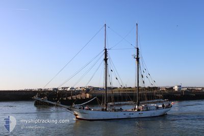
AVONTUUR
Other Type
Current Trip
| Trip Time | 52 days |
|---|---|
| Trip Distance | 179.66 nm |
| AVG Speed | 4.4 Knopen |
| MAX Speed | 8.8 Knopen |
| Diepgang | 2.2 M |
| AVG Wind | 9.8 knots |
| MAX Wind | 18.9 knots |
| MIN Temp | 28.4°C / 83.12°F |
| MAX Temp | 29.6°C / 85.28°F |
| Positie ontvangen | 2 m geleden |
Current Position
| Lengtegraad | -86.95137° |
|---|---|
| Breedtegraat | 20.51599° |
| Status | At anchor |
| Snelheid | 0.1 Knopen |
| Koers | --- |
| Gebied | Caribbean Sea |
| Station | T-AIS |
| Positie ontvangen | 2 m geleden |
Info
Information
The current position of AVONTUUR is in Caribbean Sea with coordinates 20.51599° / -86.95137° as reported on 2024-05-13 08:04 by AIS to our vessel tracker app. The vessel's current speed is 0.1 Knopen and is currently inside the port of COZUMEL.
The vessel AVONTUUR (IMO: 5336600, MMSI: 664844000) is a Other Type It's sailing under the flag of [SC] Seychelles.
In this page you can find informations about the vessels current position, last detected port calls, and current voyage information. If the vessels is not in coverage by AIS you will find the latest position.
The current position of AVONTUUR is detected by our AIS receivers and we are not responsible for the reliability of the data. The last position was recorded while the vessel was in Coverage by the Ais receivers of our vessel tracking app.
The current draught of AVONTUUR as reported by AIS is 2.2 meters
Weather
| Temperature | 27.6°C / 81.68°F |
|---|---|
| Wind Speed | 11 knots |
| Direction | 129° SE |
| Pressure | 1010 hPa |
| Humidity | 84 % |
| Cloud Coverage | 100 % |
Featured Company
Events
| Tijd | Evenement | Details | Positie / Bestemming | Info |
|---|---|---|---|---|
| 2024-05-11 19:46 | Binnenbereik |
20.51609 / -86.95126
Caribbean Sea
[MX] COZUMEL
|
Snelheid: 0.1 kn Koers: 67.2° |
|
| 2024-05-11 18:04 | Buitenbereik |
20.51597 / -86.95139
Caribbean Sea
[MX] COZUMEL
|
Snelheid: Koers: 41.7° |
|
| 2024-05-10 16:04 | Status Changed | At anchor Under way using engine |
20.51858 / -86.95112
[MX] COZUMEL
|
Snelheid: 0.3 kn Koers: 511° |
| 2024-05-10 15:41 | Stop beweging |
20.51742 / -86.94998
[MX] COZUMEL
|
Snelheid: 0.1 kn Koers: 511° |
|
| 2024-05-10 15:31 | Aankomsthaven |
|
20.52050 / -86.95202
[MX] COZUMEL
|
Snelheid: 1.5 kn Koers: 511° |
| 2024-05-10 14:54 | Start beweging | 2.13 nm, North of COZUMEL |
20.53607 / -86.97534
MX CZM
|
Snelheid: 3.1 kn Koers: 117.9° |
| 2024-05-10 14:40 | Stop beweging | 2.47 nm, North West of COZUMEL |
20.53996 / -86.98144
MX CZM
|
Snelheid: 0.2 kn Koers: 511° |
| 2024-05-10 14:33 | Destination Changed | MX CZM BZ BZE |
20.53410 / -86.98640
MX CZM
|
Snelheid: 6.3 kn Koers: 40.2° |
| 2024-05-10 14:28 | Status Changed | Under way using engine Under way sailing |
20.52883 / -86.99104
BZ BZE
|
Snelheid: 5.1 kn Koers: 37.6° |
| 2024-05-10 14:05 | Destination Changed | BZ BZE GP FAE |
20.49096 / -87.01996
BZ BZE
|
Snelheid: 8.3 kn Koers: 35.4° |