
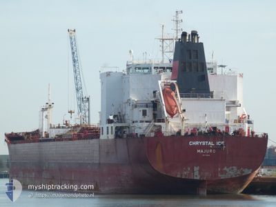
CHRYSTAL ICE
Oil Products Tanker
Current Trip
CHINA
| Time Travelled | 25 days |
|---|---|
| Remaining Time | --- |
| Distance Travelled | 7205.50 nm |
| Remaining Distance | --- |
| AVG Speed | 12 Knopen |
| MAX Speed | 12 Knopen |
| AVG Wind | 15.8 knots |
| MAX Wind | 31.2 knots |
| MIN Temp | 2.5°C / 36.5°F |
| MAX Temp | 30.5°C / 86.9°F |
| Diepgang | 12.3 M |
| Positie ontvangen | 4 d geleden |
Current Position
| Lengtegraad | 39.60111° |
|---|---|
| Breedtegraat | 18.67134° |
| Status | Under way using engine |
| Snelheid | 12.6 Knopen |
| Koers | 160.3° |
| Gebied | Red Sea |
| Station | T-AIS |
| Positie ontvangen | 4 d geleden |
Info
Information
The current position of CHRYSTAL ICE is in Red Sea with coordinates 18.67134° / 39.60111° as reported on 2024-04-28 08:21 by AIS to our vessel tracker app. The vessel's current speed is 12.6 Knopen
The vessel CHRYSTAL ICE (IMO: 9332638, MMSI: 538003523) is a Oil Products Tanker that was built in 2009 ( 15 Jaar oud ). It's sailing under the flag of [MH] Marshall Is.
In this page you can find informations about the vessels current position, last detected port calls, and current voyage information. If the vessels is not in coverage by AIS you will find the latest position.
The current position of CHRYSTAL ICE is detected by our AIS receivers and we are not responsible for the reliability of the data. The last position was recorded while the vessel was in Coverage by the Ais receivers of our vessel tracking app.
The current draught of CHRYSTAL ICE as reported by AIS is 12.3 meters
Weather
| Temperature | 29.3°C / 84.74°F |
|---|---|
| Wind Speed | 7 knots |
| Direction | 71° ENE |
| Pressure | 1011.1 hPa |
| Humidity | 65.1 % |
| Cloud Coverage | 2 % |
Featured Company
Last Port Calls
| Port | Arrival | Departure | Time In Port |
|---|---|---|---|
| 2024-04-25 11:24 | 2024-04-25 19:59 | 8 h | |
| 2024-04-01 15:57 | 2024-04-07 08:33 | 5 d | |
| 2024-03-13 09:58 | 2024-03-13 11:29 | 1 h |
Most Visited Ports (Last year)
| Port | Arrivals | |
|---|---|---|
| 7 | ||
| 6 | ||
| 3 | ||
| 3 | ||
| 1 |
Events
| Tijd | Evenement | Details | Positie / Bestemming | Info |
|---|---|---|---|---|
| 2024-04-28 09:05 | Status Changed | Default Under way using engine |
18.47745 / 39.67600
CHINA
|
Snelheid: 12.6 kn Koers: 160.3° |
| 2024-04-28 08:21 | Buitenbereik |
18.67134 / 39.60111
Red Sea
CHINA
|
Snelheid: 12.6 kn Koers: 160.3° |
|
| 2024-04-28 08:01 | Status Changed | Under way using engine Default |
18.72641 / 39.58166
CHINA
|
Snelheid: 12.9 kn Koers: 162° |
| 2024-04-28 07:43 | Status Changed | Default Under way using engine |
18.74667 / 39.57333
CHINA
|
Snelheid: 12.8 kn Koers: 161.9° |
| 2024-04-28 06:16 | Status Changed | Under way using engine Default |
19.06277 / 39.42088
CHINA
|
Snelheid: 12 kn Koers: 150° |
| 2024-04-28 05:40 | Status Changed | Default Under way using engine |
19.13667 / 39.37500
CHINA
|
Snelheid: 12.4 kn Koers: 150.5° |
| 2024-04-28 05:17 | Status Changed | Under way using engine Default |
19.21513 / 39.32861
CHINA
|
Snelheid: 12.5 kn Koers: 152° |
| 2024-04-28 04:33 | Status Changed | Default Under way using engine |
19.34428 / 39.26923
CHINA
|
Snelheid: 12.2 kn Koers: 151.5° |
| 2024-04-28 03:57 | Status Changed | Under way using engine Default |
19.45248 / 39.20452
CHINA
|
Snelheid: 12 kn Koers: 150° |
| 2024-04-28 03:52 | Binnenbereik |
19.44837 / 39.20705
Red Sea
CHINA
|
Snelheid: 12.4 kn Koers: 149.3° |