
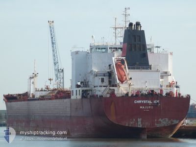
CHRYSTAL ICE
Oil Products Tanker
Current Trip
| Time Travelled | 12 days |
|---|---|
| Remaining Time | 4 days |
| Distance Travelled | 3571.53 морская миля |
| Remaining Distance | 1245.32 морская миля |
| AVG Speed | 12 Узлы |
| MAX Speed | 15.5 Узлы |
| AVG Wind | 16.2 knots |
| MAX Wind | 30.9 knots |
| MIN Temp | 2.5°C / 36.5°F |
| MAX Temp | 19.1°C / 66.38°F |
| Осадка | 12.3 м |
| Позиция Получена | 1 d тому назад |
Current Position
| Долгота | 0.10369° |
|---|---|
| Широта | 36.83346° |
| Статус | Under way using engine |
| Скорость | 12.4 Узлы |
| Курс | 70.1° |
| Район | Mediterranean Sea - Western Basin |
| Станция | T-AIS |
| Позиция Получена | 1 d тому назад |
Info
Information
The current position of CHRYSTAL ICE is in Mediterranean Sea - Western Basin with coordinates 36.83346° / 0.10369° as reported on 2024-04-18 16:13 by AIS to our vessel tracker app. The vessel's current speed is 12.4 Узлы and is heading at the port of PORT SAID. The estimated time of arrival as calculated by MyShipTracking vessel tracking app is 2024-04-24 11:31 LT
The vessel CHRYSTAL ICE (IMO: 9332638, MMSI: 538003523) is a Oil Products Tanker that was built in 2009 ( 15 лет ). It's sailing under the flag of [MH] Marshall Is.
In this page you can find informations about the vessels current position, last detected port calls, and current voyage information. If the vessels is not in coverage by AIS you will find the latest position.
The current position of CHRYSTAL ICE is detected by our AIS receivers and we are not responsible for the reliability of the data. The last position was recorded while the vessel was in Coverage by the Ais receivers of our vessel tracking app.
The current draught of CHRYSTAL ICE as reported by AIS is 12.3 meters
Weather
| Temperature | 14.6°C / 58.28°F |
|---|---|
| Wind Speed | 14 knots |
| Direction | 280° W |
| Pressure | 1016 hPa |
| Humidity | 60.8 % |
| Cloud Coverage | --- |
Featured Company
Most Visited Ports (Last year)
| Port | Arrivals | |
|---|---|---|
| 7 | ||
| 6 | ||
| 3 | ||
| 2 | ||
| 1 |
Events
| Время | Событие | Детали | Позиция / Направление | Информация |
|---|---|---|---|---|
| 2024-04-18 16:13 | Вне покрытия |
36.83346 / .10370
Mediterranean Sea - Western Basin
EGPSD
|
Скорость: 12.4 kn Курс: 70.1° |
|
| 2024-04-18 15:03 | Статус изменился | Under way using engine Default |
36.74788 / -.23635
EGPSD
|
Скорость: 12.7 kn Курс: 72° |
| 2024-04-18 15:03 | В покрытии |
36.74788 / -.23635
Mediterranean Sea - Western Basin
EGPSD
|
Скорость: 12.8 kn Курс: 72.1° |
|
| 2024-04-18 14:07 | Статус изменился | Default Under way using engine |
36.69833 / -.41333
EGPSD
|
Скорость: 12 kn Курс: 72° |
| 2024-04-18 13:52 | Вне покрытия |
36.68047 / -.48281
Mediterranean Sea - Western Basin
EGPSD
|
Скорость: 12 kn Курс: 72° |
|
| 2024-04-18 13:20 | Статус изменился | Under way using engine Default |
36.64588 / -.62177
EGPSD
|
Скорость: 11 kn Курс: 74° |
| 2024-04-18 13:07 | Статус изменился | Default Under way using engine |
36.63833 / -.64833
EGPSD
|
Скорость: 11.5 kn Курс: 73.4° |
| 2024-04-18 12:27 | Статус изменился | Under way using engine Default |
36.59930 / -.81744
EGPSD
|
Скорость: 11 kn Курс: 74° |
| 2024-04-18 11:55 | Статус изменился | Default Under way using engine |
36.57667 / -.92333
EGPSD
|
Скорость: 11.4 kn Курс: 69.4° |
| 2024-04-18 11:45 | Обнаружено в море | Algerian part of the Mediterranean Sea - Western Basin |
36.56520 / -.96573
Mediterranean Sea - Western Basin
EGPSD
|
Скорость: 11.4 kn Курс: 69.4° |