
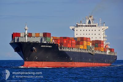
MSC ANISHA R.
Container Ship
Current Trip
| Time Travelled | 3 days |
|---|---|
| Remaining Time | --- |
| Distance Travelled | 576.22 nm |
| Remaining Distance | --- |
| AVG Speed | 11.6 Knopen |
| MAX Speed | 18.9 Knopen |
| AVG Wind | 12 knots |
| MAX Wind | 25.9 knots |
| MIN Temp | 5.9°C / 42.62°F |
| MAX Temp | 24.7°C / 76.46°F |
| Diepgang | 10.3 M |
| Positie ontvangen | 13 h, 36 m geleden |
Current Position
| Lengtegraad | --- |
|---|---|
| Breedtegraat | --- |
| Status | Under way using engine |
| Snelheid | 1.1 Knopen |
| Koers | 263° |
| Gebied | North Atlantic Ocean |
| Station | T-AIS |
| Positie ontvangen | 13 h, 36 m geleden |
Info
Information
The current position of MSC ANISHA R. is in North Atlantic Ocean with coordinates 26.22459° / -78.69413° as reported on 2026-01-19 01:06 by AIS to our vessel tracker app. The vessel's current speed is 1.1 Knopen
The vessel MSC ANISHA R. (IMO: 9227297, MMSI: 636016434) is a Container Ship that was built in 2002 ( 24 Jaar oud ). It's sailing under the flag of [LR] Liberia.
In this page you can find informations about the vessels current position, last detected port calls, and current voyage information. If the vessels is not in coverage by AIS you will find the latest position.
The current position of MSC ANISHA R. is detected by our AIS receivers and we are not responsible for the reliability of the data. The last position was recorded while the vessel was in Coverage by the Ais receivers of our vessel tracking app.
The current draught of MSC ANISHA R. as reported by AIS is 10.3 meters
Weather
| Temperature | 19.2°C / 66.56°F |
|---|---|
| Wind Speed | 16 knots |
| Direction | 358° N |
| Pressure | 1020.9 hPa |
| Humidity | 69 % |
| Cloud Coverage | 100 % |
Featured Company
Last Port Calls
| Port | Arrival | Departure | Time In Port |
|---|---|---|---|
| 2026-01-15 00:43 | 2026-01-15 18:29 | 17 h | |
| 2026-01-03 05:23 | 2026-01-04 22:06 | 1 d | |
| 2025-12-29 07:16 | 2025-12-30 11:48 | 1 d | |
| 2025-12-23 03:14 | 2025-12-24 09:26 | 1 d | |
| 2025-12-06 10:47 | 2025-12-07 11:11 | 1 d | |
| 2025-12-01 14:03 | 2025-12-02 12:30 | 22 h | |
| 2025-11-30 06:02 | 2025-11-30 23:50 | 17 h | |
| 2025-11-27 13:46 | 2025-11-27 22:26 | 8 h | |
| 2025-11-23 21:03 | 2025-11-24 20:26 | 23 h | |
| 2025-11-22 07:42 | 2025-11-23 07:14 | 23 h |
Most Visited Ports (Last year)
| Port | Arrivals | |
|---|---|---|
| 8 | ||
| 8 | ||
| 6 | ||
| 5 | ||
| 5 | ||
| 4 |
Last Trips
| Origin | Departure | Destination | Arrival | Distance | |
|---|---|---|---|---|---|
| 2026-01-04 22:06 | 2026-01-15 00:43 | 4447.52 nm | |||
| 2025-12-30 11:48 | 2026-01-03 05:23 | 1358.27 nm | |||
| 2025-12-24 09:26 | 2025-12-29 07:16 | 1630.53 nm | |||
| 2025-12-07 11:11 | 2025-12-23 03:14 | 5555.60 nm | |||
| 2025-12-02 12:30 | 2025-12-06 10:47 | 904.97 nm | |||
| 2025-11-30 23:50 | 2025-12-01 14:03 | 121.90 nm | |||
| 2025-11-27 22:26 | 2025-11-30 06:02 | 343.30 nm | |||
| 2025-11-24 20:26 | 2025-11-27 13:46 | 865.86 nm | |||
| 2025-11-23 07:14 | 2025-11-23 21:03 | 57.14 nm | |||
| 2025-11-19 10:21 | 2025-11-22 07:42 | 1254.98 nm |
Events
| Tijd | Evenement | Details | Positie / Bestemming | Info |
|---|---|---|---|---|
| 2026-01-19 01:11 | Status Changed | Default Under way using engine |
26.22287 / -78.69424
BSFPO
|
Snelheid: 1.1 kn Koers: 263° |
| 2026-01-19 01:06 | Buitenbereik |
26.22459 / -78.69413
North Atlantic Ocean
|
Snelheid: 1.1 kn Koers: 188.1° |
|
| 2026-01-18 13:45 | Status Changed | Under way using engine Default |
26.37150 / -78.81575
BSFPO
|
Snelheid: 12 kn Koers: 82° |
| 2026-01-18 12:59 | Status Changed | Default Under way using engine |
26.35845 / -78.98660
BSFPO
|
Snelheid: 11.8 kn Koers: 89.7° |
| 2026-01-18 12:53 | Status Changed | Under way using engine Default |
26.35838 / -79.00729
BSFPO
|
Snelheid: 11.7 kn Koers: 89° |
| 2026-01-18 12:15 | Status Changed | Default Under way using engine |
26.39729 / -79.12219
BSFPO
|
Snelheid: 4.8 kn Koers: 176° |
| 2026-01-18 12:03 | Status Changed | Under way using engine Default |
26.40602 / -79.11910
BSFPO
|
Snelheid: 1.7 kn Koers: 257° |
| 2026-01-18 11:55 | Status Changed | Default Under way using engine |
26.40358 / -79.11529
BSFPO
|
Snelheid: 1.7 kn Koers: 256° |
| 2026-01-18 11:43 | Status Changed | Under way using engine Default |
26.39935 / -79.11090
BSFPO
|
Snelheid: 1.6 kn Koers: 255° |
| 2026-01-18 11:35 | Status Changed | Default Under way using engine |
26.39688 / -79.10802
BSFPO
|
Snelheid: 1.5 kn Koers: 254° |