
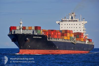
MSC ANISHA R.
Container Ship
Current Trip
| Trip Time | 10 days |
|---|---|
| Trip Distance | 4447.52 nm |
| AVG Speed | 17.9 Noeuds |
| MAX Speed | 22.4 Noeuds |
| Tirant d eau | 10.5 m |
| AVG Wind | 16 knots |
| MAX Wind | 37 knots |
| MIN Temp | -1°C / 30.2°F |
| MAX Temp | 20.9°C / 69.62°F |
| Position reçue | 2 m depuis |
Current Position
| Longitude | --- |
|---|---|
| Latitude | --- |
| Etat | Under way using engine |
| Vitesse | 8 Noeuds |
| Parcours | 316° |
| Zone | North Atlantic Ocean |
| Station | T-AIS |
| Position reçue | 2 m depuis |
Info
Information
The current position of MSC ANISHA R. is in North Atlantic Ocean with coordinates 32.81259° / -79.91563° as reported on 2026-01-15 06:09 by AIS to our vessel tracker app. The vessel's current speed is 8 Noeuds and is currently inside the port of CHARLESTON.
The vessel MSC ANISHA R. (IMO: 9227297, MMSI: 636016434) is a Container Ship that was built in 2002 ( 24 Age ). It's sailing under the flag of [LR] Liberia.
In this page you can find informations about the vessels current position, last detected port calls, and current voyage information. If the vessels is not in coverage by AIS you will find the latest position.
The current position of MSC ANISHA R. is detected by our AIS receivers and we are not responsible for the reliability of the data. The last position was recorded while the vessel was in Coverage by the Ais receivers of our vessel tracking app.
The current draught of MSC ANISHA R. as reported by AIS is 10.5 meters
Weather
| Temperature | 9.6°C / 49.28°F |
|---|---|
| Wind Speed | 10 knots |
| Direction | 256° WSW |
| Pressure | 1006.5 hPa |
| Humidity | 75.6 % |
| Cloud Coverage | 54 % |
Featured Company
Last Port Calls
| Port | Arrival | Departure | Time In Port |
|---|---|---|---|
| 2026-01-15 00:43 | |||
| 2026-01-03 05:23 | 2026-01-04 22:06 | 1 d | |
| 2025-12-29 07:16 | 2025-12-30 11:48 | 1 d | |
| 2025-12-23 03:14 | 2025-12-24 09:26 | 1 d | |
| 2025-12-06 10:47 | 2025-12-07 11:11 | 1 d | |
| 2025-12-01 14:03 | 2025-12-02 12:30 | 22 h | |
| 2025-11-30 06:02 | 2025-11-30 23:50 | 17 h | |
| 2025-11-27 13:46 | 2025-11-27 22:26 | 8 h | |
| 2025-11-23 21:03 | 2025-11-24 20:26 | 23 h | |
| 2025-11-22 07:42 | 2025-11-23 07:14 | 23 h |
Most Visited Ports (Last year)
| Port | Arrivals | |
|---|---|---|
| 8 | ||
| 8 | ||
| 6 | ||
| 5 | ||
| 5 | ||
| 4 |
Last Trips
| Origin | Departure | Destination | Arrival | Distance | |
|---|---|---|---|---|---|
| 2026-01-04 22:06 | 2026-01-15 00:43 | 4447.52 nm | |||
| 2025-12-30 11:48 | 2026-01-03 05:23 | 1358.27 nm | |||
| 2025-12-24 09:26 | 2025-12-29 07:16 | 1630.53 nm | |||
| 2025-12-07 11:11 | 2025-12-23 03:14 | 5555.60 nm | |||
| 2025-12-02 12:30 | 2025-12-06 10:47 | 904.97 nm | |||
| 2025-11-30 23:50 | 2025-12-01 14:03 | 121.90 nm | |||
| 2025-11-27 22:26 | 2025-11-30 06:02 | 343.30 nm | |||
| 2025-11-24 20:26 | 2025-11-27 13:46 | 865.86 nm | |||
| 2025-11-23 07:14 | 2025-11-23 21:03 | 57.14 nm | |||
| 2025-11-19 10:21 | 2025-11-22 07:42 | 1254.98 nm |
Events
| Heure | Evenement | Détails | Position/ Destination | Info |
|---|---|---|---|---|
| 2026-01-15 06:08 | Etat Changé | Under way using engine Default |
32.81094 / -79.91477
[US] CHARLESTON
|
Vitesse: 9.7 kn Parcours: 354° |
| 2026-01-15 06:03 | Etat Changé | Default Under way using engine |
32.79686 / -79.91667
[US] CHARLESTON
|
Vitesse: 9.1 kn Parcours: 332° |
| 2026-01-15 05:43 | Etat Changé | Under way using engine Default |
32.76308 / -79.87146
[US] CHARLESTON
|
Vitesse: 12.8 kn Parcours: 322° |
| 2026-01-15 05:43 | Port d'arrivée |
|
32.76308 / -79.87146
[US] CHARLESTON
|
Vitesse: 12.8 kn Parcours: 322° |
| 2026-01-15 05:31 | Etat Changé | Default Under way using engine |
32.73255 / -79.83067
USCHS
|
Vitesse: 15.7 kn Parcours: 298.6° |
| 2026-01-15 05:24 | Etat Changé | Under way using engine Default |
32.71791 / -79.79875
USCHS
|
Vitesse: 15.7 kn Parcours: 302° |
| 2026-01-15 05:23 | Etat Changé | Default Under way using engine |
32.71546 / -79.79388
USCHS
|
Vitesse: 15.5 kn Parcours: 300° |
| 2026-01-15 05:22 | Etat Changé | Under way using engine Default |
32.71371 / -79.79031
USCHS
|
Vitesse: 15.5 kn Parcours: 300° |
| 2026-01-15 05:22 | Changement de zone | United States part of the North Atlantic Ocean Portuguese (Azores) part of the North Atlantic Ocean |
32.71371 / -79.79031
North Atlantic Ocean
USCHS
|
Vitesse: 15.5 kn Parcours: 300° |
| 2026-01-15 05:19 | Dans la zone couverte |
32.71371 / -79.79031
North Atlantic Ocean
USCHS
|
Vitesse: 15.5 kn Parcours: 300° |