
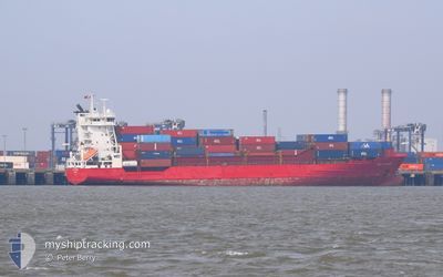
WEC VERMEER
Container Ship
Current Trip
MAAGA>>PTSIE
| Time Travelled | 3 h, 55 mins |
|---|---|
| Remaining Time | --- |
| Distance Travelled | 22.87 nm |
| Remaining Distance | --- |
| AVG Speed | 6.3 Noeuds |
| MAX Speed | 8.1 Noeuds |
| AVG Wind | 3.1 knots |
| MAX Wind | 5 knots |
| MIN Temp | 13.1°C / 55.58°F |
| MAX Temp | 14°C / 57.2°F |
| Tirant d eau | 8.6 m |
| Position reçue | 1 m depuis |
Current Position
| Longitude | --- |
|---|---|
| Latitude | --- |
| Etat | Under way using engine |
| Vitesse | 6.6 Noeuds |
| Parcours | 1.5° |
| Zone | North Atlantic Ocean |
| Station | T-AIS |
| Position reçue | 1 m depuis |
Info
Information
The current position of WEC VERMEER is in North Atlantic Ocean with coordinates 38.22643° / -8.99911° as reported on 2025-12-11 14:21 by AIS to our vessel tracker app. The vessel's current speed is 6.6 Noeuds
The vessel WEC VERMEER (IMO: 9237371, MMSI: 209177000) is a Container Ship that was built in 2001 ( 24 Age ). It's sailing under the flag of [CY] Cyprus.
In this page you can find informations about the vessels current position, last detected port calls, and current voyage information. If the vessels is not in coverage by AIS you will find the latest position.
The current position of WEC VERMEER is detected by our AIS receivers and we are not responsible for the reliability of the data. The last position was recorded while the vessel was in Coverage by the Ais receivers of our vessel tracking app.
The current draught of WEC VERMEER as reported by AIS is 8.6 meters
Weather
| Temperature | 14°C / 57.2°F |
|---|---|
| Wind Speed | 5 knots |
| Direction | 177° S |
| Pressure | 1019.6 hPa |
| Humidity | 75.5 % |
| Cloud Coverage | 100 % |
Featured Company
Last Port Calls
| Port | Arrival | Departure | Time In Port |
|---|---|---|---|
| 2025-12-10 12:43 | 2025-12-11 10:27 | 21 h | |
| 2025-12-08 13:17 | 2025-12-09 06:00 | 16 h | |
| 2025-12-04 01:38 | 2025-12-04 15:08 | 13 h | |
| 2025-12-03 06:39 | 2025-12-03 20:55 | 14 h | |
| 2025-11-30 13:10 | 2025-11-30 21:44 | 8 h | |
| 2025-11-30 02:49 | 2025-11-30 09:19 | 6 h | |
| 2025-11-27 21:06 | 2025-11-28 22:35 | 1 d | |
| 2025-11-25 12:36 | 2025-11-25 20:53 | 8 h | |
| 2025-11-24 03:23 | 2025-11-24 12:06 | 8 h | |
| 2025-11-23 03:38 | 2025-11-24 01:01 | 21 h |
Last Trips
| Origin | Departure | Destination | Arrival | Distance | |
|---|---|---|---|---|---|
| 2025-12-09 06:00 | 2025-12-10 12:43 | 478.56 nm | |||
| 2025-12-04 15:08 | 2025-12-08 13:17 | 357.86 nm | |||
| 2025-12-03 20:55 | 2025-12-04 01:38 | 62.07 nm | |||
| 2025-11-30 21:44 | 2025-12-03 06:39 | 856.27 nm | |||
| 2025-11-30 09:19 | 2025-11-30 13:10 | 75.44 nm | |||
| 2025-11-28 22:35 | 2025-11-30 02:49 | 424.60 nm | |||
| 2025-11-25 20:53 | 2025-11-27 21:06 | 749.19 nm | |||
| 2025-11-24 12:06 | 2025-11-25 12:36 | 177.33 nm | |||
| 2025-11-24 01:01 | 2025-11-24 03:23 | 24.64 nm | |||
| 2025-11-21 22:49 | 2025-11-23 03:38 | 366.57 nm |
Events
| Heure | Evenement | Détails | Position/ Destination | Info |
|---|---|---|---|---|
| 2025-12-11 14:16 | Etat Changé | Under way using engine Default |
38.21841 / -8.99925
MAAGA>>PTSIE
|
Vitesse: 6.6 kn Parcours: 355° |
| 2025-12-11 14:11 | Etat Changé | Default Under way using engine |
38.20881 / -8.99939
MAAGA>>PTSIE
|
Vitesse: 6.6 kn Parcours: 359.1° |
| 2025-12-11 14:00 | Etat Changé | Under way using engine Default |
38.18748 / -8.99990
MAAGA>>PTSIE
|
Vitesse: 6.7 kn Parcours: 359° |
| 2025-12-11 13:55 | Etat Changé | Default Under way using engine |
38.17912 / -8.99990
MAAGA>>PTSIE
|
Vitesse: 6.7 kn Parcours: 0.2° |
| 2025-12-11 13:39 | Etat Changé | Under way using engine Default |
38.14918 / -9.00001
MAAGA>>PTSIE
|
Vitesse: 6.4 kn Parcours: 359° |
| 2025-12-11 13:27 | Dans la zone couverte |
38.14918 / -9.00001
North Atlantic Ocean
|
Vitesse: 6.5 kn Parcours: 359.2° |
|
| 2025-12-11 10:27 | PORT DE DEPART |
|
37.91901 / -8.83736
MAAGA>>PTSIE
|
Vitesse: 4.8 kn Parcours: 148° |
| 2025-12-11 10:19 | Démarrage |
37.93045 / -8.84627
[PT] SINES
|
Vitesse: 3.7 kn Parcours: 147° |
|
| 2025-12-10 12:51 | Arret |
37.93324 / -8.84778
[PT] SINES
|
Vitesse: 0.2 kn Parcours: 128° |
|
| 2025-12-10 12:16 | Hors de la zone couverte |
37.90644 / -8.83570
North Atlantic Ocean
[PT] SINES
|
Vitesse: 8.9 kn Parcours: 8.2° |