
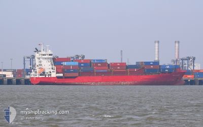
WEC VERMEER
Container Ship
Current Trip
| Time Travelled | 3 days |
|---|---|
| Remaining Time | --- |
| Distance Travelled | 350.19 nm |
| Remaining Distance | --- |
| AVG Speed | 9.2 Knop |
| MAX Speed | 16.7 Knop |
| AVG Wind | 9.8 knots |
| MAX Wind | 20 knots |
| MIN Temp | 16.4°C / 61.52°F |
| MAX Temp | 20.9°C / 69.62°F |
| Djupgående | 7 m |
| Position mottagen | 1 d sen |
Current Position
| Longitud | --- |
|---|---|
| Latitude | --- |
| Status | Under way using engine |
| Fart | 13.4 Knop |
| Kurs | 69.4° |
| Område | North Atlantic Ocean |
| Station | T-AIS |
| Position mottagen | 1 d sen |
Info
Information
The current position of WEC VERMEER is in North Atlantic Ocean with coordinates 30.12358° / -10.14579° as reported on 2025-12-06 10:24 by AIS to our vessel tracker app. The vessel's current speed is 13.4 Knop
The vessel WEC VERMEER (IMO: 9237371, MMSI: 209177000) is a Container Ship that was built in 2001 ( 24 År gammal ). It's sailing under the flag of [CY] Cyprus.
In this page you can find informations about the vessels current position, last detected port calls, and current voyage information. If the vessels is not in coverage by AIS you will find the latest position.
The current position of WEC VERMEER is detected by our AIS receivers and we are not responsible for the reliability of the data. The last position was recorded while the vessel was in Coverage by the Ais receivers of our vessel tracking app.
The current draught of WEC VERMEER as reported by AIS is 7 meters
Weather
| Temperature | 19.5°C / 67.1°F |
|---|---|
| Wind Speed | 8 knots |
| Direction | 6° N |
| Pressure | 1021.3 hPa |
| Humidity | 37 % |
| Cloud Coverage | 89 % |
Featured Company
Last Port Calls
| Port | Arrival | Departure | Time In Port |
|---|---|---|---|
| 2025-12-04 01:38 | 2025-12-04 15:08 | 13 h | |
| 2025-12-03 06:39 | 2025-12-03 20:55 | 14 h | |
| 2025-11-30 13:10 | 2025-11-30 21:44 | 8 h | |
| 2025-11-30 02:49 | 2025-11-30 09:19 | 6 h | |
| 2025-11-27 21:06 | 2025-11-28 22:35 | 1 d | |
| 2025-11-25 12:36 | 2025-11-25 20:53 | 8 h | |
| 2025-11-24 03:23 | 2025-11-24 12:06 | 8 h | |
| 2025-11-23 03:38 | 2025-11-24 01:01 | 21 h | |
| 2025-11-21 05:36 | 2025-11-21 22:49 | 17 h | |
| 2025-11-19 00:31 | 2025-11-20 02:38 | 1 d |
Last Trips
| Origin | Departure | Destination | Arrival | Distance | |
|---|---|---|---|---|---|
| 2025-12-03 20:55 | 2025-12-04 01:38 | 62.07 nm | |||
| 2025-11-30 21:44 | 2025-12-03 06:39 | 856.27 nm | |||
| 2025-11-30 09:19 | 2025-11-30 13:10 | 75.44 nm | |||
| 2025-11-28 22:35 | 2025-11-30 02:49 | 424.60 nm | |||
| 2025-11-25 20:53 | 2025-11-27 21:06 | 749.19 nm | |||
| 2025-11-24 12:06 | 2025-11-25 12:36 | 177.33 nm | |||
| 2025-11-24 01:01 | 2025-11-24 03:23 | 24.64 nm | |||
| 2025-11-21 22:49 | 2025-11-23 03:38 | 366.57 nm | |||
| 2025-11-20 02:38 | 2025-11-21 05:36 | 353.30 nm | |||
| 2025-11-15 17:39 | 2025-11-19 00:31 | 184.80 nm |
Events
| Tid | Event | Detaljer | Position / Dest | Information |
|---|---|---|---|---|
| 2025-12-06 13:08 | STOPPAR förflyttning | 2.82 nm, West of AGADIR |
30.42102 / -9.68816
ESLPA>>MAAGA
|
Fart: 0.3 kn Kurs: 308° |
| 2025-12-06 10:24 | Status ändrad | Default Under way using engine |
30.12402 / -10.14445
ESLPA>>MAAGA
|
Fart: 13.4 kn Kurs: 69.4° |
| 2025-12-06 10:24 | UTANFÖR täckningsområde |
30.12358 / -10.14579
North Atlantic Ocean
|
Fart: 13.4 kn Kurs: 69.4° |
|
| 2025-12-06 09:16 | Status ändrad | Under way using engine Default |
30.04300 / -10.42064
ESLPA>>MAAGA
|
Fart: 13.2 kn Kurs: 67° |
| 2025-12-06 09:00 | I täckningsområde |
30.04300 / -10.42064
North Atlantic Ocean
|
Fart: 13.3 kn Kurs: 64.6° |
|
| 2025-12-06 08:00 | Status ändrad | Default Under way using engine |
29.93944 / -10.51509
ESLPA>>MAAGA
|
Fart: 6.8 kn Kurs: 24.3° |
| 2025-12-06 07:58 | UTANFÖR täckningsområde |
29.93547 / -10.51405
North Atlantic Ocean
|
Fart: 6.8 kn Kurs: 24.3° |
|
| 2025-12-06 00:17 | Status ändrad | Under way using engine Default |
29.19755 / -11.94750
ESLPA>>MAAGA
|
Fart: 11.3 kn Kurs: 59° |
| 2025-12-06 00:08 | Status ändrad | Default Under way using engine |
29.18341 / -11.97500
ESLPA>>MAAGA
|
Fart: 11.3 kn Kurs: 59.9° |
| 2025-12-05 23:44 | Status ändrad | Under way using engine Default |
29.14455 / -12.04819
ESLPA>>MAAGA
|
Fart: 11.4 kn Kurs: 54° |