
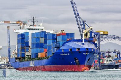
TIMUCIN A
Container Ship
Current Trip
| Time Travelled | 6 days |
|---|---|
| Remaining Time | --- |
| Distance Travelled | 222.55 nm |
| Remaining Distance | --- |
| AVG Speed | 12.5 Noeuds |
| MAX Speed | 13.7 Noeuds |
| AVG Wind | 8.9 knots |
| MAX Wind | 24.6 knots |
| MIN Temp | 14.2°C / 57.56°F |
| MAX Temp | 19.4°C / 66.92°F |
| Tirant d eau | 8.1 m |
| Position reçue | 1 d depuis |
Current Position
| Longitude | 6.92129° |
|---|---|
| Latitude | 36.91412° |
| Etat | At anchor |
| Vitesse | |
| Parcours | 347° |
| Zone | Mediterranean Sea - Western Basin |
| Station | T-AIS |
| Position reçue | 1 d depuis |
Info
Information
The current position of TIMUCIN A is in Mediterranean Sea - Western Basin with coordinates 36.91412° / 6.92129° as reported on 2024-05-05 11:16 by AIS to our vessel tracker app. The vessel's current speed is 0 Noeuds
The vessel TIMUCIN A (IMO: 9163984, MMSI: 271043491) is a Container Ship that was built in 1998 ( 26 Age ). It's sailing under the flag of [TR] Turkey.
In this page you can find informations about the vessels current position, last detected port calls, and current voyage information. If the vessels is not in coverage by AIS you will find the latest position.
The current position of TIMUCIN A is detected by our AIS receivers and we are not responsible for the reliability of the data. The last position was recorded while the vessel was in Coverage by the Ais receivers of our vessel tracking app.
The current draught of TIMUCIN A as reported by AIS is 8.1 meters
Weather
| Temperature | 19.3°C / 66.74°F |
|---|---|
| Wind Speed | 5 knots |
| Direction | 315° NW |
| Pressure | 1013.9 hPa |
| Humidity | 71.5 % |
| Cloud Coverage | 100 % |
Featured Company
Last Port Calls
| Port | Arrival | Departure | Time In Port |
|---|---|---|---|
| 2024-04-26 05:09 | 2024-04-30 11:48 | 4 d | |
| 2024-04-19 17:56 | 2024-04-22 12:08 | 2 d | |
| 2024-04-15 10:04 | 2024-04-16 02:50 | 16 h | |
| 2024-04-13 13:03 | 2024-04-14 14:40 | 1 d | |
| 2024-04-09 23:23 | 2024-04-11 06:52 | 1 d | |
| 2024-04-04 23:04 | 2024-04-07 12:25 | 2 d | |
| 2024-04-03 23:03 | 2024-04-04 16:51 | 17 h | |
| 2024-03-31 23:12 | 2024-04-02 20:36 | 1 d | |
| 2024-03-25 20:19 | 2024-03-27 00:54 | 1 d | |
| 2024-03-21 12:40 | 2024-03-22 22:57 | 1 d |
Last Trips
| Origin | Departure | Destination | Arrival | Distance | |
|---|---|---|---|---|---|
| 2024-04-22 13:08 | 2024-04-26 06:09 | 301.00 nm | |||
| 2024-04-16 05:50 | 2024-04-19 18:56 | 1059.10 nm | |||
| 2024-04-14 17:40 | 2024-04-15 13:04 | 55.98 nm | |||
| 2024-04-11 09:52 | 2024-04-13 16:03 | 316.29 nm | |||
| 2024-04-07 14:25 | 2024-04-10 02:23 | 808.81 nm | |||
| 2024-04-04 18:51 | 2024-04-05 01:04 | 76.25 nm | |||
| 2024-04-02 22:36 | 2024-04-04 01:03 | 296.97 nm | |||
| 2024-03-27 02:54 | 2024-04-01 01:12 | 250.17 nm | |||
| 2024-03-23 01:57 | 2024-03-25 22:19 | 879.34 nm | |||
| 2024-03-20 13:03 | 2024-03-21 15:40 | 58.80 nm |
Events
| Heure | Evenement | Détails | Position/ Destination | Info |
|---|---|---|---|---|
| 2024-05-05 11:22 | Etat Changé | Default At anchor |
36.91412 / 6.92149
DZSKI
|
Vitesse: Parcours: 347° |
| 2024-05-05 11:16 | Etat Changé | At anchor Default |
36.91412 / 6.92129
DZSKI
|
Vitesse: 0.1 kn Parcours: 331° |
| 2024-05-05 11:16 | Hors de la zone couverte |
36.91412 / 6.92129
Mediterranean Sea - Western Basin
|
Vitesse: Parcours: 129° |
|
| 2024-05-05 11:04 | Dans la zone couverte |
36.91412 / 6.92129
Mediterranean Sea - Western Basin
|
Vitesse: Parcours: 129° |
|
| 2024-05-03 12:52 | Etat Changé | Default At anchor |
36.91357 / 6.92148
DZSKI
|
Vitesse: 0.3 kn Parcours: 4° |
| 2024-05-03 12:46 | Hors de la zone couverte |
36.91357 / 6.92133
Mediterranean Sea - Western Basin
|
Vitesse: 0.3 kn Parcours: 96.9° |
|
| 2024-05-03 12:40 | Changement de zone | Algerian part of the Mediterranean Sea - Western Basin Tunisian part of the Mediterranean Sea - Western Basin |
36.91351 / 6.92108
Mediterranean Sea - Western Basin
|
Vitesse: Parcours: 181.6° |
| 2024-05-03 12:40 | Etat Changé | At anchor Default |
36.91351 / 6.92108
DZSKI
|
Vitesse: 0.3 kn Parcours: 339° |
| 2024-05-03 12:37 | Tirant d'eau modifié | 8.1 8.3 |
36.91358 / 6.92157
DZSKI
|
Vitesse: 0.3 kn Parcours: 339° |
| 2024-05-03 12:37 | Changement de destination | DZSKI TNRDS |
36.91358 / 6.92157
DZSKI
|
Vitesse: 0.3 kn Parcours: 339° |