
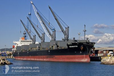
SEAMASTER
Cargo
Current Trip
| Time Travelled | 22 days |
|---|---|
| Remaining Time | --- |
| Distance Travelled | 1881.42 nm |
| Remaining Distance | 34.78 nm |
| AVG Speed | 11.6 Noeuds |
| MAX Speed | 16.5 Noeuds |
| AVG Wind | 7.1 knots |
| MAX Wind | 17 knots |
| MIN Temp | 12.4°C / 54.32°F |
| MAX Temp | 31.9°C / 89.42°F |
| Tirant d eau | 6.6 m |
| Position reçue | 1 d depuis |
Current Position
| Longitude | -88.10219° |
|---|---|
| Latitude | 30.06984° |
| Etat | At anchor |
| Vitesse | 0.1 Noeuds |
| Parcours | 14° |
| Zone | Gulf of Mexico |
| Station | T-AIS |
| Position reçue | 1 d depuis |
Info
Information
The current position of SEAMASTER is in Gulf of Mexico with coordinates 30.06984° / -88.10219° as reported on 2024-06-09 06:06 by AIS to our vessel tracker app. The vessel's current speed is 0.1 Noeuds and is heading at the port of MOBILE. The estimated time of arrival as calculated by MyShipTracking vessel tracking app is 2024-06-08 19:00 LT
The vessel SEAMASTER (IMO: 9783655, MMSI: 373773000) is a Cargo It's sailing under the flag of [PA] Panama.
In this page you can find informations about the vessels current position, last detected port calls, and current voyage information. If the vessels is not in coverage by AIS you will find the latest position.
The current position of SEAMASTER is detected by our AIS receivers and we are not responsible for the reliability of the data. The last position was recorded while the vessel was in Coverage by the Ais receivers of our vessel tracking app.
The current draught of SEAMASTER as reported by AIS is 6.6 meters
Weather
| Temperature | 28.9°C / 84.02°F |
|---|---|
| Wind Speed | 6 knots |
| Direction | 235° SW |
| Pressure | 1009.1 hPa |
| Humidity | 70.9 % |
| Cloud Coverage | 62 % |
Featured Company
Events
| Heure | Evenement | Détails | Position/ Destination | Info |
|---|---|---|---|---|
| 2024-06-09 06:11 | Etat Changé | Default At anchor |
30.06833 / -88.10167
US MOB
|
Vitesse: 0.1 kn Parcours: 14° |
| 2024-06-09 06:06 | Etat Changé | At anchor Default |
30.06984 / -88.10219
US MOB
|
Vitesse: Parcours: 13° |
| 2024-06-09 06:06 | Hors de la zone couverte |
30.06984 / -88.10219
Gulf of Mexico
|
Vitesse: 0.1 kn Parcours: 220.3° |
|
| 2024-06-09 05:45 | Etat Changé | Default At anchor |
30.06977 / -88.10210
US MOB
|
Vitesse: Parcours: 25° |
| 2024-06-09 05:36 | Etat Changé | At anchor Default |
30.06969 / -88.10225
US MOB
|
Vitesse: Parcours: 28° |
| 2024-06-09 05:33 | Etat Changé | Default At anchor |
30.06968 / -88.10231
US MOB
|
Vitesse: 0.1 kn Parcours: 30° |
| 2024-06-09 05:27 | Etat Changé | At anchor Default |
30.06975 / -88.10239
US MOB
|
Vitesse: 0.1 kn Parcours: 29° |
| 2024-06-09 05:21 | Etat Changé | Default At anchor |
30.06978 / -88.10248
US MOB
|
Vitesse: Parcours: 26° |
| 2024-06-09 05:18 | Detecté en mer | United States part of the Gulf of Mexico |
30.06974 / -88.10253
Gulf of Mexico
|
Vitesse: Parcours: 220.3° |
| 2024-06-09 05:18 | Etat Changé | At anchor Default |
30.06974 / -88.10253
US MOB
|
Vitesse: Parcours: 21° |