
QUEEN ISLAND
Cargo
Current Trip
JP ANE OFF > JP OIT
| Time Travelled | 7 days |
|---|---|
| Remaining Time | --- |
| Distance Travelled | 2029.92 nm |
| Remaining Distance | --- |
| AVG Speed | 11.2 Noeuds |
| MAX Speed | 13.1 Noeuds |
| AVG Wind | 8.5 knots |
| MAX Wind | 18 knots |
| MIN Temp | 15.8°C / 60.44°F |
| MAX Temp | 30.5°C / 86.9°F |
| Tirant d eau | 6.8 m |
| Position reçue | 20 d depuis |
Current Position
| Longitude | 139.63490° |
|---|---|
| Latitude | 34.66882° |
| Etat | Under way using engine |
| Vitesse | 12.8 Noeuds |
| Parcours | 186.7° |
| Zone | Philippine Sea |
| Station | T-AIS |
| Position reçue | 20 d depuis |
Info
Information
The current position of QUEEN ISLAND is in Philippine Sea with coordinates 34.66882° / 139.63490° as reported on 2024-04-12 10:02 by AIS to our vessel tracker app. The vessel's current speed is 12.8 Noeuds
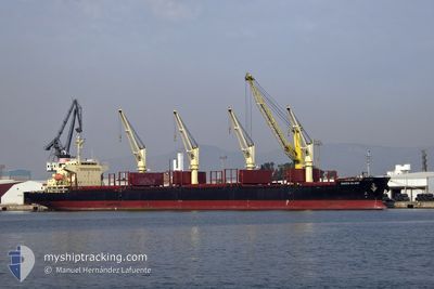
The vessel QUEEN ISLAND (IMO: 9741188, MMSI: 354141000) is a Cargo It's sailing under the flag of [PA] Panama.
In this page you can find informations about the vessels current position, last detected port calls, and current voyage information. If the vessels is not in coverage by AIS you will find the latest position.
The current position of QUEEN ISLAND is detected by our AIS receivers and we are not responsible for the reliability of the data. The last position was recorded while the vessel was in Coverage by the Ais receivers of our vessel tracking app.
The current draught of QUEEN ISLAND as reported by AIS is 6.8 meters
Weather
| Temperature | 29.4°C / 84.92°F |
|---|---|
| Wind Speed | 9 knots |
| Direction | 94° E |
| Pressure | 1007.4 hPa |
| Humidity | 74.2 % |
| Cloud Coverage | 40 % |
Featured Company
Events
| Heure | Evenement | Détails | Position/ Destination | Info |
|---|---|---|---|---|
| 2024-04-25 10:27 | PORT DE DEPART |
|
33.29256 / 131.67168
JP ANE OFF > JP OIT
|
Vitesse: 5.6 kn Parcours: 45° |
| 2024-04-25 10:08 | Démarrage |
33.26843 / 131.66446
[JP] OITA
|
Vitesse: 3.6 kn Parcours: 345° |
|
| 2024-04-22 22:44 | Arret |
33.26333 / 131.66333
[JP] OITA
|
Vitesse: Parcours: -1° |
|
| 2024-04-22 22:44 | Port d'arrivée |
|
33.26333 / 131.66333
[JP] OITA
|
Vitesse: 0.7 kn Parcours: 340° |
| 2024-04-22 21:48 | PORT DE DEPART |
|
33.29201 / 131.67880
JP ANE OFF > JP OIT
|
Vitesse: 8.5 kn Parcours: 270° |
| 2024-04-22 21:36 | Démarrage |
33.28583 / 131.70480
[JP] OITA
|
Vitesse: 4.7 kn Parcours: 320° |