
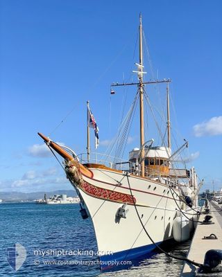
NAHLIN
Yacht
Current Trip
GONLUCEK BUKU
| Time Travelled | 37 days |
|---|---|
| Remaining Time | --- |
| Distance Travelled | 591.27 nm |
| Remaining Distance | --- |
| AVG Speed | 12.3 Noeuds |
| MAX Speed | 15 Noeuds |
| AVG Wind | 7.3 knots |
| MAX Wind | 26 knots |
| MIN Temp | 10.2°C / 50.36°F |
| MAX Temp | 30.9°C / 87.62°F |
| Tirant d eau | 4.5 m |
| Position reçue | 1 h, 58 m depuis |
Current Position
| Longitude | 27.95637° |
|---|---|
| Latitude | 36.75563° |
| Etat | At anchor |
| Vitesse | 0.4 Noeuds |
| Parcours | 258° |
| Zone | Aegean Sea |
| Station | T-AIS |
| Position reçue | 1 h, 58 m depuis |
Info
Information
The current position of NAHLIN is in Aegean Sea with coordinates 36.75563° / 27.95637° as reported on 2024-05-13 14:41 by AIS to our vessel tracker app. The vessel's current speed is 0.4 Noeuds
The vessel NAHLIN (IMO: 1009417, MMSI: 235075032) is a Yacht that was built in 1930 ( 94 Age ). It's sailing under the flag of [GB] United Kingdom.
In this page you can find informations about the vessels current position, last detected port calls, and current voyage information. If the vessels is not in coverage by AIS you will find the latest position.
The current position of NAHLIN is detected by our AIS receivers and we are not responsible for the reliability of the data. The last position was recorded while the vessel was in Coverage by the Ais receivers of our vessel tracking app.
The current draught of NAHLIN as reported by AIS is 4.5 meters
Weather
| Temperature | 20.8°C / 69.44°F |
|---|---|
| Wind Speed | 26 knots |
| Direction | 291° WNW |
| Pressure | 1011 hPa |
| Humidity | 63 % |
| Cloud Coverage | 2 % |
Featured Company
Events
| Heure | Evenement | Détails | Position/ Destination | Info |
|---|---|---|---|---|
| 2024-05-13 14:41 | Hors de la zone couverte |
36.75563 / 27.95637
Aegean Sea
GONLUCEK BUKU
|
Vitesse: 0.4 kn Parcours: 189.1° |
|
| 2024-05-13 14:41 | Dans la zone couverte |
36.75563 / 27.95637
Aegean Sea
GONLUCEK BUKU
|
Vitesse: 0.4 kn Parcours: 189.1° |
|
| 2024-05-13 08:47 | Hors de la zone couverte |
36.73508 / 27.92628
Aegean Sea
GONLUCEK BUKU
|
Vitesse: 13.8 kn Parcours: 81.7° |
|
| 2024-05-13 07:05 | Démarrage | 9.23 nm, South West of DATCA NORTH |
36.65479 / 27.49040
GONLUCEK BUKU
|
Vitesse: 5.3 kn Parcours: 114.5° |
| 2024-05-13 06:56 | Changement de destination | GONLUCEK BUKU PALAMUT |
36.65571 / 27.48722
GONLUCEK BUKU
|
Vitesse: Parcours: 329° |
| 2024-05-13 06:56 | Changement d'ETA | 2024/05/13 12:00 2024/05/12 13:00 |
36.65571 / 27.48722
GONLUCEK BUKU
|
Vitesse: Parcours: 329° |
| 2024-05-13 06:50 | Etat Changé | Under way using engine At anchor |
36.65539 / 27.48769
PALAMUT
|
Vitesse: 0.5 kn Parcours: 324° |
| 2024-05-12 10:13 | Etat Changé | At anchor Under way using engine |
36.65514 / 27.48833
PALAMUT
|
Vitesse: 1.3 kn Parcours: 295° |
| 2024-05-12 10:09 | Arret | 9.3 nm, South West of DATCA NORTH |
36.65539 / 27.48746
PALAMUT
|
Vitesse: 0.3 kn Parcours: 319° |
| 2024-05-12 09:42 | Changement de destination | PALAMUT BODRUM |
36.64765 / 27.43468
PALAMUT
|
Vitesse: 13.5 kn Parcours: 102.8° |