
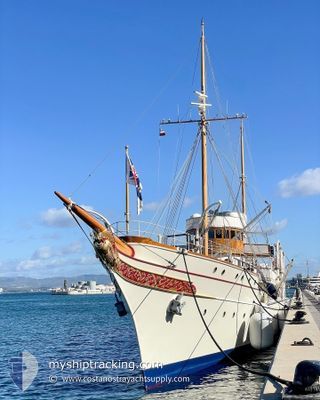
NAHLIN
Yacht
Current Trip
SKOPEA LIMANI
| Time Travelled | 13 days |
|---|---|
| Remaining Time | --- |
| Distance Travelled | 214.48 nm |
| Remaining Distance | --- |
| AVG Speed | 11.2 Knots |
| MAX Speed | 14.3 Knots |
| AVG Wind | 5.8 knots |
| MAX Wind | 15.1 knots |
| MIN Temp | 11.4°C / 52.52°F |
| MAX Temp | 23.1°C / 73.58°F |
| Dybgang | 4.5 m |
| Position Modtaget | 4 m siden |
Current Position
| Longitude | 28.90432° |
|---|---|
| Latitude | 36.67263° |
| Status | At anchor |
| Fart | |
| Kurs | 260° |
| Område | Mediterranean Sea - Eastern Basin |
| Station | T-AIS |
| Position Modtaget | 4 m siden |
Info
Information
The current position of NAHLIN is in Mediterranean Sea - Eastern Basin with coordinates 36.67263° / 28.90432° as reported on 2024-04-19 18:02 by AIS to our vessel tracker app. The vessel's current speed is 0 Knots
The vessel NAHLIN (IMO: 1009417, MMSI: 235075032) is a Yacht that was built in 1930 ( 94 år gamle ). It's sailing under the flag of [GB] United Kingdom.
In this page you can find informations about the vessels current position, last detected port calls, and current voyage information. If the vessels is not in coverage by AIS you will find the latest position.
The current position of NAHLIN is detected by our AIS receivers and we are not responsible for the reliability of the data. The last position was recorded while the vessel was in Coverage by the Ais receivers of our vessel tracking app.
The current draught of NAHLIN as reported by AIS is 4.5 meters
Weather
| Temperature | 14.5°C / 58.1°F |
|---|---|
| Wind Speed | 2 knots |
| Direction | 119° ESE |
| Pressure | 1010.6 hPa |
| Humidity | 79.8 % |
| Cloud Coverage | 45 % |
Featured Company
Events
| Tid | Hændelsen | Detaljer | Position / Dest | Info |
|---|---|---|---|---|
| 2024-04-19 17:53 | Status er ændret | At anchor Under way using engine |
36.67266 / 28.90429
SKOPEA LIMANI
|
Fart: 1.9 kn Kurs: 230° |
| 2024-04-19 17:53 | STOP Sejllads | 4.67 nm, South of GOCEK |
36.67266 / 28.90429
SKOPEA LIMANI
|
Fart: Kurs: 257° |
| 2024-04-19 17:50 | Indenfor Dækning |
36.67363 / 28.90378
Mediterranean Sea - Eastern Basin
SKOPEA LIMANI
|
Fart: 1.9 kn Kurs: 228.1° |
|
| 2024-04-19 16:50 | Udenfor Dækning |
36.67285 / 28.90401
Mediterranean Sea - Eastern Basin
SKOPEA LIMANI
|
Fart: Kurs: 117.5° |
|
| 2024-04-19 13:41 | Indenfor Dækning |
36.67267 / 28.90439
Mediterranean Sea - Eastern Basin
SKOPEA LIMANI
|
Fart: Kurs: 169.4° |
|
| 2024-04-19 12:29 | Udenfor Dækning |
36.67286 / 28.90430
Mediterranean Sea - Eastern Basin
SKOPEA LIMANI
|
Fart: 0.1 kn Kurs: 234.9° |
|
| 2024-04-19 10:53 | Status er ændret | At anchor Under way using engine |
36.67220 / 28.90328
SKOPEA LIMANI
|
Fart: 0.1 kn Kurs: 271° |
| 2024-04-19 10:46 | STOP Sejllads | 4.7 nm, South of GOCEK |
36.67226 / 28.90354
SKOPEA LIMANI
|
Fart: 0.3 kn Kurs: 215° |
| 2024-04-19 06:11 | Destination er ændret | SKOPEA LIMANI CINEVIZ LIMANI |
36.12332 / 29.68905
SKOPEA LIMANI
|
Fart: 12.7 kn Kurs: 292.5° |
| 2024-04-19 06:11 | ETA er ændret | 2024/04/19 13:00 2024/04/16 10:00 |
36.12332 / 29.68905
SKOPEA LIMANI
|
Fart: 12.7 kn Kurs: 292.5° |