
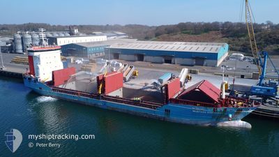
MUSTAFA SOFUOGLU
General Cargo
Current Trip
| Time Travelled | 6 days |
|---|---|
| Remaining Time | --- |
| Distance Travelled | 1111.57 nm |
| Remaining Distance | --- |
| AVG Speed | 8.3 Noeuds |
| MAX Speed | 11.2 Noeuds |
| AVG Wind | 15.5 knots |
| MAX Wind | 25 knots |
| MIN Temp | 9.8°C / 49.64°F |
| MAX Temp | 18.2°C / 64.76°F |
| Tirant d eau | 7.5 m |
| Position reçue | 8 h, 5 m depuis |
Current Position
| Longitude | --- |
|---|---|
| Latitude | --- |
| Etat | At anchor |
| Vitesse | |
| Parcours | 329° |
| Zone | Adriatic Sea |
| Station | T-AIS |
| Position reçue | 8 h, 5 m depuis |
Info
Information
The current position of MUSTAFA SOFUOGLU is in Adriatic Sea with coordinates 44.50733° / 12.48164° as reported on 2025-12-11 23:38 by AIS to our vessel tracker app. The vessel's current speed is 0 Noeuds
The vessel MUSTAFA SOFUOGLU (IMO: 9343950, MMSI: 372091000) is a General Cargo that was built in 2006 ( 19 Age ). It's sailing under the flag of [PA] Panama.
In this page you can find informations about the vessels current position, last detected port calls, and current voyage information. If the vessels is not in coverage by AIS you will find the latest position.
The current position of MUSTAFA SOFUOGLU is detected by our AIS receivers and we are not responsible for the reliability of the data. The last position was recorded while the vessel was in Coverage by the Ais receivers of our vessel tracking app.
The current draught of MUSTAFA SOFUOGLU as reported by AIS is 7.5 meters
Weather
| Temperature | 9.8°C / 49.64°F |
|---|---|
| Wind Speed | 10 knots |
| Direction | 297° WNW |
| Pressure | 1023.3 hPa |
| Humidity | 75.9 % |
| Cloud Coverage | 14 % |
Featured Company
Last Port Calls
| Port | Arrival | Departure | Time In Port |
|---|---|---|---|
| 2025-12-02 10:20 | 2025-12-06 05:01 | 3 d | |
| 2025-11-24 11:40 | 2025-11-28 16:07 | 4 d | |
| 2025-11-16 16:12 | 2025-11-18 11:27 | 1 d | |
| 2025-11-08 11:47 | 2025-11-08 17:15 | 5 h | |
| 2025-10-31 12:48 | 2025-11-01 21:13 | 1 d | |
| 2025-10-19 17:44 | 2025-10-22 22:16 | 3 d | |
| 2025-10-07 20:16 | 2025-10-15 18:28 | 7 d |
Last Trips
| Origin | Departure | Destination | Arrival | Distance | |
|---|---|---|---|---|---|
| 2025-11-28 16:07 | 2025-12-02 10:20 | 463.25 nm | |||
| 2025-11-18 11:27 | 2025-11-24 11:40 | 1110.47 nm | |||
| 2025-11-08 17:15 | 2025-11-16 16:12 | 357.83 nm | |||
| 2025-11-01 21:13 | 2025-11-08 11:47 | 759.96 nm | |||
| 2025-10-22 22:16 | 2025-10-31 12:48 | 1433.50 nm | |||
| 2025-10-15 18:28 | 2025-10-19 17:44 | 334.96 nm | |||
| 2025-09-25 10:41 | 2025-10-07 20:16 | 1606.62 nm |
Events
| Heure | Evenement | Détails | Position/ Destination | Info |
|---|---|---|---|---|
| 2025-12-11 23:53 | Etat Changé | Default At anchor |
44.50731 / 12.48187
ITRAN
|
Vitesse: Parcours: 329° |
| 2025-12-11 23:38 | Etat Changé | At anchor Default |
44.50733 / 12.48164
ITRAN
|
Vitesse: 0.1 kn Parcours: 316° |
| 2025-12-11 23:38 | Hors de la zone couverte |
44.50733 / 12.48164
Adriatic Sea
|
Vitesse: Parcours: 155° |
|
| 2025-12-11 23:31 | Dans la zone couverte |
44.50733 / 12.48164
Adriatic Sea
|
Vitesse: Parcours: 155° |
|
| 2025-12-11 17:05 | Arret | 8.82 nm, East of MARINA ROMEA |
44.50896 / 12.48097
ITRAN
|
Vitesse: 0.3 kn Parcours: 228° |
| 2025-12-11 13:46 | Etat Changé | Default Under way using engine |
44.41345 / 13.09575
ITRAN
|
Vitesse: 8.9 kn Parcours: 293.7° |
| 2025-12-11 13:42 | Etat Changé | Under way using engine Default |
44.40974 / 13.10721
ITRAN
|
Vitesse: 8.8 kn Parcours: 294° |
| 2025-12-11 13:42 | Hors de la zone couverte |
44.40974 / 13.10721
Adriatic Sea
|
Vitesse: 8.9 kn Parcours: 293.7° |
|
| 2025-12-11 13:31 | Dans la zone couverte |
44.40974 / 13.10721
Adriatic Sea
|
Vitesse: 8.9 kn Parcours: 293.7° |
|
| 2025-12-11 12:38 | Hors de la zone couverte |
44.29597 / 13.24738
Adriatic Sea
|
Vitesse: 9 kn Parcours: 308.7° |