
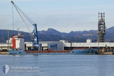
MUSTAFA SOFUOGLU
General Cargo
Current Trip
| Time Travelled | 1 day |
|---|---|
| Remaining Time | 23 h, 39 mins |
| Distance Travelled | 261.40 nm |
| Remaining Distance | 208.54 nm |
| AVG Speed | 9.7 Knots |
| MAX Speed | 10.8 Knots |
| AVG Wind | 10.6 knots |
| MAX Wind | 16 knots |
| MIN Temp | 16.4°C / 61.52°F |
| MAX Temp | 19.5°C / 67.1°F |
| Draught | 4.9 m |
| Position Received | 1 m ago |
Current Position
| Longitude | -9.51850° |
|---|---|
| Latitude | 37.50383° |
| Status | Under way using engine |
| Speed | 8.8 Knots |
| Course | 347° |
| Area | North Atlantic Ocean |
| Station | T-AIS |
| Position Received | 1 m ago |
Info
Information
The current position of MUSTAFA SOFUOGLU is in North Atlantic Ocean with coordinates 37.50383° / -9.51850° as reported on 2024-04-24 16:39 by AIS to our vessel tracker app. The vessel's current speed is 8.8 Knots and is heading at the port of AVEIRO. The estimated time of arrival as calculated by MyShipTracking vessel tracking app is 2024-04-25 16:19 LT
The vessel MUSTAFA SOFUOGLU (IMO: 9343950, MMSI: 372091000) is a General Cargo that was built in 2006 ( 18 years old ). It's sailing under the flag of [PA] Panama.
In this page you can find informations about the vessels current position, last detected port calls, and current voyage information. If the vessels is not in coverage by AIS you will find the latest position.
The current position of MUSTAFA SOFUOGLU is detected by our AIS receivers and we are not responsible for the reliability of the data. The last position was recorded while the vessel was in Coverage by the Ais receivers of our vessel tracking app.
The current draught of MUSTAFA SOFUOGLU as reported by AIS is 4.9 meters
Weather
| Temperature | 16.7°C / 62.06°F |
|---|---|
| Wind Speed | 16 knots |
| Direction | 336° NNW |
| Pressure | 1017.1 hPa |
| Humidity | 76.9 % |
| Cloud Coverage | 100 % |
Featured Company
Last Port Calls
| Port | Arrival | Departure | Time In Port |
|---|---|---|---|
| 2024-04-18 09:02 | 2024-04-22 19:46 | 4 d | |
| 2024-04-14 09:52 | 2024-04-14 15:47 | 5 h | |
| 2024-03-28 09:22 | 2024-04-06 13:12 | 9 d | |
| 2024-03-18 05:24 | 2024-03-21 15:35 | 3 d | |
| 2024-03-11 18:29 | |||
| 2024-02-29 19:42 | |||
| 2024-02-26 06:02 | 2024-02-28 06:07 | 2 d | |
| 2024-02-17 22:22 | 2024-02-23 19:50 | 5 d | |
| 2024-02-14 00:36 | 2024-02-15 18:43 | 1 d | |
| 2024-02-01 12:22 | 2024-02-03 07:58 | 1 d |
Last Trips
| Origin | Departure | Destination | Arrival | Distance | |
|---|---|---|---|---|---|
| 2024-04-14 17:47 | 2024-04-18 10:02 | 200.82 nm | |||
| 2024-04-06 16:12 | 2024-04-14 11:52 | 1637.88 nm | |||
| 2024-03-21 16:35 | 2024-03-28 12:22 | 970.15 nm | |||
| 2024-02-28 07:07 | 2024-02-29 20:42 | 346.26 nm | |||
| 2024-02-23 20:50 | 2024-02-26 07:02 | 298.60 nm | |||
| 2024-02-15 19:43 | 2024-02-17 23:22 | 551.69 nm | |||
| 2024-02-03 09:58 | 2024-02-14 01:36 | 1449.98 nm | |||
| 2024-01-19 01:01 | 2024-02-01 14:22 | 470.98 nm |
Events
| Time | Event | Details | Position / Dest | Info |
|---|---|---|---|---|
| 2024-04-24 05:18 | Status Changed | Under way using engine Default |
35.87317 / -8.61383
PTAVE
|
Speed: 10.2 kn Course: 339° |
| 2024-04-24 04:34 | Status Changed | Default Under way using engine |
35.75550 / -8.56300
PTAVE
|
Speed: 10.1 kn Course: 340° |
| 2024-04-24 04:19 | Status Changed | Under way using engine Default |
35.71383 / -8.54550
PTAVE
|
Speed: 10 kn Course: 343° |
| 2024-04-24 04:18 | Status Changed | Default Under way using engine |
35.71267 / -8.54500
PTAVE
|
Speed: 10.2 kn Course: 341° |
| 2024-04-24 04:10 | Detected in Sea | Portuguese part of the North Atlantic Ocean |
35.69100 / -8.53567
North Atlantic Ocean
PTAVE
|
Speed: 10.2 kn Course: 341° |
| 2024-04-24 04:10 | Status Changed | Under way using engine Default |
35.69100 / -8.53567
PTAVE
|
Speed: 10.2 kn Course: 342° |
| 2024-04-24 04:03 | IN Coverage |
35.69100 / -8.53567
North Atlantic Ocean
PTAVE
|
Speed: 10.2 kn Course: 341° |
|
| 2024-04-24 01:15 | Status Changed | Default Under way using engine |
35.22800 / -8.33267
PTAVE
|
Speed: 10.3 kn Course: 338° |
| 2024-04-24 01:12 | OUT of Coverage |
35.22117 / -8.32933
North Atlantic Ocean
PTAVE
|
Speed: 10.3 kn Course: 338° |
|
| 2024-04-24 00:30 | Status Changed | Under way using engine Default |
35.10800 / -8.27650
PTAVE
|
Speed: 10.4 kn Course: 340° |