
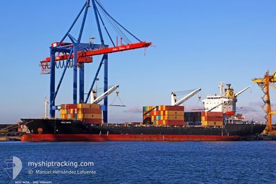
MSC NITA
Container Ship
Current Trip
| Trip Time | 3 days |
|---|---|
| Trip Distance | 14.61 nm |
| AVG Speed | 6.2 Noeuds |
| MAX Speed | 9.6 Noeuds |
| Tirant d eau | 7 m |
| AVG Wind | 12.5 knots |
| MAX Wind | 22 knots |
| MIN Temp | 18°C / 64.4°F |
| MAX Temp | 19.9°C / 67.82°F |
| Position reçue | 8 d depuis |
Current Position
| Longitude | --- |
|---|---|
| Latitude | --- |
| Etat | Under way using engine |
| Vitesse | 8 Noeuds |
| Parcours | 288.7° |
| Zone | Mediterranean Sea - Eastern Basin |
| Station | T-AIS |
| Position reçue | 8 d depuis |
Info
Information
The current position of MSC NITA is in Mediterranean Sea - Eastern Basin with coordinates 31.87367° / 34.56020° as reported on 2025-12-07 22:27 by AIS to our vessel tracker app. The vessel's current speed is 8 Noeuds and is currently inside the port of ALEXANDRIA.
The vessel MSC NITA (IMO: 9084607, MMSI: 636018389) is a Container Ship that was built in 1996 ( 29 Age ). It's sailing under the flag of [LR] Liberia.
In this page you can find informations about the vessels current position, last detected port calls, and current voyage information. If the vessels is not in coverage by AIS you will find the latest position.
The current position of MSC NITA is detected by our AIS receivers and we are not responsible for the reliability of the data. The last position was recorded while the vessel was in Coverage by the Ais receivers of our vessel tracking app.
The current draught of MSC NITA as reported by AIS is 7 meters
Weather
| Temperature | 18.1°C / 64.58°F |
|---|---|
| Wind Speed | 11 knots |
| Direction | 21° NNE |
| Pressure | 1019.7 hPa |
| Humidity | 61.6 % |
| Cloud Coverage | 100 % |
Featured Company
Last Port Calls
| Port | Arrival | Departure | Time In Port |
|---|---|---|---|
| 2025-12-15 13:50 | |||
| 2025-12-11 08:37 | 2025-12-12 06:24 | 21 h | |
| 2025-12-06 06:39 | 2025-12-07 21:53 | 1 d | |
| 2025-12-05 01:42 | 2025-12-05 18:31 | 16 h | |
| 2025-12-03 11:38 | 2025-12-04 02:57 | 15 h | |
| 2025-12-02 05:09 | 2025-12-02 15:05 | 9 h | |
| 2025-11-28 23:15 | 2025-11-29 20:20 | 21 h | |
| 2025-11-26 07:06 | 2025-11-27 13:03 | 1 d | |
| 2025-11-24 06:14 | 2025-11-25 09:21 | 1 d | |
| 2025-11-20 01:25 | 2025-11-20 13:45 | 12 h |
Most Visited Ports (Last year)
| Port | Arrivals | |
|---|---|---|
| 20 | ||
| 18 | ||
| 17 | ||
| 13 | ||
| 12 | ||
| 9 |
Last Trips
| Origin | Departure | Destination | Arrival | Distance | |
|---|---|---|---|---|---|
| 2025-12-12 08:24 | 2025-12-15 15:50 | 14.61 nm | |||
| 2025-12-07 23:53 | 2025-12-11 10:37 | 301.85 nm | |||
| 2025-12-05 20:31 | 2025-12-06 08:39 | 84.60 nm | |||
| 2025-12-04 05:57 | 2025-12-05 03:42 | 240.22 nm | |||
| 2025-12-02 18:05 | 2025-12-03 14:38 | 86.02 nm | |||
| 2025-11-29 22:20 | 2025-12-02 08:09 | 674.06 nm | |||
| 2025-11-27 15:03 | 2025-11-29 01:15 | 265.64 nm | |||
| 2025-11-25 11:21 | 2025-11-26 09:06 | 261.94 nm | |||
| 2025-11-20 15:45 | 2025-11-24 08:14 | 646.65 nm | |||
| 2025-11-18 18:47 | 2025-11-20 03:25 | 283.19 nm |
Events
| Heure | Evenement | Détails | Position/ Destination | Info |
|---|---|---|---|---|
| 2025-12-15 14:34 | Arret |
31.18895 / 29.87511
[EG] ALEXANDRIA
|
Vitesse: 0.1 kn Parcours: -1° |
|
| 2025-12-15 13:50 | Port d'arrivée |
|
31.16092 / 29.84320
[EG] ALEXANDRIA
|
Vitesse: 7.8 kn Parcours: 96° |
| 2025-12-15 13:18 | Démarrage | 3.6 nm, North West of EL DEKHEILA |
31.20014 / 29.77452
EGEDK
|
Vitesse: 7.1 kn Parcours: 98° |
| 2025-12-15 05:18 | Arret | 3.72 nm, North West of EL DEKHEILA |
31.19971 / 29.76882
EGEDK
|
Vitesse: 0.3 kn Parcours: -1° |
| 2025-12-15 04:34 | Démarrage | 3.72 nm, North West of EL DEKHEILA |
31.20191 / 29.77376
EGEDK
|
Vitesse: 4.1 kn Parcours: -1° |
| 2025-12-12 06:24 | PORT DE DEPART |
|
31.19978 / 29.77251
EGEDK
|
Vitesse: Parcours: -1° |
| 2025-12-11 09:13 | Arret |
31.14344 / 29.79111
[EG] EL DEKHEILA
|
Vitesse: 0.2 kn Parcours: -1° |
|
| 2025-12-11 08:37 | Port d'arrivée |
|
31.15193 / 29.80867
[EG] EL DEKHEILA
|
Vitesse: 6.3 kn Parcours: 171° |
| 2025-12-11 08:21 | Démarrage | 1.86 nm, North of EL DEKHEILA |
31.17733 / 29.80186
EGEDK
|
Vitesse: 5.1 kn Parcours: 133° |
| 2025-12-11 07:53 | Arret | 2.44 nm, North of EL DEKHEILA |
31.18566 / 29.79301
EGEDK
|
Vitesse: 0.3 kn Parcours: -1° |