
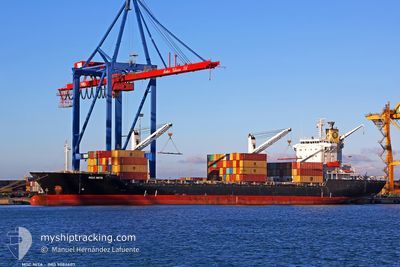
MSC NITA
Container Ship
Current Trip
| Time Travelled | 1 day |
|---|---|
| Remaining Time | 40 mins |
| Distance Travelled | 326.33 nm |
| Remaining Distance | 9.58 nm |
| AVG Speed | 12.4 Knots |
| MAX Speed | 15.9 Knots |
| AVG Wind | 13.5 knots |
| MAX Wind | 32.9 knots |
| MIN Temp | 13°C / 55.4°F |
| MAX Temp | 23.7°C / 74.66°F |
| Draught | 0 m |
| Position Received | 1 m ago |
Current Position
| Longitude | 26.87860° |
|---|---|
| Latitude | 38.40667° |
| Status | Moored |
| Speed | 11.3 Knots |
| Course | 125.5° |
| Area | Aegean Sea |
| Station | T-AIS |
| Position Received | 1 m ago |
Info
Information
The current position of MSC NITA is in Aegean Sea with coordinates 38.40667° / 26.87860° as reported on 2024-04-23 20:21 by AIS to our vessel tracker app. The vessel's current speed is 11.3 Knots and is heading at the port of IZMIR. The estimated time of arrival as calculated by MyShipTracking vessel tracking app is 2024-04-23 21:02 LT
The vessel MSC NITA (IMO: 9084607, MMSI: 636018389) is a Container Ship that was built in 1996 ( 28 years old ). It's sailing under the flag of [LR] Liberia.
In this page you can find informations about the vessels current position, last detected port calls, and current voyage information. If the vessels is not in coverage by AIS you will find the latest position.
The current position of MSC NITA is detected by our AIS receivers and we are not responsible for the reliability of the data. The last position was recorded while the vessel was in Coverage by the Ais receivers of our vessel tracking app.
Weather
| Temperature | 23.7°C / 74.66°F |
|---|---|
| Wind Speed | 24 knots |
| Direction | 164° SSE |
| Pressure | 1005.8 hPa |
| Humidity | 36.8 % |
| Cloud Coverage | 100 % |
Featured Company
Last Port Calls
| Port | Arrival | Departure | Time In Port |
|---|---|---|---|
| 2024-04-22 08:33 | 2024-04-22 17:14 | 8 h | |
| 2024-04-21 08:19 | 2024-04-21 21:25 | 13 h | |
| 2024-04-17 21:13 | 2024-04-18 22:50 | 1 d | |
| 2024-04-05 02:48 | 2024-04-07 06:20 | 2 d | |
| 2024-03-30 11:12 | 2024-03-31 01:09 | 13 h | |
| 2024-03-28 21:04 | 2024-03-29 08:23 | 11 h | |
| 2024-03-28 08:15 | 2024-03-28 13:29 | 5 h | |
| 2024-03-27 12:18 | 2024-03-27 21:20 | 9 h | |
| 2024-03-22 16:22 | 2024-03-23 15:10 | 22 h | |
| 2024-03-16 21:24 | 2024-03-17 12:59 | 15 h |
Last Trips
| Origin | Departure | Destination | Arrival | Distance | |
|---|---|---|---|---|---|
| 2024-04-22 00:25 | 2024-04-22 11:33 | 112.45 nm | |||
| 2024-04-19 01:50 | 2024-04-21 11:19 | 296.23 nm | |||
| 2024-04-07 09:20 | 2024-04-18 00:13 | 1255.64 nm | |||
| 2024-03-31 04:09 | 2024-04-05 05:48 | 1110.80 nm | |||
| 2024-03-29 11:23 | 2024-03-30 14:12 | 336.87 nm | |||
| 2024-03-28 16:29 | 2024-03-29 00:04 | 82.06 nm | |||
| 2024-03-28 00:20 | 2024-03-28 11:15 | 93.30 nm | |||
| 2024-03-23 17:10 | 2024-03-27 15:18 | 354.99 nm | |||
| 2024-03-17 15:59 | 2024-03-22 18:22 | 364.38 nm | |||
| 2024-03-15 20:44 | 2024-03-17 00:24 | 279.49 nm |
Events
| Time | Event | Details | Position / Dest | Info |
|---|---|---|---|---|
| 2024-04-23 20:01 | Status Changed | Moored Default |
38.46665 / 26.81701
IZMIR
|
Speed: 11.7 kn Course: 141° |
| 2024-04-23 19:55 | Status Changed | Default Moored |
38.47192 / 26.81171
IZMIR
|
Speed: 11.4 kn Course: 141° |
| 2024-04-23 19:30 | Status Changed | Moored Default |
38.54019 / 26.74142
IZMIR
|
Speed: 11.1 kn Course: 141° |
| 2024-04-23 19:19 | Status Changed | Default Moored |
38.56021 / 26.72113
IZMIR
|
Speed: 10.6 kn Course: 139.6° |
| 2024-04-23 19:05 | Change Sea Area | Turkish part of the Aegean Sea Greek part of the Aegean Sea |
38.59655 / 26.68292
Aegean Sea
|
Speed: 11 kn Course: 143.4° |
| 2024-04-23 19:05 | Status Changed | Moored Default |
38.59655 / 26.68292
IZMIR
|
Speed: 11.3 kn Course: 144° |
| 2024-04-23 18:48 | IN Coverage |
38.59655 / 26.68292
Aegean Sea
|
Speed: 11 kn Course: 143.4° |
|
| 2024-04-23 16:35 | Status Changed | Default Moored |
38.86229 / 26.19904
IZMIR
|
Speed: 11.1 kn Course: 123.7° |
| 2024-04-23 16:34 | OUT of Coverage |
38.86449 / 26.19469
Aegean Sea
|
Speed: 11.1 kn Course: 123.7° |
|
| 2024-04-23 16:33 | Status Changed | Moored Default |
38.86561 / 26.19247
IZMIR
|
Speed: 11.3 kn Course: 122° |