
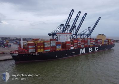
MSC ALLEGRA
Cargo
Current Trip
| Time Travelled | 12 days |
|---|---|
| Remaining Time | --- |
| Distance Travelled | 4901.15 nm |
| Remaining Distance | --- |
| AVG Speed | 16.7 Noeuds |
| MAX Speed | 21.5 Noeuds |
| AVG Wind | 12.1 knots |
| MAX Wind | 33 knots |
| MIN Temp | 15.3°C / 59.54°F |
| MAX Temp | 28.1°C / 82.58°F |
| Tirant d eau | 12.7 m |
| Position reçue | 6 d depuis |
Current Position
| Longitude | -13.39937° |
|---|---|
| Latitude | 28.07711° |
| Etat | Under way using engine |
| Vitesse | 21.5 Noeuds |
| Parcours | 218.8° |
| Zone | North Atlantic Ocean |
| Station | T-AIS |
| Position reçue | 6 d depuis |
Info
Information
The current position of MSC ALLEGRA is in North Atlantic Ocean with coordinates 28.07711° / -13.39937° as reported on 2024-06-09 20:53 by AIS to our vessel tracker app. The vessel's current speed is 21.5 Noeuds and is heading at the port of SINGAPORE. The estimated time of arrival as calculated by MyShipTracking vessel tracking app is 2024-07-03 04:00 LT
The vessel MSC ALLEGRA (IMO: 9897028, MMSI: 636020600) is a Cargo It's sailing under the flag of [LR] Liberia.
In this page you can find informations about the vessels current position, last detected port calls, and current voyage information. If the vessels is not in coverage by AIS you will find the latest position.
The current position of MSC ALLEGRA is detected by our AIS receivers and we are not responsible for the reliability of the data. The last position was recorded while the vessel was in Coverage by the Ais receivers of our vessel tracking app.
The current draught of MSC ALLEGRA as reported by AIS is 12.7 meters
Weather
| Temperature | 20.1°C / 68.18°F |
|---|---|
| Wind Speed | 13 knots |
| Direction | 171° S |
| Pressure | 1014.6 hPa |
| Humidity | 78.3 % |
| Cloud Coverage | 55 % |
Featured Company
Last Port Calls
| Port | Arrival | Departure | Time In Port |
|---|---|---|---|
| 2024-06-01 22:56 | 2024-06-04 04:37 | 2 d | |
| 2024-05-24 13:41 | 2024-05-30 19:48 | 6 d | |
| 2024-05-21 02:05 | 2024-05-23 04:02 | 2 d | |
| 2024-04-23 04:30 | 2024-04-25 01:06 | 1 d | |
| 2024-04-16 14:15 | 2024-04-17 12:49 | 22 h | |
| 2024-04-14 14:38 | 2024-04-15 11:40 | 21 h | |
| 2024-04-11 20:36 | 2024-04-11 21:01 | 25 m | |
| 2024-04-11 17:45 | 2024-04-11 20:16 | 2 h | |
| 2024-04-11 16:00 | 2024-04-11 16:19 | 19 m | |
| 2024-04-11 11:21 | 2024-04-11 15:55 | 4 h |
Last Trips
| Origin | Departure | Destination | Arrival | Distance | |
|---|---|---|---|---|---|
| 2024-05-30 21:48 | 2024-06-02 00:56 | 683.85 nm | |||
| 2024-05-23 06:02 | 2024-05-24 15:41 | 181.80 nm | |||
| 2024-04-25 09:06 | 2024-05-21 04:05 | 11161.12 nm | |||
| 2024-04-17 20:49 | 2024-04-23 12:30 | 1490.12 nm | |||
| 2024-04-15 19:40 | 2024-04-16 22:15 | 133.23 nm | |||
| 2024-04-12 05:01 | 2024-04-14 22:38 | 885.49 nm | |||
| 2024-04-12 04:16 | 2024-04-12 04:36 | 0.11 nm | |||
| 2024-04-12 00:19 | 2024-04-12 01:45 | 0.33 nm | |||
| 2024-04-11 23:55 | 2024-04-12 00:00 | 0.11 nm | |||
| 2024-04-11 19:05 | 2024-04-11 19:21 | 0.11 nm |
Events
| Heure | Evenement | Détails | Position/ Destination | Info |
|---|---|---|---|---|
| 2024-06-09 21:02 | Etat Changé | Default Under way using engine |
28.03167 / -13.43500
SGSIN WBG'A'
|
Vitesse: 21.5 kn Parcours: 218.8° |
| 2024-06-09 20:53 | Hors de la zone couverte |
28.07711 / -13.39937
North Atlantic Ocean
SGSIN WBG'A'
|
Vitesse: 21.5 kn Parcours: 218.8° |
|
| 2024-06-09 20:41 | Etat Changé | Under way using engine Default |
28.13398 / -13.34838
SGSIN WBG'A'
|
Vitesse: 21 kn Parcours: 218° |
| 2024-06-09 19:53 | Etat Changé | Default Under way using engine |
28.36500 / -13.16333
SGSIN WBG'A'
|
Vitesse: 21.3 kn Parcours: 214.5° |
| 2024-06-09 19:49 | Changement de zone | Moroccan part of the North Atlantic Ocean Spanish (Canary Islands) part of the North Atlantic Ocean |
28.38437 / -13.14916
North Atlantic Ocean
SGSIN WBG'A'
|
Vitesse: 21.3 kn Parcours: 214.5° |
| 2024-06-09 19:49 | Etat Changé | Under way using engine Default |
28.38437 / -13.14916
SGSIN WBG'A'
|
Vitesse: 21 kn Parcours: 214° |
| 2024-06-09 19:14 | Etat Changé | Default Under way using engine |
28.55500 / -13.01667
SGSIN WBG'A'
|
Vitesse: 21 kn Parcours: 215.1° |
| 2024-06-09 19:07 | Etat Changé | Under way using engine Default |
28.59253 / -12.98868
SGSIN WBG'A'
|
Vitesse: 21 kn Parcours: 213° |
| 2024-06-09 18:55 | Etat Changé | Default Under way using engine |
28.64866 / -12.94587
SGSIN WBG'A'
|
Vitesse: 20.8 kn Parcours: 214.6° |
| 2024-06-09 18:50 | Changement de zone | Spanish (Canary Islands) part of the North Atlantic Ocean Moroccan part of the North Atlantic Ocean |
28.67573 / -12.92492
North Atlantic Ocean
SGSIN WBG'A'
|
Vitesse: 20.8 kn Parcours: 214.5° |