
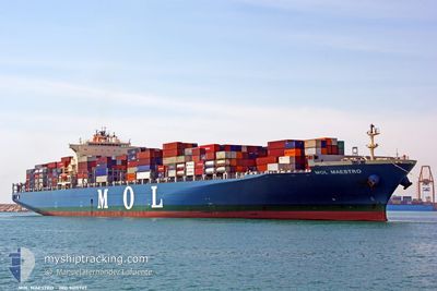
MOL MAESTRO
Container Ship
Current Trip
| Time Travelled | 17 h, 28 mins |
|---|---|
| Remaining Time | 9 days |
| Distance Travelled | 293.63 nm |
| Remaining Distance | 4065.96 nm |
| AVG Speed | 16.7 Noeuds |
| MAX Speed | 19.6 Noeuds |
| AVG Wind | 9.4 knots |
| MAX Wind | 12.2 knots |
| MIN Temp | 17.5°C / 63.5°F |
| MAX Temp | 20.3°C / 68.54°F |
| Tirant d eau | 13.3 m |
| Position reçue | 6 h, 56 m depuis |
Current Position
| Longitude | 142.30434° |
|---|---|
| Latitude | 35.40635° |
| Etat | Under way using engine |
| Vitesse | 16.7 Noeuds |
| Parcours | 72.1° |
| Zone | North Pacific Ocean |
| Station | T-AIS |
| Position reçue | 6 h, 56 m depuis |
Info
Information
The current position of MOL MAESTRO is in North Pacific Ocean with coordinates 35.40635° / 142.30434° as reported on 2024-04-26 07:47 by AIS to our vessel tracker app. The vessel's current speed is 16.7 Noeuds and is heading at the port of TACOMA. The estimated time of arrival as calculated by MyShipTracking vessel tracking app is 2024-05-06 13:11 LT
The vessel MOL MAESTRO (IMO: 9415727, MMSI: 373457000) is a Container Ship that was built in 2010 ( 14 Age ). It's sailing under the flag of [PA] Panama.
In this page you can find informations about the vessels current position, last detected port calls, and current voyage information. If the vessels is not in coverage by AIS you will find the latest position.
The current position of MOL MAESTRO is detected by our AIS receivers and we are not responsible for the reliability of the data. The last position was recorded while the vessel was in Coverage by the Ais receivers of our vessel tracking app.
The current draught of MOL MAESTRO as reported by AIS is 13.3 meters
Weather
| Temperature | 17.5°C / 63.5°F |
|---|---|
| Wind Speed | 11 knots |
| Direction | 181° S |
| Pressure | 1017.8 hPa |
| Humidity | 79.9 % |
| Cloud Coverage | 100 % |
Featured Company
Last Port Calls
| Port | Arrival | Departure | Time In Port |
|---|---|---|---|
| 2024-04-25 08:44 | 2024-04-25 21:16 | 12 h | |
| 2024-04-24 03:21 | 2024-04-24 16:48 | 13 h | |
| 2024-04-20 09:04 | 2024-04-21 17:16 | 1 d | |
| 2024-04-12 16:12 | 2024-04-13 08:13 | 16 h | |
| 2024-04-07 23:02 | 2024-04-08 12:21 | 13 h | |
| 2024-04-06 22:24 | 2024-04-07 08:49 | 10 h | |
| 2024-04-04 22:13 | 2024-04-05 18:57 | 20 h | |
| 2024-03-16 19:48 | 2024-03-20 20:33 | 4 d | |
| 2024-03-16 18:42 | 2024-03-16 18:50 | 8 m | |
| 2024-03-02 11:11 | 2024-03-09 12:12 | 7 d |
Last Trips
| Origin | Departure | Destination | Arrival | Distance | |
|---|---|---|---|---|---|
| 2024-04-25 01:48 | 2024-04-25 17:44 | 221.16 nm | |||
| 2024-04-22 01:16 | 2024-04-24 12:21 | 910.62 nm | |||
| 2024-04-13 16:13 | 2024-04-20 17:04 | 604.46 nm | |||
| 2024-04-08 21:21 | 2024-04-13 00:12 | 1429.36 nm | |||
| 2024-04-07 17:49 | 2024-04-08 08:02 | 247.43 nm | |||
| 2024-04-06 03:57 | 2024-04-07 07:24 | 375.59 nm | |||
| 2024-03-20 13:33 | 2024-04-05 07:13 | 4295.29 nm | |||
| 2024-03-16 11:50 | 2024-03-16 12:48 | 1.62 nm | |||
| 2024-03-09 04:12 | 2024-03-16 11:42 | 220.89 nm | |||
| 2024-02-19 22:58 | 2024-03-02 03:11 | 4376.86 nm |
Events
| Heure | Evenement | Détails | Position/ Destination | Info |
|---|---|---|---|---|
| 2024-04-26 07:51 | Etat Changé | Default Under way using engine |
35.41174 / 142.32364
USTIW
|
Vitesse: 16.7 kn Parcours: 72.1° |
| 2024-04-26 07:47 | Hors de la zone couverte |
35.40635 / 142.30434
North Pacific Ocean
USTIW
|
Vitesse: 16.7 kn Parcours: 72.1° |
|
| 2024-04-26 07:45 | Etat Changé | Under way using engine Default |
35.40198 / 142.28859
USTIW
|
Vitesse: 16.5 kn Parcours: 72° |
| 2024-04-26 07:39 | Dans la zone couverte |
35.40230 / 142.28967
North Pacific Ocean
USTIW
|
Vitesse: 16.6 kn Parcours: 70.8° |
|
| 2024-04-26 06:04 | Etat Changé | Default Under way using engine |
35.23500 / 141.73500
USTIW
|
Vitesse: 17.9 kn Parcours: 71.4° |
| 2024-04-26 05:59 | Hors de la zone couverte |
35.22894 / 141.70911
North Pacific Ocean
USTIW
|
Vitesse: 17.9 kn Parcours: 71.4° |
|
| 2024-04-26 05:59 | Etat Changé | Under way using engine Default |
35.22830 / 141.70680
USTIW
|
Vitesse: 17 kn Parcours: 71° |
| 2024-04-26 05:43 | Etat Changé | Default Under way using engine |
35.20334 / 141.61333
USTIW
|
Vitesse: 18.1 kn Parcours: 74.7° |
| 2024-04-26 05:36 | Etat Changé | Under way using engine Default |
35.19557 / 141.57319
USTIW
|
Vitesse: 18 kn Parcours: 75° |
| 2024-04-26 05:31 | Etat Changé | Default Under way using engine |
35.18833 / 141.54167
USTIW
|
Vitesse: 18 kn Parcours: 72.5° |