
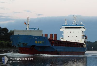
MARIT
General Cargo
Current Trip
| Time Travelled | 7 days |
|---|---|
| Remaining Time | 16 h, 11 mins |
| Distance Travelled | 2091.37 nm |
| Remaining Distance | 180.98 nm |
| AVG Speed | 10.5 Noeuds |
| MAX Speed | 14.8 Noeuds |
| AVG Wind | 9.7 knots |
| MAX Wind | 31.8 knots |
| MIN Temp | 3.1°C / 37.58°F |
| MAX Temp | 16°C / 60.8°F |
| Tirant d eau | 7.4 m |
| Position reçue | 9 h, 41 m depuis |
Current Position
| Longitude | 19.03364° |
|---|---|
| Latitude | 60.37791° |
| Etat | Under way using engine |
| Vitesse | 8.8 Noeuds |
| Parcours | 4.6° |
| Zone | Gulf of Bothnia |
| Station | T-AIS |
| Position reçue | 9 h, 41 m depuis |
Info
Information
The current position of MARIT is in Gulf of Bothnia with coordinates 60.37791° / 19.03364° as reported on 2024-05-10 04:59 by AIS to our vessel tracker app. The vessel's current speed is 8.8 Noeuds and is heading at the port of RONNSKAR. The estimated time of arrival as calculated by MyShipTracking vessel tracking app is 2024-05-11 06:52 LT
The vessel MARIT (IMO: 9364148, MMSI: 246127000) is a General Cargo that was built in 2008 ( 16 Age ). It's sailing under the flag of [NL] Netherlands.
In this page you can find informations about the vessels current position, last detected port calls, and current voyage information. If the vessels is not in coverage by AIS you will find the latest position.
The current position of MARIT is detected by our AIS receivers and we are not responsible for the reliability of the data. The last position was recorded while the vessel was in Coverage by the Ais receivers of our vessel tracking app.
The current draught of MARIT as reported by AIS is 7.4 meters
Weather
| Temperature | 3.9°C / 39.02°F |
|---|---|
| Wind Speed | 10 knots |
| Direction | 315° NW |
| Pressure | 1019.2 hPa |
| Humidity | 72.1 % |
| Cloud Coverage | --- |
Featured Company
Last Port Calls
| Port | Arrival | Departure | Time In Port |
|---|---|---|---|
| 2024-04-29 16:35 | 2024-05-02 16:28 | 2 d | |
| 2024-04-21 08:21 | 2024-04-23 18:16 | 2 d | |
| 2024-04-17 07:47 | 2024-04-17 18:51 | 11 h | |
| 2024-04-01 15:53 | 2024-04-03 16:21 | 2 d | |
| 2024-03-30 14:29 | 2024-04-01 05:17 | 1 d | |
| 2024-03-11 21:54 | 2024-03-13 14:46 | 1 d | |
| 2024-03-06 19:04 | 2024-03-08 16:35 | 1 d | |
| 2024-03-04 10:07 | 2024-03-04 16:35 | 6 h |
Last Trips
| Origin | Departure | Destination | Arrival | Distance | |
|---|---|---|---|---|---|
| 2024-04-23 20:16 | 2024-04-29 17:35 | 1184.85 nm | |||
| 2024-04-17 20:51 | 2024-04-21 10:21 | 792.10 nm | |||
| 2024-04-03 18:21 | 2024-04-17 09:47 | 3248.25 nm | |||
| 2024-04-01 08:17 | 2024-04-01 17:53 | 129.27 nm | |||
| 2024-03-13 14:46 | 2024-03-30 16:29 | 2100.89 nm | |||
| 2024-03-08 17:35 | 2024-03-11 21:54 | 709.99 nm | |||
| 2024-03-04 16:35 | 2024-03-06 20:04 | 516.17 nm | |||
| 2024-02-27 16:01 | 2024-03-04 10:07 | 1276.25 nm |
Events
| Heure | Evenement | Détails | Position/ Destination | Info |
|---|---|---|---|---|
| 2024-05-10 05:05 | Etat Changé | Default Under way using engine |
60.39163 / 19.03615
SEROR
|
Vitesse: 8.8 kn Parcours: 4.6° |
| 2024-05-10 04:59 | Hors de la zone couverte |
60.37791 / 19.03364
Gulf of Bothnia
SEROR
|
Vitesse: 8.8 kn Parcours: 4.6° |
|
| 2024-05-10 04:49 | Etat Changé | Under way using engine Default |
60.35445 / 19.02875
SEROR
|
Vitesse: 8.9 kn Parcours: 6° |
| 2024-05-10 04:48 | Etat Changé | Default Under way using engine |
60.35195 / 19.02818
SEROR
|
Vitesse: 8.9 kn Parcours: 6.2° |
| 2024-05-10 04:48 | Etat Changé | Under way using engine Default |
60.35030 / 19.02783
SEROR
|
Vitesse: 8.9 kn Parcours: 6° |
| 2024-05-10 04:44 | Etat Changé | Default Under way using engine |
60.34200 / 19.02593
SEROR
|
Vitesse: 8.9 kn Parcours: 6.5° |
| 2024-05-10 03:50 | Changement de zone | Swedish part of the Gulf of Bothnia Finnish part of the Gulf of Bothnia |
60.20507 / 19.08645
Gulf of Bothnia
SEROR
|
Vitesse: 9.5 kn Parcours: 337.7° |
| 2024-05-10 00:38 | Changement de zone | Finnish part of the Gulf of Bothnia Finnish part of the Baltic Sea |
59.78935 / 19.77020
Gulf of Bothnia
SEROR
|
Vitesse: 10.8 kn Parcours: 320.5° |
| 2024-05-09 22:59 | Changement de zone | Finnish part of the Baltic Sea Swedish part of the Baltic Sea |
59.55248 / 20.16031
Baltic Sea
SEROR
|
Vitesse: 11.4 kn Parcours: 356.2° |
| 2024-05-09 22:59 | Etat Changé | Under way using engine Default |
59.55248 / 20.16031
SEROR
|
Vitesse: 11.3 kn Parcours: 356° |