
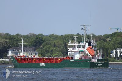
MAUREEN S
General Cargo
Current Trip
| Time Travelled | 6 days |
|---|---|
| Remaining Time | 17 h, 46 mins |
| Distance Travelled | 755.86 nm |
| Remaining Distance | 285.00 nm |
| AVG Speed | 10.4 Noeuds |
| MAX Speed | 14.8 Noeuds |
| AVG Wind | 10.3 knots |
| MAX Wind | 23.1 knots |
| MIN Temp | 6°C / 42.8°F |
| MAX Temp | 24.3°C / 75.74°F |
| Tirant d eau | 3.3 m |
| Position reçue | 1 m depuis |
Current Position
| Longitude | 3.95480° |
|---|---|
| Latitude | 52.66655° |
| Etat | Under way using engine |
| Vitesse | 12.3 Noeuds |
| Parcours | 42° |
| Zone | North Sea |
| Station | T-AIS |
| Position reçue | 1 m depuis |
Info
Information
The current position of MAUREEN S is in North Sea with coordinates 52.66655° / 3.95480° as reported on 2024-05-03 00:55 by AIS to our vessel tracker app. The vessel's current speed is 12.3 Noeuds and is heading at the port of BREMEN. The estimated time of arrival as calculated by MyShipTracking vessel tracking app is 2024-05-03 18:43 LT
The vessel MAUREEN S (IMO: 8707783, MMSI: 304323000) is a General Cargo that was built in 1987 ( 37 Age ). It's sailing under the flag of [AG] Antigua Barbuda.
In this page you can find informations about the vessels current position, last detected port calls, and current voyage information. If the vessels is not in coverage by AIS you will find the latest position.
The current position of MAUREEN S is detected by our AIS receivers and we are not responsible for the reliability of the data. The last position was recorded while the vessel was in Coverage by the Ais receivers of our vessel tracking app.
The current draught of MAUREEN S as reported by AIS is 3.3 meters
Weather
| Temperature | 11.2°C / 52.16°F |
|---|---|
| Wind Speed | 14 knots |
| Direction | 248° WSW |
| Pressure | 1001.6 hPa |
| Humidity | 95 % |
| Cloud Coverage | 100 % |
Featured Company
Last Port Calls
| Port | Arrival | Departure | Time In Port |
|---|---|---|---|
| 2024-04-25 23:16 | 2024-04-26 18:06 | 18 h | |
| 2024-04-17 03:27 | 2024-04-17 22:07 | 18 h | |
| 2024-04-15 03:10 | 2024-04-15 16:03 | 12 h | |
| 2024-04-11 12:28 | 2024-04-12 16:21 | 1 d | |
| 2024-04-04 23:31 | 2024-04-08 05:31 | 3 d | |
| 2024-03-28 05:08 | 2024-04-03 14:09 | 6 d | |
| 2024-03-26 12:02 | 2024-03-27 07:12 | 19 h | |
| 2024-03-24 21:55 | 2024-03-25 10:51 | 12 h | |
| 2024-03-23 19:33 | 2024-03-24 09:25 | 13 h | |
| 2024-03-19 14:59 | 2024-03-20 15:59 | 1 d |
Most Visited Ports (Last year)
| Port | Arrivals | |
|---|---|---|
| 4 | ||
| 4 | ||
| 4 | ||
| 3 | ||
| 3 | ||
| 3 |
Last Trips
| Origin | Departure | Destination | Arrival | Distance | |
|---|---|---|---|---|---|
| 2024-04-18 01:07 | 2024-04-26 00:16 | 1399.32 nm | |||
| 2024-04-15 19:03 | 2024-04-17 06:27 | 400.14 nm | |||
| 2024-04-12 18:21 | 2024-04-15 06:10 | 642.11 nm | |||
| 2024-04-08 07:31 | 2024-04-11 14:28 | 507.08 nm | |||
| 2024-04-03 16:09 | 2024-04-05 01:31 | 308.61 nm | |||
| 2024-03-27 08:12 | 2024-03-28 06:08 | 216.45 nm | |||
| 2024-03-25 11:51 | 2024-03-26 13:02 | 105.83 nm | |||
| 2024-03-24 10:25 | 2024-03-24 22:55 | 134.38 nm | |||
| 2024-03-20 16:59 | 2024-03-23 20:33 | 500.45 nm | |||
| 2024-03-19 06:42 | 2024-03-19 15:59 | 96.17 nm |
Events
| Heure | Evenement | Détails | Position/ Destination | Info |
|---|---|---|---|---|
| 2024-05-03 00:55 | Etat Changé | Under way using engine Default |
52.66655 / 3.95480
DE BRE
|
Vitesse: 12.5 kn Parcours: 40° |
| 2024-05-02 20:54 | Etat Changé | Default Under way using engine |
51.91245 / 3.35907
DE BRE
|
Vitesse: 13.3 kn Parcours: 17° |
| 2024-05-02 20:52 | Hors de la zone couverte |
51.90375 / 3.35442
North Sea
DE BRE
|
Vitesse: 13.3 kn Parcours: 17° |
|
| 2024-05-02 13:29 | Démarrage | 0.64 nm, South East of RUPELMONDE |
51.11977 / 4.30370
DE BRE
|
Vitesse: 7.3 kn Parcours: 17° |
| 2024-05-02 13:00 | Arret | 0.69 nm, South East of RUPELMONDE |
51.11725 / 4.30235
DE BRE
|
Vitesse: 0.3 kn Parcours: 18° |
| 2024-05-02 12:27 | Démarrage | 2.66 nm, South East of RUPELMONDE |
51.09308 / 4.33775
DE BRE
|
Vitesse: 3.2 kn Parcours: 296° |
| 2024-05-02 12:17 | Etat Changé | Under way using engine Default |
51.09092 / 4.34322
DE BRE
|
Vitesse: 1.9 kn Parcours: 117° |
| 2024-05-02 12:16 | Etat Changé | Default Moored |
51.09078 / 4.34348
DE BRE
|
Vitesse: Parcours: 138° |
| 2024-05-02 11:37 | Tirant d'eau modifié | 3.3 5.9 |
51.09065 / 4.34432
DE BRE
|
Vitesse: 0.1 kn Parcours: 139° |
| 2024-05-02 11:37 | Changement de destination | DE BRE BEPUU |
51.09065 / 4.34432
DE BRE
|
Vitesse: 0.1 kn Parcours: 139° |