
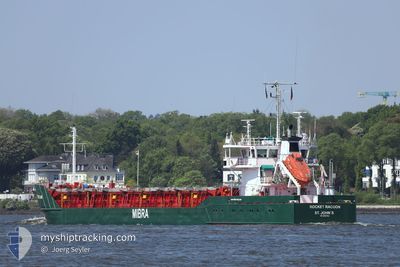
MAUREEN S
General Cargo
Current Trip
| Time Travelled | 1 day |
|---|---|
| Remaining Time | --- |
| Distance Travelled | 429.68 nm |
| Remaining Distance | --- |
| AVG Speed | 8.1 Knopen |
| MAX Speed | 11.3 Knopen |
| AVG Wind | 13.2 knots |
| MAX Wind | 21.2 knots |
| MIN Temp | 3.8°C / 38.84°F |
| MAX Temp | 8.6°C / 47.48°F |
| Diepgang | 5.8 M |
| Positie ontvangen | Nu |
Current Position
| Lengtegraad | 9.60518° |
|---|---|
| Breedtegraat | 54.23198° |
| Status | Under way using engine |
| Snelheid | 6.8 Knopen |
| Koers | 201° |
| Gebied | Baltic Sea |
| Station | T-AIS |
| Positie ontvangen | Nu |
Info
Information
The current position of MAUREEN S is in Baltic Sea with coordinates 54.23198° / 9.60518° as reported on 2024-04-19 20:56 by AIS to our vessel tracker app. The vessel's current speed is 6.8 Knopen and is heading at the port of NEW ROSS. The estimated time of arrival as calculated by MyShipTracking vessel tracking app is 2024-04-23 04:00 LT
The vessel MAUREEN S (IMO: 8707783, MMSI: 304323000) is a General Cargo that was built in 1987 ( 37 Jaar oud ). It's sailing under the flag of [AG] Antigua Barbuda.
In this page you can find informations about the vessels current position, last detected port calls, and current voyage information. If the vessels is not in coverage by AIS you will find the latest position.
The current position of MAUREEN S is detected by our AIS receivers and we are not responsible for the reliability of the data. The last position was recorded while the vessel was in Coverage by the Ais receivers of our vessel tracking app.
The current draught of MAUREEN S as reported by AIS is 5.8 meters
Weather
| Temperature | 4.3°C / 39.74°F |
|---|---|
| Wind Speed | 12 knots |
| Direction | 4° N |
| Pressure | 1007 hPa |
| Humidity | 88.1 % |
| Cloud Coverage | 91 % |
Featured Company
Last Port Calls
| Port | Arrival | Departure | Time In Port |
|---|---|---|---|
| 2024-04-17 03:27 | 2024-04-17 22:07 | 18 h | |
| 2024-04-15 03:10 | 2024-04-15 16:03 | 12 h | |
| 2024-04-11 12:28 | 2024-04-12 16:21 | 1 d | |
| 2024-04-04 23:31 | 2024-04-08 05:31 | 3 d | |
| 2024-03-28 05:08 | 2024-04-03 14:09 | 6 d | |
| 2024-03-26 12:02 | 2024-03-27 07:12 | 19 h | |
| 2024-03-24 21:55 | 2024-03-25 10:51 | 12 h | |
| 2024-03-23 19:33 | 2024-03-24 09:25 | 13 h | |
| 2024-03-19 14:59 | 2024-03-20 15:59 | 1 d | |
| 2024-03-16 14:08 | 2024-03-19 05:42 | 2 d |
Most Visited Ports (Last year)
| Port | Arrivals | |
|---|---|---|
| 4 | ||
| 4 | ||
| 4 | ||
| 3 | ||
| 3 | ||
| 3 |
Last Trips
| Origin | Departure | Destination | Arrival | Distance | |
|---|---|---|---|---|---|
| 2024-04-15 19:03 | 2024-04-17 06:27 | 400.14 nm | |||
| 2024-04-12 18:21 | 2024-04-15 06:10 | 642.11 nm | |||
| 2024-04-08 07:31 | 2024-04-11 14:28 | 507.08 nm | |||
| 2024-04-03 16:09 | 2024-04-05 01:31 | 308.61 nm | |||
| 2024-03-27 08:12 | 2024-03-28 06:08 | 216.45 nm | |||
| 2024-03-25 11:51 | 2024-03-26 13:02 | 105.83 nm | |||
| 2024-03-24 10:25 | 2024-03-24 22:55 | 134.38 nm | |||
| 2024-03-20 16:59 | 2024-03-23 20:33 | 500.45 nm | |||
| 2024-03-19 06:42 | 2024-03-19 15:59 | 96.17 nm | |||
| 2024-03-14 15:31 | 2024-03-16 15:08 | 510.58 nm |
Events
| Tijd | Evenement | Details | Positie / Bestemming | Info |
|---|---|---|---|---|
| 2024-04-19 19:53 | Start beweging | 0.13 nm, North West of AUDORF |
54.32060 / 9.71293
IE NRS
|
Snelheid: 3.7 kn Koers: 184° |
| 2024-04-19 19:25 | Stop beweging | 0.22 nm, North of AUDORF |
54.32240 / 9.71340
IE NRS
|
Snelheid: 0.2 kn Koers: 189° |
| 2024-04-19 16:39 | Start beweging | 1.4 nm, South West of STICKENHΟRN SPORT |
54.36660 / 10.13918
IE NRS
|
Snelheid: 3.1 kn Koers: 286° |
| 2024-04-19 15:55 | Stop beweging | 1.36 nm, South West of STICKENHΟRN SPORT |
54.36602 / 10.14218
IE NRS
|
Snelheid: 0.2 kn Koers: 284° |
| 2024-04-19 15:28 | Start beweging | 0.65 nm, South of STICKENHΟRN SPORT |
54.37213 / 10.16993
IE NRS
|
Snelheid: 3.1 kn Koers: 189° |
| 2024-04-19 14:53 | Stop beweging | 0.58 nm, South of STICKENHΟRN SPORT |
54.37372 / 10.17292
IE NRS
|
Snelheid: 0.3 kn Koers: 196° |
| 2024-04-19 12:10 | Wijzig zee gebeid | German part of the Baltic Sea Danish part of the Baltic Sea |
54.56398 / 10.56642
Baltic Sea
IE NRS
|
Snelheid: 5.8 kn Koers: 243° |
| 2024-04-19 11:13 | Wijzig zee gebeid | Danish part of the Baltic Sea German part of the Baltic Sea |
54.58600 / 10.80338
Baltic Sea
IE NRS
|
Snelheid: 10.4 kn Koers: 262° |
| 2024-04-19 09:46 | Wijzig zee gebeid | German part of the Baltic Sea Danish part of the Baltic Sea |
54.59147 / 11.24472
Baltic Sea
IE NRS
|
Snelheid: 10.7 kn Koers: 284° |
| 2024-04-19 06:01 | Wijzig zee gebeid | Danish part of the Baltic Sea German part of the Baltic Sea |
54.53968 / 12.25393
Baltic Sea
IE NRS
|
Snelheid: 9.9 kn Koers: 260° |